Social Icons

Pages

Saturday, February 27, 2010

Acropolis of Athens

The Acropolis of Athens is the best known acropolis in the world. Although there is many other acropolis in Greece, the importance of the Acropolis of Athens is such that it is generally known as The Acropolis without qualification. The Acropolis was officially proclaimed as the pre-eminent monument on the European Cultural Heritage list of monuments on 26 March 2007. The Acropolis is a flat-topped rock that rises 150 m or 490 ft above sea level in the city of Athens, with a surface area of about 3 hectares. It was also known as Cecropia, after the legendary serpent-man, Cecrops, the first Athenian king.

Acropolis of AthensWhile the earliest artifacts date to the Middle Neolithic era, there have been documented habitations in Attica from the Early Neolithic 6th millennium BC. There is little doubt that a Mycenaean megaron stood upon the hill during the late Bronze Age. Nothing of this megaron survives except, probably, a single limestone column-base and pieces of several sandstone steps. Soon after the palace was built a Cyclopean massive circuit wall was built, 760 meters long, up to 10 meters high, and ranging from 3.5 to 6 meters thick. This wall would serve as the main defense for the acropolis until the fifth century. The wall consisted of two parapets built with large stone blocks and cemented with an earth mortar called emplekton.

There is no conclusive evidence for the existence of a Mycenean palace on top of the Athenian Acropolis. However, if there was such a palace, it seems to have been transplanted by later building activity on the Acropolis. Not much is known as to the architectural appearance of the Acropolis until the archaic era. In the 7th and the 6th centuries BC the site was taken over by Kylon during the failed Kylonian revolt, and twice by Pisistratus.

A temple sacred to Athena Polias was quickly erected by mid of 6th century BC. This Doric limestone building, from which many relics survive, is referred to as the Bluebeard temple, named after the pedimental three-bodied man-serpent sculpture, whose beards were painted dark blue. Whether this temple replaced an older one, or a mere sacred precinct or altar, is not known. In the late 6th century BC yet another temple was built, usually referred to as the Archaios Naos. This temple of Athena Polias was built upon the Doerpfeld foundations.

Most of the major temples were rebuilt under the leadership of Pericles during the Golden Age of Athens 460 – 430 BC. Phidias, a great Athenian sculptor, and Ictinus and Callicrates, two famous architects, were responsible for the reconstruction. During the 5th century BC, the Acropolis gained its final shape. After winning at Eurymedon in 468 BC, Cimon and Themistocles ordered the reconstruction of southern and northern walls, and Pericles entrusted the building of the Parthenon to Ictinus and Phidias.

In 437 BC Mnesicles started building the Propylaea, monumental gates with columns of Pentelic marble, partly built upon the old propylaea of Pisistratus. These colonnades were almost finished in 432 BC and had two wings, the northern one serving as picture gallery. At the same time, south of the propylaea, building of the small Ionic Temple of Athena Nike commenced. After an interruption caused by the Peloponnesian War, the temple was finished in the time of Nicias peace, between 421 BC and 415 BC. During the same period the building of the Erechtheum, a combination of sacred precincts including the temples of Athena Polias, Poseidon, Erechtheus, Cecrops, Herse, Pandrosos and Aglauros, with its so-called the Kore Porch was begun.

Acropolis of AthensErechtheum
Behind the Propylaea, Phidias' gigantic bronze statue of Athena Promachos, built between 450 BC and 448 BC, dominated. The base was 1.50 m or 4 ft 11 inches high, while the total height of the statue was 9 m or 30 ft. In the Byzantine period, the Parthenon was turned into a church, dedicated to the Virgin Mary. A large tower was added, which was demolished in the 19th century. The buildings of the Acropolis suffered significant damage during the 1687 siege by the Venetians in the Morean War. The Parthenon, which was being used as a gunpowder magazine, was hit by artillery fire and severely damaged.

The entrance to the Acropolis was a monumental gateway called the Propylaea. To the south of the entrance is the tiny Temple of Athena Nike. A bronze statue of Athena, sculpted by Phidias, originally stood at its centre. At the centre of the Acropolis is the Parthenon or Temple of Athena Parthenos. East of the entrance and north of the Parthenon is temple known as Erechtheum. South of the platform that forms the top of Acropolis there are also the remains of an outdoor theatre called Theatre of Dionysus. A few hundred metres away, there is the now partially reconstructed Theatre of Herodes Atticus. All the valuable ancient artifacts are situated in the Acropolis Museum, which resides on the southern slope of the same rock, 280 metres from the Parthenon.

Friday, February 26, 2010

Hagia Sophia

Hagia Sophia is an earlier Orthodox patriarchal basilica, later a mosque, now a museum in Istanbul, Turkey. It is also called as Ayasofya in Turkish which means Holy Wisdom. It is famous in particular for its massive dome which is considered as epitome of Byzantine architecture and changed the history of architecture. It was the largest cathedral in the world for nearly a thousand years, until the completion of the Seville Cathedral in 1520.

Hagia SophiaThe current building was originally constructed as a church between 532 and 537 A.D. on the orders of the Byzantine Emperor Justinian. In fact the third Church of the Holy Wisdom to occupy the site. The previous two had both been destroyed by riots. It was designed by Isidore of Miletus, a physicist, and Anthemius of Tralles, a mathematician. The church contained a large collection of holy relics and featured, among other things, a 15 metre 49 foot silver iconostasis. It was the seat of the Patriarch of Constantinople and the religious focal point of the Eastern Orthodox Church for nearly one thousand years. It was the church in which Cardinal Humbert in 1054 marched up to the altar and excommunicated Michael I Cerularius, which is commonly considered the start of the Great Schism.

In 1453, Constantinople was conquered by the Ottoman Turks and Sultan Mehmed II ordered the building to be converted into a mosque. The bells, altar, iconostasis, and sacrificial vessels were removed, and many mosaics were finally plastered over. The Islamic features such as mihrab, minbar, and four minarets outside were added over the course of its history under the Ottomans. It remained as a mosque until 1935, when it was converted into a museum by the Republic of Turkey. For almost 500 years the principal mosque of Istanbul, Hagia Sophia served as a model for many of the Ottoman mosques such as the Sultan Ahmed Mosque, the Sehzade Mosque, the Suleymaniye Mosque, the Rustem Pasha Mosque, and the Kilic Ali Pasa Mosque. Although it is sometimes referred to as Sancta Sophia, as though it were named after a saint named Sophia which in Latin of the Greek word for wisdom. The church is dedicated to Jesus Christ, in Eastern Orthodox theology, the Holy Wisdom of God.

Hagia Sophia is one of the greatest surviving examples of Byzantine architecture. Of great artistic value was its decorated interior with mosaics and marble pillars and coverings. The temple itself was so richly and artistically decorated that Justinian proclaimed, Solomon, I have outdone thee! Justinian himself had overseen the completion of the greatest cathedral ever built up to that time, and it was to remain the largest cathedral for 1,000 years up until the completion of the cathedral in Seville in Spain.

Justinian's basilica was at once the culminating architectural achievement of late antiquity and the first masterpiece of Byzantine architecture. Its influence, both architecturally and liturgically, was widespread and enduring in the Eastern Orthodox, Roman Catholic, and Muslim worlds alike. The largest columns are about 19 or 20 metres tall. They are at least 1.5 metres diameter. They are made out of granite, the largest weighing well over 70 tons. Under Justinian's orders, eight Corinthian columns were disassembled from Baalbek, Lebanon and shipped to Constantinople for the construction of Hagia Sophia.

Hagia SophiaHagia SophiaThe vast interior has a complex structure. The nave is covered by a central dome which has a maximum diameter of 31.24 metres or 102 ft 6 in and a height from floor level of 55.6 metres 182 ft 5 in, about one fourth smaller and greater, respectively, than the dome of the Pantheon. The dome seems rendered weightless by the unbroken arcade of 40 arched windows under it, which help flood the colourful interior with light. Due to consecutive repairs in the course of its history, the dome has lost its perfect circular base and has become somewhat elliptical with a diameter varying between 31.24 m 102 ft 6 in and 30.86 m 101 ft 3 in.

The dome is carried on pendentives four concave triangular sections of masonry which solve the problem of setting the circular base of a dome on a rectangular base. At Hagia Sophia the weight of the dome passes through the pendentives to four massive piers at the corners. Between them the dome seems to float upon four great arches. These were reinforced with buttresses during Ottoman times, under the guidance of the architect Sinan. At the western and eastern ends, the arched openings are extended by half domes carried on smaller semi-domed exedras.

All interior surfaces are sheathed with polychrome marbles, green and white with purple porphyry and gold mosaics, encrusted upon the brick. This sheathing camouflaged the large pillars, giving them, at the same time, a brighter aspect. On the exterior, simple stuccoed walls reveal the clarity of massed vaults and domes. The yellow and red colour of the exterior was added by the architect Fossati during the restorations in the 19th century.

Thursday, February 25, 2010

Great Wall of China

The Great Wall of China is a series of stone and earthen fortifications in northern China, built, rebuilt, and maintained between the 5th century BC and the 16th century to protect the northern borders of the Chinese Empire. Since the 5th century BC, several walls have been built that were referred to as the Great Wall. One of the most famous is the wall built between 220–206 BC by the first Emperor of China, Qin Shi Huang. Little of that wall remains the majority of the existing wall were built during the Ming Dynasty.

Great Wall of ChinaThe Great Wall stretches from Shanhaiguan in the east to Lop Nur in the west, along an arc that roughly delineates the southern edge of Inner Mongolia. The most comprehensive archaeological survey, using advanced technologies, has recently concluded that the entire Great Wall, with all of its branches, stretches for 8,851.8 km or 5,500.3 miles. This is made up of 6,259.6 km or 3,889.5 miles of sections of actual wall, 359.7 km or 223.5 miles of trenches and 2,232.5 km or 1,387.2 miles of natural defensive barriers such as hills and rivers.

The Chinese were already familiar with the techniques of wall-building by the time of the spring and Autumn Period, which began around the 8th century BC. During the Warring States Period from the 5th century BC to 221 BC, the states of Qi, Yan and Zhao all constructed extensive fortifications to defend their own borders. Built to withstand the attack of small arms such as swords and spears, these walls were made mostly by stamping earth and gravel between board frames. Qin Shi Huang conquered all opposing states and unified China in 221 BC, establishing the Qin Dynasty.

The Great Wall concept was revived again during the Ming Dynasty following the Ming army's defeat by the Oirats in the Battle of Tumu in 1449. The Ming had failed to gain a clear upper-hand over the Manchurian and Mongolian tribes after successive battles, and the long-drawn conflict was taking a toll on the empire. The Ming adopted a new strategy to keep the nomadic tribes out by constructing walls along the northern border of China. The Ming construction was stronger and more elaborate due to the use of bricks and stone instead of rammed earth. As Mongol raids continued periodically over the years, the Ming devoted considerable resources to repair and reinforce the walls. Sections near the Ming capital of Beijing were especially strong.

Great Wall of ChinaGreat Wall of ChinaFrom 1440 –1460 the Ming also built Liaodong Wall. Similar in function to the Great Wall but more basic in construction, the Liaodong Wall enclosed the agricultural heartland of the Liaodong province, protecting it against potential incursions by Jurched-Mongol Oriyanghan from the northwest and the Jianzhou Jurchens from the north. While stones and tiles were used in some parts of the Liaodong Wall, most of it was in fact simply an earth dike with moats on both sides.

Towards the end of the Ming Dynasty, the Great Wall helped defend the empire against the Manchu invasions that began around 1600. Under the military command of Yuan Chonghuan, the Ming army held off the Manchus at the heavily fortified Shanhaiguan pass, preventing the Manchus from entering the Chinese heartland. The Manchus were finally able to cross the Great Wall in 1644, when the gates at Shanhaiguan were opened by Wu Sangui, a Ming border general who disliked the activities of rulers of the Shun Dynasty. The Manchus quickly seized Beijing, and defeated the newly founded Shun Dynasty and remaining Ming resistance, to establish the Qing Dynasty.

In 2009, an additional 290 kilometres or 180 miles of previously undetected portions of the wall, built during the Ming Dynasty, were discovered. The newly discovered sections range from the Hushan mountains in the northern Liaoning province to Jiayuguan in western Gansu province. The sections had been submerged over time by sandstorms that moved across the arid region. Under Qing rule, China's borders extended beyond the walls and Mongolia was annexed into the empire, so construction and repairs on the Great Wall were discontinued.

Some portions north of Beijing and near tourist centers have been preserved and even extensively renovated, in many locations the Wall are in disrepair. Those parts might serve as a village playground or a source of stones to rebuild houses and roads. Sections of the Wall are also prone to graffiti and vandalism. Parts have been destroyed because the Wall is in the way of construction. More than 60 kilometres or 37 miles of the wall in Gansu province may disappear in the next 20 years, due to erosion from sandstorms. In places, the height of the wall has been reduced from more than five meters or 16.4 ft to less than two meters. The square lookout towers that characterize the most famous images of the wall have disappeared completely. Many western sections of the wall are constructed from mud, rather than brick and stone, and thus are more susceptible to erosion.

Wednesday, February 24, 2010

Pisa Tower

The Pisa Tower or Leaning Tower of Pisa or simply the Tower of Pisa is the campanile, or freestanding bell tower, of the cathedral of the Italian city of Pisa. It is also called as Torre pendente di Pisa in Italian language. It is situated behind the Cathedral and is the third oldest structure in Pisa's Cathedral Square after the Cathedral and the Baptistry. Although planned to stand vertically, the tower began leaning to the southeast after the onset of construction in 1173 due to a badly laid foundation and loose substrate that has allowed the foundation to shift direction. The tower currently leans to the southwest.

Pisa TowerThe height of the tower is 55.86 m or 183.27 ft from the ground on the lowest side and 56.70 m or 186.02 ft on the highest side. The width of the walls at the base is 4.09 m or 13.42 ft and at the top 2.48 m or 8.14 ft. Its weight is estimated at 14,500 metric tons or 16,000 short tons. The tower has 296 or 294 steps; the seventh floor has two fewer steps on the north-facing staircase. Prior to restoration work performed between 1990 and 2001, the tower leaned at an angle of 5.5 degrees, but the tower now leans at about 3.99 degrees. This means that the top of the tower is 3.9 metres or 12 ft 10 in from where it would stand if the tower were perfectly vertical.

The Tower of Pisa was a work of art, performed in three stages over a period of about 177 years. Construction of the first floor of the white marble campanile began on August 9, 1173, a period of military success and prosperity. The tower began to sink after construction had progressed to the third floor in 1178. This was due to a mere three-meter foundation, set in weak, unstable subsoil, a design that was flawed from the beginning. Construction was subsequently halted for almost a century, because the Pisans were almost continually engaged in battles with Genoa, Lucca and Florence. In 1198, clocks were temporarily installed on the third floor of the unfinished construction.

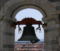
In 1272, construction resumed under Giovanni di Simone, architect of the Camposanto. In an effort to compensate for the tilt, the engineers built upper floors with one side taller than the other. This made the tower begin to lean in the other direction. Because of this, the tower is actually curved. Construction was halted again in 1284, when the Pisans were defeated by the Genoans in the Battle of Meloria.The seventh floor was completed in 1319. The bell-chamber was not finally added until 1372. It was built by Tommaso di Andrea Pisano, who succeeded in harmonizing the Gothic elements of the bell-chamber with the Romanesque style of the tower. There are seven bells, one for each note of the musical major scale. The largest one was installed in 1655.

Galileo Galilei is said to have dropped two cannon balls of different masses from the tower to demonstrate that their speed of descent was independent of their mass. This is considered an apocryphal tale, its only source being however Galileo's secretary. During World War II, the Allies discovered that the Nazis were using it as an observation post. A U.S. Army sergeant was briefly entrusted with the fate of the tower and his decision not to call in an artillery strike saved the tower from destruction.

On February 27, 1964, the government of Italy requested aid in preventing the tower from toppling. It was, however, considered important to retain the current tilt, due to the vital role that this element played in promoting the tourism industry of Pisa. A multinational task force of engineers, mathematicians and historians was assigned and met on the Azores islands to discuss stabilization methods. It was found that the tilt was increasing in combination with the softer foundations on the lower side. Many methods were proposed to stabilize the tower, including the addition of 800 metric tonnes of lead counterweights to the raised end of the base.

Pisa TowerPisa Tower BellIn 1987, the tower was declared as part of the Piazza del Duomo UNESCO World Heritage Site along with the neighbouring cathedral, baptistery and cemetery. On January 7, 1990, after over two decades of work on the subject, the tower was closed to the public. While the tower was closed, the bells were removed to relieve some weight, and cables were cinched around the third level and anchored several hundred meters away. The final solution to prevent the collapse of the tower was to slightly straighten the tower to a safer angle, by removing 38 cubic metres 50 cu yd of soil from underneath the raised end. The tower was straightened by 18 inches or 45 centimetres, returning to position that it occupied in 1838. The tower was reopened to the public on December 15, 2001, and has been declared stable for at least another 300 years.

In May 2008, after the removal of another 70 metric tons or 77 short tons of earth, engineers announced that the Tower had been stabilized such that it had stopped moving for the first time in its history. They stated it would be stable for at least 200 years. Two German churches have challenged the towers status as the world's most lop sided building the 15th century square Leaning Tower of Suurhusen and the 14th century bell tower in the town of Bad Frankenhausen. Guinness World Records measured the Pisa and Suurhusen towers, finding the former's tilt to be 3.97 degrees.

Tuesday, February 23, 2010

Christ the Redeemer Statue

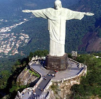
Christ the Redeemer is a statue of Jesus Christ in Rio de Janeiro, Brazil considered the largest art deco statue in the world. It is also called as O Cristo Redentor in Portuguese, formerly Portuguese: Christo redemptor. The statue stands 39.6 metres or 130 ft tall, including its 9.5 metre or 31 ft pedestal, and 30 metres or 98 ft wide. It weighs 635 tons or 700 short tons, and is located at the peak of the 700 metres or 2,300 ft Corcovado Mountain in the Tijuca Forest National Park overlooking the city.

Christ the Redeemer StatueIt is one of the tallest of its kind in the world. The statue of Cristo de la Concordia in Cochabamba, Bolivia, is slightly taller, standing at 40.44 metres or 132.7 ft tall with its 6.24 metres or 20.5 ft pedestal and 34.20 metres or 112.2 ft wide. A symbol of Catholicism, the statue has become an icon of Rio and Brazil. It is made of reinforced concrete and soapstone.

The idea for erecting a large statue atop Corcovado was first suggested in the mid-1850s, when Catholic priest Pedro Maria Boss requested financing from Princess Isabel to build a large religious monument. Princess Isabel did not think much of the idea and it was completely dismissed in 1889, when Brazil became a republic, with laws mandating the separation of church and state. The second proposal for a landmark statue on the mountain was made in 1921 by the Catholic Circle of Rio.

The group organised an event called Semana do Monumento or Monument Week to attract donations and collect signatures to support the building of the statue. The donations came mostly from Brazilian Catholics. The designs considered for the "Statue of the Christ" included a representation of the Christian cross, a statue of Jesus with a globe in his hands, and a pedestal symbolizing the world. The statue of Christ the Redeemer with open arms was chosen.

Local engineer Heitor da Silva Costa designed the statue; it was sculpted by French sculptor Paul Landowski. A group of engineers and technicians studied Landowski's submissions and the decision was made to build the structure out of reinforced concrete designed by Albert Caquot instead of steel, more suitable for the cross-shaped statue. The outer layers are soapstone, chosen for its enduring qualities and ease of use. Construction took nine years, from 1922 to 1931.

The monument was opened on October 12, 1931. The cost of the monument was $250,000. The statue was meant to be lit by a battery of floodlights triggered remotely by shortwave radio pioneer Guglielmo Marconi, stationed 5,700 miles or 9,200 km away in Rome, but poor weather affected the signal and it had to be lit by workers in Rio.

Christ the Redeemer StatueChrist the Redeemer StatueThe statue was struck by lightning during a violent electrical storm on Sunday, February 10, 2008. The storm caused havoc in Rio, but the statue was left unscathed because soapstone, the material forming the outer layers of the statue, is an insulator. In October 2006, on the statue's 75th anniversary, Archbishop of Rio Cardinal Eusebio Oscar Scheid consecrated a chapel named for the patron saint of Brazil Nossa Senhora Aparecida, or Our Lady of the Apparition, under the statue. This allows Catholics to hold baptisms and weddings there.

On 7 July 2007, Christ the Redeemer was named one of the New Seven Wonders of the World in a list compiled by the Swiss-based The New Open World Corporation. Leading corporate sponsors, including Banco Bradesco and Rede Globo, put large sums of money in the effort to have the statue voted into the top seven.

Monday, February 22, 2010

Chichen Itza

Chichen Itza is a large pre Columbian archaeological site built by the Maya civilization located in the northern center of the Yucatan Peninsula, in the Yucatan state, at present in Mexico. The Maya name Chichen Itza meaning at the mouth of the well of the Itza. This derives from chi, meaning mouth or edge, and cheen, meaning well. Itza is the name of an ethnic-lineage group that gained political and economic dominance of the northern peninsula. The name is believed to derive from the Maya itz, meaning magic, and meaning water.

Chichen ItzaChichen Itza was a major focal point in the northern Maya lowlands from the Late Classic through the Terminal Classic and into the early portion of the Early Postclassic period. The site exhibits a multitude of architectural styles, from what is called Mexicanized and reminiscent of styles seen in central Mexico to the Puuc style found among the Puuc Maya of the northern lowlands. The presence of central Mexican styles was once thought to have been representative of direct migration or even conquest from central Mexico.

The ruins of Chichen Itza are federal property, and the site’s stewardship is maintained by Mexicos Instituto Nacional de Antropologia e Historia which is known as National Institute of Anthropology and History, INAH. The land under the monuments, however, is privately-owned by the Barbachano family. The site contains many fine stone buildings in various states of preservation, and many have been restored. The buildings are connected by a dense network of formerly paved roads, called sacbeob. Archaeologists have found almost 100 sacbeob criss-crossing the site, and extending in all directions from the city.

The buildings of Chichen Itza are grouped in a series of architectonic sets, and each set was at one time separated from the other by a series of low walls. The three best known of these complexes are the Great North Platform, which includes the monuments of El Castillo, Temple of Warriors and the Great Ball Court; The Ossario Group, which includes the pyramid of the same name as well as the Temple of Xtoloc and the Central Group, which includes the Caracol, Las Monjas, and Akab Dzib. South of Las Monjas, in an area known as Chichen Viejo and only open to archaeologists, are several other complexes, such as the Group of the Initial Series, Group of the Lintels, and Group of the Old Castle.

Tourism has been a factor at Chichen Itza for more than a century. John Lloyd Stephens, who popularized the Maya Yucatan in the public imagination with his book Incidents of Travel in Yucatan, inspired many to make a pilgrimage to Chichen Itza. Even before the book was published, Benjamin Norman and Baron Emanuel von Friedrichsthal traveled to Chichen after meeting Stephens, and both published the results of what they found. Friedrichsthal was the first to photograph Chichen Itza, using the recently invented daguerreotype.

After Edward Thompson in 1894 purchased the Hacienda Chichen, which included Chichen Itza, he received a constant stream of visitors. In 1910 he announced his intention to construct a hotel on his property, but abandoned those plans, probably because of the Mexican Revolution.

In the early 1920s, a group of Yucatecans, led by writer/photographer Francisco Gomez Rul, began working toward expanding tourism to Yucatan. They urged Governor Felipe Carrillo Puerto to build roads to the more famous monuments, including Chichen Itza. In 1923, Governor Carrillo Puerto officially opened the highway to Chichen Itza. Gomez Rul published one of the first guidebooks to Yucatan and the ruins.

Gomez Rul's son-in-law, Fernando Barbachano started Yucatans first official tourism business in early 1920s. He began by meeting passengers that arrived by steamship to Progreso, the port north of Merida, and convincing them to spend a week in Yucatan, after which they would catch the next steamship to their next destination. In his first year Barbachano Peon reportedly was only able to convince seven passengers to leave the ship and join him on a tour. In the mid-1920s Barbachano Peon persuaded Edward Thompson to sell 5 acres next to Chichen for a hotel.

In 1944, Barbachano Peon purchased all of the Hacienda Chichen, including Chichen Itza, from the heirs of Edward Thompson. In 1972, Mexico enacted the Ley Federal Sobre Monumentos y Zonas Arqueologicas, Artisticas e Historicas which is known as Federal Law over Monuments and Archeological, Artistic and Historic Sites that put all the nation's pre-Columbian monuments, including those at Chichen Itza, under federal ownership. There were now hundreds, if not thousands, of visitors every year to Chichen Itza, and more were expected with the development of the Cancun resort area to the east.

Chichen Itza, a UNESCO World Heritage Site, is the second-most visited of Mexico's archaeological sites. The archaeological site draws many visitors from the popular tourist resort of Cancun, who make a day trip on tour buses. In 2007, Chichen Itza's El Castillo was named one of the New Seven Wonders of the World after a worldwide vote. Over the past several years, INAH, which manages the site, has been closing monuments to public access. While visitors can walk around them, they can no longer climb them or go inside their chambers. The most recent was El Castillo, which was closed after a San Diego, Calif., woman fell to her death in 2006.

Chichen Itza is a large pre Columbian archaeological site built by the Maya civilization located in the northern center of the Yucatan Peninsula, in the Yucatan state, at present in Mexico. The Maya name Chichen Itza meaning at the mouth of the well of the Itza. This derives from chi, meaning mouth or edge, and cheen, meaning well. Itza is the name of an ethnic-lineage group that gained political and economic dominance of the northern peninsula. The name is believed to derive from the Maya itz, meaning "magic," and meaning water.

Chichen Itza was a major focal point in the northern Maya lowlands from the Late Classic through the Terminal Classic and into the early portion of the Early Postclassic period. The site exhibits a multitude of architectural styles, from what is called Mexicanized and reminiscent of styles seen in central Mexico to the Puuc style found among the Puuc Maya of the northern lowlands. The presence of central Mexican styles was once thought to have been representative of direct migration or even conquest from central Mexico.

The ruins of Chichen Itza are federal property, and the site’s stewardship is maintained by Mexicos Instituto Nacional de Antropologia e Historia which is known as National Institute of Anthropology and History, INAH. The land under the monuments, however, is privately-owned by the Barbachano family. The site contains many fine stone buildings in various states of preservation, and many have been restored. The buildings are connected by a dense network of formerly paved roads, called sacbeob. Archaeologists have found almost 100 sacbeob criss-crossing the site, and extending in all directions from the city.

The buildings of Chichen Itza are grouped in a series of architectonic sets, and each set was at one time separated from the other by a series of low walls. The three best known of these complexes are the Great North Platform, which includes the monuments of El Castillo, Temple of Warriors and the Great Ball Court; The Ossario Group, which includes the pyramid of the same name as well as the Temple of Xtoloc and the Central Group, which includes the Caracol, Las Monjas, and Akab Dzib. South of Las Monjas, in an area known as Chichen Viejo and only open to archaeologists, are several other complexes, such as the Group of the Initial Series, Group of the Lintels, and Group of the Old Castle.

Chichen ItzaChichen ItzaTourism has been a factor at Chichen Itza for more than a century. John Lloyd Stephens, who popularized the Maya Yucatan in the public imagination with his book Incidents of Travel in Yucatan, inspired many to make a pilgrimage to Chichen Itza. Even before the book was published, Benjamin Norman and Baron Emanuel von Friedrichsthal traveled to Chichen after meeting Stephens, and both published the results of what they found. Friedrichsthal was the first to photograph Chichen Itza, using the recently invented daguerreotype.

After Edward Thompson in 1894 purchased the Hacienda Chichen, which included Chichen Itza, he received a constant stream of visitors. In 1910 he announced his intention to construct a hotel on his property, but abandoned those plans, probably because of the Mexican Revolution.In the early 1920s, a group of Yucatecans, led by writer/photographer Francisco Gomez Rul, began working toward expanding tourism to Yucatan. They urged Governor Felipe Carrillo Puerto to build roads to the more famous monuments, including Chichen Itza. In 1923, Governor Carrillo Puerto officially opened the highway to Chichen Itza. Gomez Rul published one of the first guidebooks to Yucatan and the ruins.

Gomez Rul's son-in-law, Fernando Barbachano started Yucatans first official tourism business in early 1920s. He began by meeting passengers that arrived by steamship to Progreso, the port north of Merida, and convincing them to spend a week in Yucatan, after which they would catch the next steamship to their next destination. In his first year Barbachano Peon reportedly was only able to convince seven passengers to leave the ship and join him on a tour. In the mid-1920s Barbachano Peon persuaded Edward Thompson to sell 5 acres next to Chichen for a hotel.

In 1944, Barbachano Peon purchased all of the Hacienda Chichen, including Chichen Itza, from the heirs of Edward Thompson. In 1972, Mexico enacted the Ley Federal Sobre Monumentos y Zonas Arqueologicas, Artisticas e Historicas which is known as Federal Law over Monuments and Archeological, Artistic and Historic Sites that put all the nation's pre-Columbian monuments, including those at Chichen Itza, under federal ownership. There were now hundreds, if not thousands, of visitors every year to Chichen Itza, and more were expected with the development of the Cancun resort area to the east.
Chichen Itza, a UNESCO World Heritage Site, is the second-most visited of Mexico's archaeological sites. The archaeological site draws many visitors from the popular tourist resort of Cancun, who make a day trip on tour buses. In 2007, Chichen Itza's El Castillo was named one of the New Seven Wonders of the World after a worldwide vote. Over the past several years, INAH, which manages the site, has been closing monuments to public access. While visitors can walk around them, they can no longer climb them or go inside their chambers. The most recent was El Castillo, which was closed after a San Diego, Calif., woman fell to her death in 2006.

Friday, February 19, 2010

Palace of Westminster

The Palace of Westminster also known as the Houses of Parliament or Westminster Palace is the seat of the two houses of the Parliament of the United Kingdom the House of Lords and the House of Commons. It lies on the north bank of the River Thames in the heart of the London borough of the City of Westminster, close to the historic Westminster Abbey and the government buildings of Whitehall and Downing Street. The name may refer to either of two structures: the Old Palace, a medieval building complex most of which was destroyed in 1834, and its replacement New Palace that stands today it has retained the style and status of a royal residence, despite its actual use.

Westminster Palace

The first royal palace was built on the site in the eleventh century, and Westminster was the primary London residence of the Kings of England until a fire destroyed much of the complex in 1512. After that, it served as the home of Parliament, which had been meeting there since the thirteenth century, and the seat of the Royal Courts of Justice, based in and around Westminster Hall. In 1834, an even greater fire ravaged the heavily rebuilt Houses of Parliament, and the only structures of significance to survive were Westminster Hall, the Cloisters and Chapter House of St Stephen's, the Chapel of St Mary Undercroft and the Jewel Tower.

The subsequent competition for the reconstruction of the Palace was won by architect Charles Barry and his design for a building in the Perpendicular Gothic style. The remains of the Old Palace were incorporated in its much larger replacement, which contains over 1,100 rooms organised symmetrically around two series of courtyards. Part of the New Palace's area of 3.24 hectares or 8 acres was reclaimed from the Thames, which is the setting of its principal façade, the 265.8-metre or 872 ft river front. Barry was assisted by Augustus W. N. Pugin, a leading authority on Gothic architecture and style, who provided designs for the decoration and furnishings of the Palace. Construction started in 1840 and lasted for thirty years, suffering great delays and cost overruns, as well as the death of both leading architects; works for the interior decoration continued intermittently well into the twentieth century. Major conservation work has been carried out since, due to the effects of London's pollution, and extensive repairs took place after the Second World War, including the reconstruction of the Commons Chamber following its bombing in 1941.

The Palace is one of the centres of political life in the United Kingdom Westminster has become a metonym for the UK Parliament, and the Westminster system of government has taken its name after it. Its Clock Tower, in particular, which has become known as "Big Ben" after its main bell, is an iconic landmark of London and the United Kingdom in general, one of the most popular tourist attractions in the city and an emblem of parliamentary democracy. The Palace of Westminster has been a Grade I listed building since 1970 and part of a UNESCO World Heritage Site since 1987.

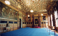
he grandest entrance to the Palace of Westminster is the Sovereign's Entrance beneath the Victoria Tower. It is designed for the use of the monarch, who travels from Buckingham Palace by carriage every year for the State Opening of Parliament. The Queen's Robing Room lies at the southern end of the ceremonial axis of the Palace and occupies the centre of the building's south front, overlooking the Victoria Tower Gardens. The Prince's Chamber is a small roombetween the Royal Gallery and the Lords Chamber, named after the room adjoining the Parliament Chamber in the Old Palace of Westminster. The Chamber of the house of lords located in the southern part of the Palace of Westminster. The exterior of the Palace of Westminster especially the Clock Tower is recognized worldwide, and is one of the most visited tourist attractions in London. The UNESCO classifies the Palace of Westminster, along with neighbouring Westminster Abbey and St. Margarets, as a World Heritage Site. It is also a Grade I listed building.

Queen Royal Robing RoomWestminster palace
There is no casual access to the interior, but it may be seen in a number of ways. UK residents may obtain tickets in advance from their MP. It is also possible for both UK residents and overseas visitors to queue for admission on the day, but capacity is limited and there is no guarantee of admission. Only a very small part of the Palace interior may be seen. Either House may exclude strangers if it desires to sit in private. UK residents may apply to their MP or a peer for a place on a guided tour of Parliament while it is in session. British educational institutions may also arrange a tour through their MP. Overseas visitors may only tour Parliament during the summer recess. Tours are available during a two-month period during the summer when Parliament is not sitting. These tours are open to both UK residents and overseas visitors. Live broadcasts of Parliamentary sessions can be viewed on BBC Parliament; recorded footage is shown when Parliament is not in session.

Currently, only UK Residents can tour the Clock Tower, by arranging a tour through their local MP. Architectural historian Dan Cruickshank selected the Palace as one of his five choices for the 2006 BBC television documentary series Britain's Best Buildings. The nearest London Underground station is Westminster on the District, Circle and Jubilee Lines.

Thursday, February 18, 2010

Great Pyramids or Giza Necropolis

The Giza Necropolis stands on the Giza Plateau, on the outskirts of Cairo, Egypt. This complex of ancient monuments includes the three pyramids known as the Great Pyramids, along with the massive sculpture known as the Great Sphinx. It is located some 8 km or 5 miles inland into the desert from the old town of Giza on the Nile, some 25 km 15 miles southwest of Cairo city centre. One of the monuments, the Great Pyramid of Giza, is the only remaining monument of the Seven Wonders of the Ancient World.

Great PyramidsThe Great Pyramids consist of the Great Pyramid of Giza, the somewhat smaller Pyramid of Khafre a few hundred meters to the south-west, and the relatively modest-sized Pyramid of Menkaure a few hundred meters further south-west. The Great Sphinx lies on the east side of the complex, facing east. Current consensus among Egyptologists is that the head of the Great Sphinx is that of Khafre. Along with these major monuments are a number of smaller satellite edifices, known as queens pyramids, causeways and valley pyramids.

In the four major monuments, Menkaures Pyramid is seen today without any of its original polished limestone casing. Khafres Pyramid retains a prominent display of casing stones at its apex, while Khufus Pyramid maintains a more limited collection at its base. Khafres Pyramid appears larger than the adjacent. The most active phase of construction here was in the 23rd century BC. It was popularised in Hellenistic times when the Great Pyramid was listed by Antipater of Sidon as one of the Seven Wonders of the World. Today it is the only one of the ancient Wonders still in existence.

Pyramids of Giza were the tallest structures on the planet. Khufus pyramid originally rose 479 feet but reduced to 449 feet with the loss of its limestone casing. Khafre's Pyramid had stood 471 feet at its completion while Menkaure's Pyramid stands at a modest 218 feet. In 1300 AD the Great Pyramid was surpassed as the tallest structure in the world by England's Lincoln Cathedral. Due largely to 19th-century images, the Pyramids of Giza are generally thought of by foreigners as lying in a remote, desert location, even though they are located in what is now part of the most populous city in Africa . The ancient sites in the Memphis area, including those at Giza, together with those at Saqqara, Dahshur, Abu Ruwaysh, and Abusir, were collectively declared a World Heritage Site in 1979.

Researchers have long been impressed with the precision with which the pyramids of this complex were created. The base of the Great Pyramid forms a nearly perfect square, with only a 19-cm or 7.50-in difference between its longest and shortest sides, out of a total length of about 230 m or 756 ft. The Great Pyramid raised 146.7 m or 481.4 ft nearly 50 stories high. Researchers estimate that 2.3 million blocks were used to build the Great Pyramid, with an average weight of about 2.5 metric tons per block. The largest block weighs as much as 15 metric tons.

It is not known how they were made but there have been varying theories regarding the construction techniques. Most construction theories are based on the idea that the pyramids were built by moving huge stones from a quarry and dragging and lifting them into place. The disagreements center on the method by which the stones were conveyed and placed and how possible the method was. A recent though unpopular theory proposes that the building blocks were manufactured in-place from a kind of limestone concrete.

The work of quarrying, moving, setting, and sculpting the huge amount of stone used to build the pyramids might have been accomplished by several thousand skilled workers, unskilled laborers and supporting workers. Bakers, carpenters, water carriers, and others were also needed for the project. Along with the methods utilized to construct the pyramids, there is also wide speculation regarding the exact number of workers needed for a building project of this magnitude. When Greek historian Herodotus visited Giza in 450 BC he was told by Egyptian priests that the Great Pyramid had taken 400,000 men 20 years to build, working in three-month shifts 100,000 men at a time.

Great PyramidsGreat Pyramids
In 1990, tombs belonging to the pyramid workers were discovered alongside the pyramids with an additional burial site found nearby in 2009. Evidence from the tombs indicates that a workforce of 10,000 laborers working in three month shifts took around 30 years to build a pyramid. Most of the workers appear to have been from poor families. Farms supplied the laborers with 21 cattle and 23 sheep daily. Specialists such as architects, masons, metalworkers and carpenters, were permanently employed by the king to fill positions that required the most skill.

The Pyramids of Giza and other were constructed to house the remains of the deceased Pharaohs who ruled over ancient Egypt. A portion of the Pharaoh's spirit called his ka was believed to remain with his corpse. Proper care of the remains was necessary in order for the former Pharaoh to perform his new duties as king of the dead. The pyramid not only served as a tomb for the Pharaoh but also as storage for the various items he would need in the afterlife. The people of Ancient Egypt believed that death on Earth was the start of a journey to the next world. The embalmed body of the King was entombed underneath or within the pyramid to protect it and allow his transformation and ascension to the afterlife.

Wednesday, February 17, 2010

Eiffel Tower

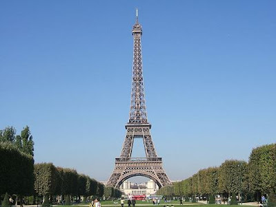
The Eiffel Tower is a 19th century iron lattice tower located on the Champ de Mars in Paris that has become both a global icon of France and one of the most recognizable structures in the world. The Eiffel Tower, which is the tallest building in Paris, is the single most visited paid monument in the world; millions of people ascend it every year. Named after its designer, engineer Gustave Eiffel, the tower was built as the entrance arch for the 1889 Worlds Fair.

Eiffel TowerThe tower stands at 324 m or 1,063 ft tall, about the same height as an 81-story building. It was the tallest structure in the world from its completion until 1930, when it was eclipsed by the Chrysler Building in New York City. Not including broadcast antennas, it is the second-tallest structure in France, behind the Millau Viaduct, completed in 2004. And while the Eiffel Tower is an iron structure, and weighs approximately 10,000 tonnes, it actually has a relatively low density, weighing less than a cylinder of air occupying the same dimensions as the tower.

The tower has three levels for visitors. Tickets can be purchased to ascend either on stairs or lifts to the first and second levels. The walk to the first level is over 300 steps, as is the walk from the first to the second level. The third and highest level is accessible only by lift. Both the first and second levels feature restaurants. The tower has become the most prominent symbol of both Paris and France, often in the establishing shot of movies set in the city.

Eiffel originally planned to build the tower in Barcelona, for the Universal Exposition of 1888, but those responsible at the Barcelona city hall thought it was a strange and expensive construction, which did not fit into design of the city. After the refusal of the Consistory of Barcelona, Eiffel submitted his draft to those responsible for the Universal Exhibition in Paris, where he would build his tower a year later, in 1889. The tower was inaugurated on 31 March 1889, and opened on 6 May. Three hundred workers joined together 18,038 pieces of puddled iron, using two and a half million rivets, in a structural design by Maurice Koechlin. The risk of accident was great, for unlike modern skyscrapers the tower is an open frame without any intermediate floors except the two platforms.

Eiffel TowerEiffel TowerThe metal structure of the Eiffel Tower weighs 7,300 tonnes while the entire structure including non-metal components is approximately 10,000 tonnes. Depending on the ambient temperature, the top of the tower may shift away from the sun by up to 18 cm or 7.1 in because of thermal expansion of the metal on the side facing the sun. As demonstration of the economy of design, if the 7300 tonnes of the metal structure were melted down it would fill the 125 metre square base to a depth of only 6 cm or 2.36 in, assuming a density of the metal to be 7.8 tonnes per cubic metre. The tower has a mass less than the mass of the air contained in a cylinder of the same dimensions that is 324 metres high and 88.3 metres in radius. The weight of the tower is 10,100 tonnes compared to 10,265 tonnes of air.

Maintenance of the tower includes applying 50 to 60 tonnes of paint every seven years to protect it from rust. More than 200,000,000 people have visited the tower since its construction in 1889, including 6,719,200 in 2006, making it the most visited paid monument in the world. The tower has two restaurants Altitude 95, on the first floor 311 ft or 95 m above sea level and the Jules Verne, an expensive gastronomical restaurant on the second floor, with a private lift. This restaurant has one star in the Michelin Red Guide. In January 2007, the multi-Michelin star chef Alain Ducasse was brought in to run Jules Verne.

Tuesday, February 16, 2010

Taj Mahal

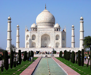
The Taj Mahal is a mausoleum located in Agra, India, built by Mughal Emperor Shah Jahan in memory of his favorite wife, Mumtaz Mahal. The Taj Mahal is considered the finest example of Mughal architecture, a style that combines elements from Persian, Indian, and Islamic architectural styles. In 1983, the Taj Mahal became a UNESCO World Heritage Site and was cited as the jewel of Muslim art in India and one of the universally admired masterpieces of worlds heritage.

Taj MahalWhile the white domed marble mausoleum is its most familiar component, the Taj Mahal is actually an integrated complex of structures. Building began around 1632 and was completed around 1653, and employed thousands of artisans and craftsmen. The construction of the Taj Mahal was entrusted to a board of architects under imperial supervision including Abdul-Karim Mamur Khan, Makramat Khan, and Ustad Ahmad Lahauri. Lahauri is generally considered to be the principal designer.

In 1631, Shah Jahan, emperor during the Mughal empires period of greatest prosperity, was grief stricken when his third wife, Mumtaz Mahal, died during the birth of their fourteenth child, Gauhara Begum. Construction of the Taj Mahal began in 1632, one year after her death. The court chronicles of Shah Jahans grief illustrate the love story traditionally held as an inspiration for Taj Mahal. The principal mausoleum was completed in 1648 and the surrounding buildings and garden were finished five years later. The central focus of the complex is the tomb. This large, white marble structure stands on a square plinth and consists of a symmetrical building with an iwan topped by a large dome and finial. Like most Mughal tombs, the basic elements are Persian in origin.

The base structure is essentially a large, multi-chambered cube with chamfered corners, forming an unequal octagon that is approximately 55 meters on each of the four long sides. Four minarets frame the tomb, one at each corner of the plinth facing the chamfered corners. The main chamber houses the false sarcophagi of Mumtaz Mahal and Shah Jahan; the actual graves are at a lower level. Tall decorative spires extend from edges of base walls, and provide visual emphasis to the height of the dome. The lotus motif is repeated on both the chattris and guldastas. The dome and chattris are topped by a gilded finial, which mixes traditional Persian and Hindu decorative elements.

The main finial was originally made of gold but was replaced by a copy made of gilded bronze in the early 19th century. This feature provides a clear example of integration of traditional Persian and Hindu decorative elements. The finial is topped by a moon, a typical Islamic motif whose horns point heavenward. Because of its placement on the main spire, the horns of the moon and the finial point combine to create a trident shape.

Shah Jahan and Mumtaj TombsTaj Mahal and Yamuna River
The minarets, which are each more than 40 meters tall, display the designer's penchant for symmetry. They were designed as working minarets a traditional element of mosques, used by the muezzin to call the Islamic faithful to prayer. Each minaret is effectively divided into three equal parts by two working balconies that ring the tower. At the top of the tower is a final balcony surmounted by a chattri that mirrors the design of those on the tomb. The chattris all share the same decorative elements of a lotus design topped by a gilded finial. The minarets were constructed slightly outside of the plinth so that, in the event of collapse, the material from the towers would tend to fall away from the tomb.

The Taj Mahal attracts from 2 to 4 million visitors annually, with more than 200,000 from overseas. Most tourists visit in the cooler months of October, November and February. Polluting traffic is not allowed near the complex and tourists must either walk from parking lots or catch an electric bus. Lists of recommended travel destinations often feature the Taj Mahal, which also appears in several listings of seven wonders of the modern world, including the recently announced New Seven Wonders of the World, a recent poll with 100 million votes.

The grounds are open from 6 am to 7 pm weekdays, except for Friday when the complex is open for prayers at the mosque between 12 pm and 2 pm. The complex is open for night viewing on the day of the full moon and two days before and after, excluding Fridays and the month of Ramzan.

Thursday, February 11, 2010

Belem Tower

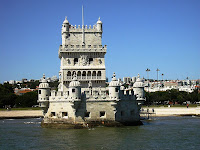
Belem Tower or the Tower of St Vincent is a fortified tower located in the Belem district of Lisbon, Portugal, and is an UNESCO World Heritage Site due to the significant role it played in the Portuguese maritime discoveries of the era of the Age of Discoveries. The tower was commissioned by King John II to be both part of a defense system at the mouth of the Tagus River and a ceremonial gateway to Lisbon.

Belem TowerThe tower was built in the early sixteenth century and is a prominent example of the Portuguese Manueline style, but it also incorporates hints of other architectural styles. The structure was built from lioz limestone and is composed of a bastion and the 30 meter or 100 foot, four story tower. It has incorrectly been stated that the tower was built in the middle of the Tagus and now sits near the shore because the river was redirected after the 1755 Lisbon earthquake. In fact, the tower was built on a small island in the Tagus River near the Lisbon shore.

The Belem Tower was built from lioz limestone, a light colored, rare stone that is local to the Lisbon area. The building is divided into two parts: the bastion and the four story tower, located on the north side of the bastion. The bastion is shaped like an irregular hexagon. It is composed of the bulwark, which sits just above the water and housed the cannons in the 16-gun emplacement in the walls. The open center above the casemate made it easier to dispel the cannon smoke. Below the bulwark are the storerooms, which were later used as prisons. Above the bulwark is a terrace with six turrets. The bastion platform could also be used for light-caliber guns. This was the first Portuguese fortification with a two-level gun emplacement and it marks a new development in military architecture. Later a statue of the virgin was constructed on the terrace.

The tower is about 12 meters or 40 feet square and about 30 meters 100 feet tall. The first floor is at the same level as the bulwark terrace and is called the Governor's room. The second floor is the King's room; the third, the Audience room; and the fourth, the chapel. Narrow spiral staircases connect the floors. The King's room has a loggia that overlooks the river. The Audience room has two light windows on each of three sides and round-headed windows on south side. On the external wall there is a large coat of arms between the windows. There is a terrace above the chapel that offers views of the surrounding landscape.

Belem TowerBelem TowerThe sixteenth century tower is considered one of the main works of the Portuguese late gothic, Manueline style. This is especially apparent in its elaborate rib vaulting, crosses of the Order of Christ, armillary spheres and twisted rope. Gothic rib vaulting is evident in the casemate of the bastion, the rooms of the tower and the cupolas of the watchtowers on the bastion terrace. King Manuel I was a member of the Order of Christ and the Manueline cross of the Order of Christ is repeated numerous times on the parapets. These were a symbol of Manuel's military strength as the knights of the Order of Christ contributed to numerous military conquests in that era.


The bastion platform is on the south, and most ornate, side of the tower. The corners of this platform have turrets topped by Moorish-looking cupolas. The base of the turrets have images of beasts, including a rhinoceros. This rhinoceros is considered to be the first sculpture of such an animal in Western European art and probably depicts the rhinoceros that Manuel I sent to Pope Leo X in 1515. A richly carved niche with a Manueline baldachin sits on the platform in front of the river. A statue of the virgin of Belem also called Our Lady of Good Success, Our Lady of the Grapes and the Virgin of Safe Homecoming stands in this niche. She is holding a child in her right hand and a bunch of grapes in her left.

Wednesday, February 10, 2010

Monte Cassino

Monte Cassino is a rocky hill about 130 km or 80 miles southeast of Rome, Italy, 2 km to the west of the town of Cassino the Roman Casinum having been on the hill and 520 m altitude. St. Benedict of Nursia established his first monastery, the source of the Benedictine Order, here around 529. It was the site of Battle of Monte Cassino in 1944. The site has been visited many times by the Popes and other senior clergy, including a visit by Pope Benedict XVI in May 2009. The monastery is one of the few remaining territorial abbeys within the Catholic Church.

Monte CassinoThe monastery was constructed on an older pagan site, a temple of Apollo that crowned the hill, enclosed by a fortifying wall above the small town of Cassino, still largely pagan at the time and recently devastated by the Goths. Benedict's first act was to smash the sculpture of Apollo and destroy the altar. He rededicated the site to John the Baptist. Once established there, Benedict never left. At Monte Cassino he wrote the Benedictine Rule that became the founding principle for western monasticism. There at Monte Cassino he received a visit from Totila, king of the Ostrogoths, perhaps in 543 and there he died.

Monte Cassino became a model for future developments. It was sacked or destroyed a number of times. In 584, during the abbacy of Bonitus, the Lombards sacked the Abbey, and the surviving monks fled to Rome and stayed for more than a century. A flourishing period of Monte Cassino followed its reestablishment in 718 by Abbot Petronax, when among the monks were Carloman, son of Charles Martel, Ratchis, predecessor of the great Lombard Duke and King Aistulf and Paul the Deacon, the historian of the Lombards. Thus, the monastery became the capital of a state comprising a compact and strategic region between the Lombard principality of Benevento and the Byzantine city-states of the coast. In 883 Saracens sacked and then burned it down, and Abbot Bertharius was killed during the attack.

It was rebuilt and reached the apex of its fame in the 11th century under the abbot Desiderius who later became Pope Victor III. The number of monks rose to over two hundred, and the library, the manuscripts produced in the scriptorium and the school of manuscript illuminators became famous throughout the West. The unique Beneventan script flourished there during Desiderius abbacy. The buildings of the monastery were reconstructed on a scale of great magnificence, artists being brought from Amalfi, Lombardy, and even Constantinople to supervise the various works. The abbey church, rebuilt and decorated with the utmost splendor, was consecrated in 1071 by Pope Alexander II. A detailed account of the abbey at this date exists in the Chronica monasterii Cassinensis by Leo of Ostia and Amatus of Monte Cassino gives us our best source on the early Normans in the south.

Monte CassinoMonte CassinoAn earthquake damaged the Abbey in 1349, and although the site was rebuilt it marked the beginning of a long period of decline. In 1321, Pope John XXII made the church of Monte Cassino a cathedral. In 1505 the monastery was joined with that of St. Justina of Padua. The site was sacked by Napoleon's troops in 1799 and from the dissolution of the Italian monasteries in 1866, Monte Cassino became a national monument. There was a final destruction on February 15, 1944 when during the Battle of Monte Cassino, the entire building was pulverized in a series of heavy air-raids due to the mistaken belief it was a German stronghold. In fact the Abbey was being used as a refuge from the battle by the women and children of nearby Cassino. The Abbey was rebuilt after the war, financed by the Italian State. Pope Paul VI reconsecrated it in 1964.

The archives, besides a vast number of documents relating to the history of the abbey, contained some 1400 irreplaceable manuscript codices, chiefly patristic and historical. They also contained the collections of the Keats-Shelley House in Rome which had been sent to the Abbey for safety in December 1942. By great foresight on the part of Lt.Col. Julius Schlegel, a Vienna-born German officer, and Captain Maximilian Becker from the Panzer-Division Hermann Goring, these were all transferred to the Vatican at the beginning of the battle.

Tuesday, February 9, 2010

Pico de Orizaba Mountain

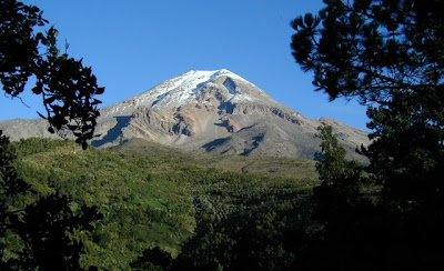
The Pico de Orizaba, or Citlaltepetl is a stratovolcano, the highest mountain in Mexico and the third highest in North America. It rises 5,636 meters or 18,490 feet above sea level in the eastern end of the Eje Volcanico Transversal mountain range, on the border between the states of Veracruz and Puebla. The volcano is currently dormant but not extinct the last eruptions occurred in 1687, with previous eruptions in 1630, 1613, 1569, 1566 and 1537. It is the second most prominent volcanic peak in the world after Africa's Mount Kilimanjaro.

Pico OrizabaThe Pico overlooks the valley and city of Orizaba, from which it gets its name. The name Citlaltepetl is not used by Nahuatl speakers of the Orizaba area, who instead call it Istaktepetl in the traditional orthography for Classical Nahuatl 'White Mountain'.

A regionally dominant peak, and in fact the highest peak between Colombia and the Yukon, the Pico de Orizaba is ranked 7th in the world in topographic prominence. It is the second most prominent volcanic peak in the world after Africa's Mount Kilimanjaro. Although it is about 110 km or 75 miles inland, to the west of the port of Veracruz, its peak is visible to ships approaching the port in the Gulf of Mexico, and at dawn rays of sunlight strike the Pico while Veracruz still lies in shadow. The Pico is ranked 16th in the world for topographic isolation.
Justify Full
Pico OrizabaPico OrizabaThe peak is one of three volcanoes that contain permanent snow and glaciers in Mexico. The others are Popocatepetl and Iztaccihuatl. A companion peak lying about six km to the southwest of the Pico de Orizaba is the Sierra Negra, at 4,640 metres or 15,223 ft. This subsidiary peak, though far lower than its massive neighbor, is still higher than anything in the 48 contiguous states of the U.S., and on its summit, serviced by the highest road in North America, is one of the world's premier astronomical instruments, the Large Millimeter Telescope.

The Pico de Orizaba was important in such pre-Hispanic cultures as those of the Nahuatl-speaking Aztecs and the Totonacs. The summit and its surrounding foothills are part of a national park. There are many routes for approaching and climbing the volcano, and many people visit it. For information on climbing Pico de Orizaba, search summit orizaba. Pico de Orizaba is home of the highest altitude growing pine trees in the world, which NASA are studying in order to possibly grow them somewhere outside the Earth in the future.

Monday, February 8, 2010

Mykonos Island

Mykonos is a Greek island and a top tourist destination, renowned for its cosmopolitan character and its intense nightlife. The island is part of the Cyclades, lying between Tinos, Syros, Paros and Naxos. It spans an area of 105.183 km2 or 41 square miles and rises at an elevation of 341 m or 1,119 ft at its highest point. The island is composed primarily of granite. It has little natural fresh water and relies on the desalination of sea water in order to meet its needs. There are 9,320 inhabitants most of whom live in the largest town. Mykonos, also known as Chora which lies on the west coast.

MykonosMykonos is believed that the island was named after a local hero, who is considered an offspring of the god Apollo and was worshipped locally in antiquity. Archaeological finds indicate that the Ionians settled on Mykonos in the early part of the 11th century BC. More recent discoveries have uncovered remnants in Ftelia beach from the Neolithic Kares tribe dating back to as far as 3000 BC.

In Greek mythology Mykonos was the location of the battle between Zeus and the Titan, and the island was named in honor of Apollo's grandson Mykonos. During these ancient times, Mykonos, due to its proximity to the then highly populated island of Delos became very important as a supply island and possibly as a getaway location for Delian citizens.

Mykonos is one of the most cosmopolitan islands in Greece, having become increasingly popular with mass tourism. It is known for its diverse and intense nightlife as evidenced by a vast number of bars and nightclubs. Mykonos is also known for its sandy beaches. The nightlife of Mykonos is marketed as among the best in Europe. Mykonos also attracts famous DJs to its renowned clubs and beach bars. Mykonos nightlife focuses mainly on bars rather than clubs, yet a number of notable clubs can be found throughout the island.

Mykonos Pelican Mykonos WindmillsMykonos is famous for its rhythm of life: the party starts at midday on the beaches, then continues to the night until sunrise, when the club-goers then sleep until the afternoon. Mykonos attracts thousands of people each month of the summer, including many famous celebrities. The island is considered to be "a playground for adults".

Petros the Pelican is an old celebrity of the town's waterfront, "Petros" has been the official mascot of Mykonos for over 50 years. Mykonos windmills is From as early as the 16th century, they are one of the most recognized landmarks of Mykonos. Little Venice the buildings have been constructed right on the sea's edge with their balconies overhanging the water. Paraportiani is one of the most famous architectural structures in Greece. Its name means inner or secondary door which it was to the Medieval stone walls which encircled the area. Archaeological Museum Houses marble sculptures, ceramics and jewellery recovered from the islands of Delos, Renia and Mykonos.