Social Icons

Pages

Wednesday, March 31, 2010

Ely Cathedral

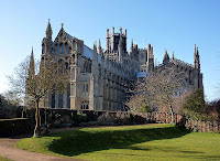
Ely Cathedral which is also called as The Cathedral Church of the Holy and Undivided Trinity of Ely is the principal church of the Diocese of Ely, in Cambridgeshire, England, and the seat of the Bishop of Ely. It is known locally as the ship of the Fens, because of its prominent shape that towers above the surrounding flat and watery landscape. Ely Cathedral is a famous tourist attraction which will be visited by number of visitors every year. More details about Ely Cathedral are given in world tour guides below.

Ely CathedralThe first Christian building on the site was founded by St.Ethelthryth, daughter of the Anglo-Saxon King Anna of East Anglia, who was born in 630 at Exning near Newmarket. She may have acquired land at Ely from her first husband Tondberht, described by Bede as a prince of the South Gyrwas. After the end of her second marriage to Ecgfrith, a prince of Northumbria, she set up and ruled a monastery at Ely in 673, and, when she died, a shrine was built there to her memory. The monastery is traditionally believed to have been destroyed in the Danish invasions of the late 9th century, together with what is now the city. However, while the lay settlement of the time would have been a minor one, it is likely that a church survived there until its refoundation in the 10th century.

A new Benedictine monastery was built and endowed on the site by Athelwold, Bishop of Winchester, in 970, in a wave of monastic refoundations which locally included Peterborough and Ramsey. This became a cathedral in 1109, after a new Diocese of Ely was created out of land taken from the Diocese of Lincoln.

Ely Cathedral LanternThe present cathedral was started by Abbot Simeon under William I in 1083. Building continued under Simeon's successor, Abbot Richard. The Anglo-Saxon church was demolished, but some of its relics, such as the remains of its benefactors, were moved to the cathedral. The main transepts were built early on, crossing the nave below a central tower, and are the oldest surviving part of the cathedral. The West Tower was built between 1174 and 1197, and the Romanesque style of the west front overall shows that it was built in the 12th century, with the later addition of the Galilee porch. The west tower is 66m high or 215ft. The unique Octagon Lantern Tower was constructed during the 1300s and replaced the old central tower which collapsed. The Lantern is 23m or 74ft wide and is 52m or 170ft high. From the floor to central roof boss Lantern is 43m or 142ft or high.

The cathedral is built from stone quarried from Barnack in Northamptonshire bought from Peterborough Abbey, whose lands included the quarries, for 8000 eels a year, with decorations in Purbeck Marble and local clunch. The plan of the building is cross shaped, with the altar at the east end. The total length is 537 feet or 163.7 m, and with the nave at over 75 m long or 250ft, remains the longest in Britain.

Attached to the north transept is the Lady Chapel by the sacrist Alan of Walsingham. It was to his plans, too, that the octagonal tower or octagon was built after Simeon's original crossing tower collapsed in 1322, injuring nobody but destroying the choir. This central octagon rises from the whole breadth of the building and towers up until its roof, a wooden lantern, forms the only Gothic dome in existence. The north-west transept collapsed in the 15th century and was never rebuilt, leaving a scar on the outside of that corner that can still be seen. Dating from the early 16th century is a set of 44 misericords.

In 1539, during Henry VIII's Dissolution of the Monasteries, the cathedral suffered only minor damage, but St Etheldreda's shrine was destroyed. The cathedral was soon refounded in 1541, although many of the statues in the lady chapel were severely damaged. The Bishop of Ely in the mid 17th century was Matthew Wren and in connection with this, his nephew Christopher Wren was responsible for a rather splendid Gothic door, dating from the 1650s, on the north face of the cathedral.
Ely CathedralEly CathedralThe building has been the subject of several major restoration projects. In the 18th century restoration is done under James Essex. In 1839 under George Peacock with the architect George Gilbert Scott restoration is done. A painted wooden ceiling was added to the nave in this restoration. The building is still in active use, and also houses a collection of stained glass from the 13th century to the present that is of national importance and includes works from notable contemporary artists including Ervin Bossanyi.

Ely has a cathedral choir of boys and men, which has recently attracted international attention because of its association with The Choirboys two of its members, Patrick Aspbury and CJ Porter-Thaw, are choristers at the cathedral. Boys are educated in the junior department of The Kings School, Ely. The Ely Cathedral Girls Choir was also launched in 2006, comprising 18 girl choristers. The choir's debut CD, Sing reign of fair maid Music for Christmas and the New Year, directed of Sarah MacDonald, is available from Regent Records. The cathedral community also has an adult voluntary choir, The Octagon Singers and a children's choir The Ely Imp.

Tuesday, March 30, 2010

Tenere

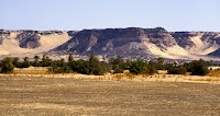
The Tenere is a desert region in the south central Sahara. It comprises a vast plain of sand stretching from northeastern Niger into western Chad, occupying an area of over 154,440 square miles or 400,000 km². Its boundaries are said to be the Air Mountains in the west, the Hoggar Mountains in the north, the Djado Plateau in the northeast, the Tibesti Mountains in the east, and the basin of Lake Chad in the south. The central part of the desert, the Erg du Bilma.

TenereThe name Tenere comes from the Tuareg language, meaning "desert", in much the same way that the Arabic word for "desert", Sahara, came to be applied to the region as a whole. The Tenere is arid, with an extremely hot and dry climate and virtually no plant life. Temperatures reach as high as 42 °C or 108 °F in summer, with little more than 25 mm or 1 inch of rain annually. Water is notoriously difficult to find, even underground, and wells may be hundreds of miles apart.

Most of the Tenere is a flat basin, once the bed of the prehistoric Lake Chad. In the north, the Tenere is a vast sand sheet - the true, featureless Tenere of legend reaching up to the low hills of the Tassili du Hoggar along the Algerian border. In the centre the Bilma Erg, forms rows of easily navigable low dunes whose corridors make regular byways for the azelai or salt caravans. To the west, the Aïr Mountains rise up. To the south east the Tenere is bordered by the Kaour cliffs running 100 km north to south. At the base lie a string of oases including the famous Bilma The total eclipse of March 2006 passed through this region at which time people in Dirkou were seen running for the mosque. Periodic outcrops, such as the unusual marble Blue Mountains in the northwest near Adrar Chiriet, or the Agram hills near the oasis of Fachi and Adrar Madet to the north, are rare but notable landmarks.

The region was not always a desert. During the prehistoric Carboniferous period it was a sea floor and later a tropical forest. A major dinosaur cemetery lies southeast of Agadez at Gadoufaoua, many fossils have been found there, having eroded out from the ground. An almost complete specimen of the crocodile-like reptile Sarcosuchus imperator, nicknamed the SuperCroc, was discovered there by paleontologists. During early human history, it was a fertile land much more congenial to human life than it is now. The region was inhabited by modern humans as long ago as the Paleolithic period some 60,000 years ago. They hunted wild animals and left evidence of their presence in the form of stone tools including tiny, finely carved arrow heads. During the Neolithic period about 10,000 years ago, ancient hunters, the Kiffian people, created rock engravings and paintings that can still be found across the region. The human population dwindled as the Sahara dried out, and by 2500 BC it had largely become as dry as it is today.

The Tenere is very lightly populated. Fachi is the only settlement that is not on the edge of the Tenere. While the well known Tuareg occupy the Air Mountains and Agadez to the west, and still operate the salt caravans for Hausa merchants, the true inhabitants of the Tenere, found from oases like Fachi eastwards, are the non-Berber Kanure and Tebu, the latter thought to be descended from among the original inhabitants of the Sahara.

In 1960 the Tuareg territory becomes part of the independent republic of Niger. It has been divided between seven departments. The central part of the Tenere is a protected area, under the auspices of the Air and Tenere Natural Reserve. The capital of the Tenere is the town of Agadez, south of the Aïr Mountains and west of the Tenere. There are also various oasis settlements, some like Bilma and Seguedine based on salt production. Settlements and villages of Tenere are Fachi, Achegour, Bilma, Dirkou, Chirfa, Agadem and Seguedine.

TenereTenereThe desert is also known for the celebrated Tree of Tenere, once thought to be among the most remote in the world. Situated by the last well before entering the Grand Erg du Bilma on the way to Fachi, salt caravans relied on the tree as a landmark until it was allegedly knocked down by a truck driver in 1973. It was replaced by a metal sculpture and the remains are enshrined at the museum in Niamey. New trees were planted but, because of the very low water table, irregular watering by passing travellers saw them fail to survive. Despite this unfortunate mishap, the tree is still often indicated on maps of the region as a notable landmark, as is the less well known Arbre Perdu or Lost Tree situated in the true Tenere to the north, east of Chirfa.

Monday, March 29, 2010

CN Tower

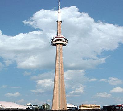
The CN Tower, located in downtown Toronto, Ontario, Canada, is a communications and observation tower standing 553.3 metres or 1,815 ft tall. It surpassed the height of the Ostankino Tower while still under construction in 1975, becoming the tallest free-standing structure on land in the world for the next 31 years. On September 12, 2007 the CN Tower was surpassed in height by Burj Khalifa. It remains the tallest free-standing structure in the Western Hemisphere, the signature icon of Toronto's skyline, and a symbol of Canada, attracting more than two million international visitors annually.

CN TowerCN originally referred to Canadian National, the railway company that built the tower. Following the railway's decision to divest non-core freight railway assets, prior to the company's privatization in 1995 it transferred the tower to the Canada Lands Company, a federal Crown corporation responsible for real estate development. Since local residents wished to retain the name CN Tower, the abbreviation is now said to expand to Canada's National Tower rather than the original Canadian National Tower; however, neither of these names are commonly used.

In 1995, the CN Tower was declared one of the modern Seven Wonders of the World by the American Society of Civil Engineers. It also belongs to the World Federation of Great Towers, where it holds the 1st place ranking. Construction on the CN Tower began on February 6, 1973 with massive excavations at the tower base for the foundation. By the time the foundation was complete, 56,000 t of dirt and shale were removed to a depth of 15 metres or 49.2 ft in the centre, and a base incorporating 7,000 cubic metres or 9,156 cu yd of concrete with 450 tonnes of rebar and 36 tonnes of steel cable had been built to a thickness of 6.7 metres or 22.0 ft. This portion of the construction was fairly rapid, with only four months needed between the start and the foundation being ready for construction on top.

The CN Tower consists of several substructures. The main portion of the tower is a hollow concrete hexagonal pillar containing the six elevators, stairwells, and power and plumbing connections. On top of this is a 102-metre or 334.6 ft tall metal broadcast antenna, carrying TV and radio signals. There are two visitor areas: the main deck level located at 346 metres or 1,135 ft, and the higher Sky Pod at 446.5 metres or 1,465 ft, just below the metal antenna. The hexagonal shape can be seen between the two areas; however, below the main deck, three large supporting legs give the tower the appearance of a large tripod.

The main level is seven storeys, some of which are open to the public. Below the public areas at 338 metres or 1,108.9 ft is a large white donut-shaped radome containing the structure's microwave receivers. The glass floor and outdoor observation deck are at 342 metres or 1,122.0 ft. The glass floor has an area of 24 square metres or 258 sq ft and can withstand a pressure of 4,100 kilopascals or 595 psi. The floor's thermal glass units are 64 millimetres or 2.5 in thick, consisting of a pane of 25-millimetre or 1.0 in laminated glass, 25 millimetres or 1.0 in airspace and a pane of 13-millimetre or 0.5 in laminated glass. Some people experience acrophobia when standing on the glass floor and looking down at the ground 342 metres or 1,122.0 ft below.

CN TowerCN Tower

In 2008, one elevator was upgraded to add a glass floor panel, believed to have the highest vertical rise of any elevator equipped with this feature. The Horizons Cafe and the lookout level are at 346 metres or 1,135.2 ft. The 360 Restaurant, a revolving restaurant that completes a full rotation once every 72 minutes, is at 351 metres or1,151.6 ft. When the tower first opened, it also featured a disco named Sparkles, billed as the highest disco and dance floor in the world. The Sky Pod is the second-highest public observation deck in the world, surpassed only by the Shanghai World Financial Center. On a clear day, it is possible to see 100 to 120 kilometres or 62–75 miles away, to the city of Rochester across Lake Ontario in the United States, the mist rising from Niagara Falls, or the shores of Lake Simcoe.

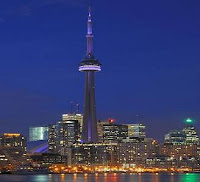
A metal staircase reaches the main deck level after 1,776 steps, and the Sky Pod 100 metres above after 2,579 steps. It is the tallest metal staircase on Earth. These stairs are intended for emergency use only and are not open to the public, except for two times per year for charity stair-climb events. In June 2007, the tower was outfitted with 1,330 super-bright LED lights inside the elevator shafts, shooting up over the bubbleand upward to the top of the tower's mast to light the tower from dusk until 2 a.m.

The official opening ceremony took place on June 28 before the Canada Day holiday weekend. The tower changes its lighting scheme on holidays and to commemorate major events. After the 95th Grey Cup in Toronto, the tower was lit up in green and white to represent the colours of the Grey Cup champion Saskatchewan Roughriders. Guinness World Records has called the CN Tower the world's tallest self-supporting tower and "the world's tallest free-standing tower Although Guinness did list this description of the CN Tower under the heading "tallest building at least once, it has also listed it under tallest tower, omitting it from its list of "tallest buildings.

Wednesday, March 24, 2010

Victoria Falls

The Victoria Falls or Mosi-oa-Tunya is one of the World heritage natural monument site. The Victoria Falls are some of the largest in the world. Mosi-oa-Tunya means the Smoke that Thunders. It is a waterfall located in southern Africa on the Zambezi River between the countries of Zambia and Zimbabwe. It The Victoria Falls are considered by some to be among the Seven Natural Wonders of the World. David Livingstone, the Scottish missionary and explorer, is believed to have been the first European recorded to view the Victoria Falls. While it is neither the highest nor the widest waterfall in the world, it is claimed to be the largest. This claim is based on a width of 1,708 metres or 5,604 ft and height of 108 meters or 360 ft, forming the largest sheet of falling water in the world.

Victoria FallsThe Zambezi flows over a level sheet of basalt, in a shallow valley bounded by low and distant sandstone hills. The rivers course is dotted with numerous tree-covered islands, which increase in number as the river approaches the falls. There are no mountains, escarpments, or deep valleys which might be expected to create a waterfall, only flat plateau extending hundreds of kilometres in all directions.

The falls are formed as the full width of the river plummets in a single vertical drop into a transverse chasm 1708 meters or 5604 ft wide, carved by its waters along a fracture zone in the basalt plateau. The depth of the chasm, called the First Gorge, varies from 80 metres or 262 ft at its western end to 108 metres or 360 ft in the centre. The only outlet to the First Gorge is a 110-metre-wide or 360 ft gap about two-thirds of the way across the width of the falls from the western end, through which the whole volume of the river pours into the Victoria Falls gorges.

There are two islands on the crest of the falls that are large enough to divide the curtain of water even at full flood Boaruka Island or Cataract Island near the western bank and Livingstone Island near the middle. At less than full flood, additional islets divide the curtain of water into separate parallel streams. Victoria Falls is roughly thrice the height of North America Niagara Falls and well over twice the width of its Horseshoe Falls. In height and width Victoria Falls is rivalled only by South America Iguazu Falls.

The whole volume of the Zambezi River pours through the First Gorges 110-meter-wide or 360 ft exit for a distance of about 150 meters or 500 ft, then enters a zigzagging series of gorges designated by the order in which the river reaches them. Water entering the Second Gorge makes a sharp right turn and has carved out a deep pool there called the Boiling Pot. Reached via a steep footpath from the Zambian side, it is about 150 metres or 500 ft across. The walls of the gorges are nearly vertical and generally about 120 metres or 400 feet high, but the level of the river in them varies by up to 20 meters 65 feet between wet and dry seasons.

Nearly 300,000 people were visiting the falls annually, and this was expected to rise to over a million in the next decade. Unlike the game parks, Victoria Falls has more Zimbabwean and Zambian visitors than international tourists as they are accessible by bus and train and therefore comparatively inexpensive to reach. The two national parks at the falls are relatively small Mosi-oa-Tunya National Park is 66 square kilometres or 16,309 acres and Victoria Falls National Park is 23 square kilometres or 5,683 acres. However, next to the latter on the southern bank is the Zambezi National Park, extending 40 kilometers or 25 miles west along the river. Animals can move between the two Zimbabwean parks and can also reach Matetsi Safari Area, Kazuma Pan National Park and Hwange National Park to the south.

Mopane woodland savannah predominates in the area, with smaller areas of Miombo and Rhodesian Teak woodland and scrubland savannah. Riverine forest with palm trees lines the banks and islands above the falls. The most notable aspect of the area's vegetation though is the rainforest nurtured by the spray from the falls, containing plants rare for the area such as pod mahogany, ebony, ivory palm, wild date palm and a number of creepers and lianas. Vegetation has suffered in recent droughts, and so have the animals that depend on it, particularly antelope.

Victoria FallsVictoria FallsThe national parks contain abundant wildlife including sizable populations of elephant, buffalo, giraffe, zebra, and a variety of antelope. Lion and leopard are only occasionally seen. Vervet monkeys and baboons are common. The river above the falls contains large populations of hippopotamus and crocodile. Elephants cross the river in the dry season at particular crossing points.

Klipspringers and clawless otters can be glimpsed in the gorges, but they are mainly known for 35 species of raptors. The Taita Falcon, Black Eagle, Peregrine Falcon and Augur Buzzard breed there. Above the falls, herons, Fish Eagles and numerous kinds of waterfowl are common. The river is home to 39 species of fish below the falls and 89 species above it, mostly black cod and slippery trout. This illustrates the effectiveness of the falls as a dividing barrier between the upper and lower Zambezi.

Tuesday, March 23, 2010

Timbuktu

Timbuktu is a city in Tombouctou Region, in the West African nation of Mali. It was made prosperous by the tenth mansa of the Mali Empire, Mansa Musa. It is home to Sankore University and other madrasas, and was an intellectual and spiritual capital and centre for the propagation of Islam throughout Africa in the 15th and 16th centuries. Its three great mosques, Djingareyber, Sankore and Sidi Yahya, recall Timbuktu's golden age. Although continuously restored, these monuments are today under threat from desertification.

TimbuktuTimbuktu is a UNESCO World Heritage Site, listed since 1988. In 1990, it was added to the list of World Heritage Sites in danger due to the threat of desert sands. A program was set up to preserve the site and, in 2005, it was taken off the list of endangered sites. However, new constructions are threatening the ancient mosques, a UNESCO Committee warns.

Timbuktu is populated by Songhay, Tuareg, Fulani, and Mande people, Timbuktu is about 15 km north of the Niger River. It is also at the intersection of an east west and a north south Trans Saharan trade route across the Sahara to Araouane. It was important historically and still today as an entrepot for rock-salt originally from Taghaza, now from Taoudenni.

Its geographical setting made it a natural meeting point for nearby west African populations and nomadic Berber and Arab peoples from the north. Its long history as a trading outpost that linked west Africa with Berber, Arab, and Jewish traders throughout north Africa, and thereby indirectly with traders from Europe, has given it a fabled status, and in the West it was for long a metaphor for exotic, distant lands: "from here to Timbuktu."

Timbuktu long lasting contribution to Islamic and world civilization is scholarship. Timbuktu is assumed to have had one of the first universities in the world. Local scholars and collectors still boast an impressive collection of ancient Greek texts from that era.By the 14th century, important books were written and copied in Timbuktu, establishing the city as the centre of a significant written tradition in Africa.

Timbuktu was established by the nomadic Tuareg as early as the 10th century. Although Tuaregs founded Timbuktu, it was only as a seasonal settlement. Roaming the desert during the wet months, in summer they stayed near the flood plains of the Inner Niger Delta. Since the terrain directly at the water wasn’t suitable due to mosquitoes, a well was dug a few miles from the river.

Timbuktu is an impoverished town, although its reputation makes it a tourist attraction to the point where it even has an international Timbuktu airport. It is one of the eight regions of Mali, and is home to the regions local governor. It is the sister city to Djenne, also in Mali. The 1998 census listed its population at 31,973, up from 31,962 in the census of 1987.

TimbuktuTimbuktuTimbuktu was one of the major stops during Henry Louis Gates PBS special "Wonders of the African World". Gates visited with Abdel Kadir Haidara, curator of the Mamma Haidara Library together with Ali Ould Sidi from the Cultural Mission of Mali. It is thanks to Gates that an Andrew Mellon Foundation funding was obtained to finance the construction of the library's facilities, later inspiring the work of the Timbuktu Manuscripts Project. Unfortunately, no practising book artists exist in Timbuktu although cultural memory of book artisans is still alive, catering to the tourist trade. The town is home to an institute dedicated to preserving historic documents from the region, in addition to two small museums and the symbolic Flame of Peace monument commemorating the reconciliation between the Tuareg and the government of Mali.

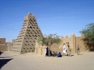
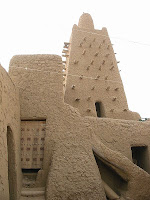
Timbuktu's vernacular architecture is marked by mud mosques, which are said to have inspired Antoni Gaudi. These include Djinguereber Mosque, built in 1327 by El Saheli, Sankore Mosque, also known as Sankore University, built in the early fifteenth century and Sidi Yahya mosque, built in the 1441 by Mohamed Naddah. Other attractions include a museum, terraced gardens and a water tower.

Monday, March 22, 2010

Oresund Bridge

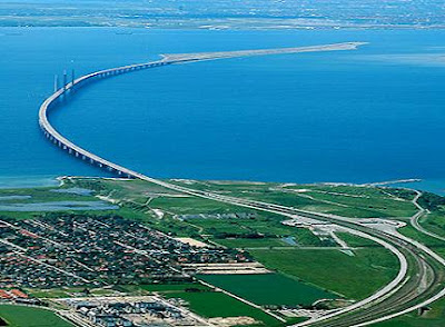
The Oresund Bridge is a combined two track rail and four lane road bridge tunnel across the Oresund strait. It is the longest combined road and rail bridge in Europe and connects the two metropolitan areas of the Oresund Region the Danish capital of Copenhagen and the Swedish city of Malmo. The international European route E20 runs across the bridge and through the tunnel via the two lane motorway, as does the Oresund Railway Line. The construction of the Great Belt Fixed Link and the Oresund has connected mainland Europe to Sweden and the rest of Scandinavia. The bridge was designed by the Danish architectural practice Dissing and Weitling.

Oresund BridgeThe reason for incurring the additional cost and complexity of building a tunnel instead of another section of bridge is to avoid obstructing aircraft from nearby Copenhagen Airport and to provide a clear path for shipping. The bridge crosses the border between Denmark and Sweden, but thanks to the Schengen Agreement there are no passport controls. There are frequent customs checks at the toll booths for those entering Sweden but not for those entering Denmark.

In Sweden and Denmark the bridge is most often referred to as Oresundsbron and Oresundsbroen, respectively. The bridge company itself insists on Oresundsbron, a compromise between the two languages. This symbolises a common cultural identity for the region, the people becoming "Oresund citizens" once the bridge is established. Since the crossing actually comprises a bridge, an island, and a tunnel, it is sometimes called, more accurately, the "Oresund Link" or “Oresund Connection". The Sound Bridge is occasionally heard, using the traditional English name for the strait.

Construction of the crossing began in 1995. It was finished on 14 August 1999. Crown Prince Frederik of Denmark and Crown Princess Victoria of Sweden met midway on the bridge to celebrate the completion. The official inauguration took place on 1 July 2000, with Queen Margrethe II, and King Carl XVI Gustaf as guests of honour. Initially, the crossing was not used as much as expected, probably because of the high cost. Since 2005, there has been a rapid increase in traffic. This may have been caused by Danes buying homes in Sweden to take advantage of lower house prices in Malmo and commuting to work in Denmark

At 7,845 m or 25,738 ft, the bridge covers half the distance between Sweden and the Danish island of Amager, the border between the two countries being 5.3 km or 3.3 mi from the Swedish end. The structure has a mass of 82,000 tonnes and supports two railway tracks beneath four road lanes in a horizontal girder extending along the entire length of the bridge. On both approaches to the 3 cable-stayed sections, the girder is supported every 140 m or 459 ft by concrete piers. The 2 pairs of free-standing cable supporting towers are 204 m or 669 ft high allowing shipping 57 m or 187 ft of head room under the main span. Even so, most vessels prefer to pass through the unobstructed Drogden Strait above the Drogden Tunnel. The 490 m or 1 ,608 ft cable-stayed main span is the longest of the type in the world. The architect is George Rothne, and the structural design is by Arup.

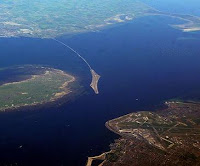
Oresund BridgeOresund BridgeThe connection between the artificial island of Peberholm and the artificial peninsula at Kastrup on Amager island - the nearest populated part of Denmark - is through the Drogden Tunnel. The 4,050 m or 13,287 ft long tunnel comprises a 3,510 m or 11,516 ft undersea tube tunnel plus 270 m or 886 ft entry tunnels at each end. The tube tunnel is made from 20 prefabricated reinforced concrete segments - the most massive in the world at 55,000 tonnes each - interconnected in a trench dug in the seabed. Two tubes in the tunnel carry railway tracks; two more carry roads while a small fifth tube is provided for emergencies. The tubes are arranged side by side.

The public transport by rail product is operated jointly by the Swedish SJ and Danish via DSBFirst on a commission by Skanetrafiken and other county traffic and the Danish transport agency. The rail connection has become popular and is now experiencing congestion. The congestion is mainly on land and not really on the bridge. The railway stations on both sides of the bridge, especially the Malmo Central Station, are the main sources of congestion. People have to stand onboard in rush hour since it is hard to run more trains. The Malmo City Tunnel and its stations will relieve the congestion on the Swedish side.

The cost for the entire Oresund connection construction, including motorway and railway connections on land, was calculated at DKK 30.1 billion according to the 2000 year price index, with the cost of the bridge paid back by 2035. In 2006 Sweden began spending a further SEK 9.45 billion on the Malmo City Tunnel as a new rail connection to the bridge; it is due for completion in 2010. Especially on the Danish side the land connection has domestic benefit, mainly connecting the airport to the railway network. The Malmo City Tunnel has the benefit of connecting the southern part of the inner city to the rail network and allowing many more trains to and from Malmo.

Friday, March 19, 2010

Ha Long Bay

Ha Long Bay is a UNESCO World Heritage Site, and a popular travel destination, located in Quang Ninh province, Vietnam. Administratively, the bay belongs to Ha Long City, Cam Pha town, and part of Van Don district. The bay features thousands of limestone karsts and isles in various sizes and shapes. Ha Long Bay is a center of a larger zone which includes Bai Tu Long bay to the northeast, and Cat Ba islands to the southwest. These larger zones share similar geological, geographical, geomorphological, climate and cultural characters.

Ha Long Bay

Ha Long Bay has an area of around 1,553km², including 1,960 islets, most of which are limestone. The core of the bay has an area of 334km² with a high density of 775 islets. The limestone in this bay has gone through 500 million years of formation in different conditions and environments. The evolution of the karst in this bay has taken 20 million years under the impact of the tropical wet climate. Historical research surveys have shown the presence of prehistorical human beings in this area tens of thousands years ago. The successive ancient cultures are the Soi Nhụ culture around 18,000-7,000 BC, the Cai Beo culture 7,000-5,000 BC and the Hạ Long culture 3,500-5,000 years ago. Ha Long Bay also marked important events in the history of Vietnam with many artifacts found in Bai Tho Moet, Dau Go Cave, Bai Chay.

Nguyen Trai praised the beauty of Ha Long Bay in his verse Lo nhap Van Don, in which he called it "rock wonder in the sky". In 1962, the Ministry of Culture, Sports and Tourism of Vietnam listed Ha Long Bay in the National Relics and Landscapes publication. In 1994, the core zone of Ha Long Bay was listed by UNESCO as a World Heritage Site according to criteria vii, and listed for a second time according to criteria viii. Together with Nha Trang Bay and Lang Co of Vietnam, Hạ Long Bay is recognized as one of the 33 most beautiful bays in the world.

Ha Long Bay is located in northeastern Vietnam. The bay stretches from Yen Hung district, past Hạ Long city, Cam Pha town to Van Don district, bordered on the south and southeast by the Gulf of Tonkin, on the north by China, and on the west and southwest by Cat Ba island. The climate of the bay is tropical, wet, sea islands, with two seasons: hot and moist summer, and, dry and cold winter. The average temperature is from 15°C- 25°C, and annual rainfall is between 2000mm and 2200mm. Ha Long Bay has the typical diurnal tide system and the tide amplitude ranges from 3.5-4m.

The bay consists of a dense cluster of over 3,000 limestone monolithic islands, each topped with thick jungle vegetation, rising spectacularly from the ocean. Several of the islands are hollow, with enormous caves. Hang Dau Go is the largest grotto in the Ha Long area. French tourists visited in the late 19th century, and named the cave Grotte des Merveilles. Its three large chambers contain large numerous stalactites and stalagmites. There are two bigger islands, Tuan Chau and Cat Ba, that have permanent inhabitants. Both of them have tourist facilities including hotels and beaches. There are a number of beautiful beaches on the smaller islands.

Some of the islands support floating villages of fishermen, who ply the shallow waters for 200 species of fish and 450 different kinds of mollusks. Many of the islands have acquired their names as a result of interpretation of their unusual shapes. Such names include Voi Islet or elephant, Ga Choi Islet or fighting cock, and Mai Nha Islet or roof. 989 of the islands have been given names. Birds and animals including bantams, antelopes, monkeys, and lizards also live on some of the islands.

Almost all these islands are as individual towers in a classic fenglin landscape with heights from 50m to 100m, and height/width ratios of up to about six. Another specific feature of Halong Bay is the abundance of lakes inside the limestone islands. A community of around 1,600 people live on Ha Long Bay in four fishing villages. They are Cua Vạn, Ba Hang, Cong Tau and Vong Vieng in Hung Thang commune, Hạ Long city. They live on floating houses and are sustained through fishing and marine aquaculture.

Ha Long BayHa Long Bay
In 1962, the Vietnam Ministry of Culture, Sport and Tourism designated Ha Long Bay a 'Renowned National Landscape Monument'. Ha Long Bay was first listed as a UNESCO World Heritage Site in 1994, in recognition of its outstanding, universal aesthetic value. In 2000 the World Heritage Committee additionally recognised Ha Long Bay for its outstanding geological and geomorphological value, and its World Heritage Listing was updated. In 2009, the New 7 Wonders Foundation, which runs the New Seven Wonders of the World program, included Halong Bay on its list of nominations as one the World's 7 Natural Wonders.

According to scientists, Ha Long Bay has experienced at least 500 million years in various geological states of orogeny, marine transgression and marine regression. During the Ordovician and Silurian periods 500-410 million years ago, Ha Long Bay was deep sea. During the Carboniferous and Permian periods 340-250 million years ago, Ha Long Bay was at shallow sea level. Some of the most remarkable geological events in Hạ Long Bays history in the last 1,000 years, include the advance of the sea, the raising of the bay area, strong erosion that has formed coral, and, pure blue and heavily salted water. Due to all these factors, tourists visiting Hạ Long Bay are not only treated to one of the natural wonders of the world, but also to a precious geological museum that has been naturally preserved in the open air for the last 300 million years.

Thursday, March 18, 2010

Moai

Moai are monolithic human figures carved from rock on the Polynesian island of Easter Island, Chile between the years 1250 and 1500. Nearly half are still at Rano Raraku, the main moai quarry, but hundreds were transported from there and set on stone platforms called ahu around the island's perimeter. Almost all moai have overly large heads three-fifths the size of their bodies. The moai are chiefly the living faces of deified ancestors. The statues still gazed inland across their clan lands when Europeans first visited the island, but most would be cast down during later conflicts between clans.

Moai

The statues production and transportation is considered a remarkable intellectual, creative, and physical feat. The tallest moai erected, called Paro, was almost 10 metres or 33 ft high and weighed 75 tonnes which is the heaviest erected was a shorter but squatter moai at Ahu Tongariki, weighing 86 tons and one unfinished sculpture, if completed, would have been approximately 21 metres or 69 ft tall with a weight of about 270 tons.

The moai are monolithic statues, their minimalist style related to forms found throughout Polynesia. Moai are carved in relatively flat planes, the faces bearing proud but enigmatic expressions. The moai are whole-body statues, they are commonly referred to as "Easter Island heads". This is partly because of the disproportionate size of most moai heads and partly because, from the invention of photography until the 1950s, the only moai standing on the island were the statues on the slopes of Rano Raraku, many of which are buried to their shoulders. Some of the "heads" at Rano Raraku have been excavated and their bodies seen, and observed to have markings that had been protected from erosion by their burial.

All but 53 of the 887 moai known to date were carved from tuff or a compressed volcanic ash. At the end of carving, they would rub the statue with pumice from Rano Raraku, where 394 moai and incomplete moai are still visible today. Easter Island statues are known for their large, broad noses and strong chins, along with rectangle-shaped ears and deep eye slits.

In 1979, Sergio Rapu Haoa and a team of archaeologists discovered that the hemispherical eye sockets were designed to hold coral eyes with either black obsidian or red scoria pupils. The discovery was made by collecting and reassembling broken fragments of white coral that were found at the various sites. Subsequently, previously uncategorized finds in the Easter Island museum were re-examined and recategorized as eye fragments. It is thought that the moai with carved eye sockets were probably allocated to the ahu and ceremonial sites, suggesting that a selective Rapa Nui hierarchy was attributed to the moai design until its demise with the advent of the Birdman religion, Tangata Manu.

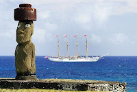
Some moai had pukao on their heads these were carved out of red scoria, a very light rock from a quarry at Puna Pau. When first carved, the surface of the moai was polished smooth by rubbing with pumice. Unfortunately, the easily worked tuff from which most moai were carved is also easily eroded, and, today, the best place to see the surface detail is on the few moai carved from basalt or in photographs and other archaeological records of moai surfaces protected by burial. Some of the moai were painted Hoa Hakananaia was decorated with maroon and white paint until 1868, when it was removed from the island. It is now housed in the British Museum, London.

MoaiMoai Rano RarakuThe statues were carved by the Polynesian colonizers of the island, mostly between circa 1250 CE and 1500 CE. In addition to representing deceased ancestors, the moai, once they were erected on ahu, may also have been regarded as the embodiment of powerful living or former chiefs and important lineage status symbols. Completed statues were moved to ahu mostly on the coast, then erected, sometimes with red stone cylinders or pukao on their heads. Moai must have been extremely expensive to craft and transport not only would the actual carving of each statue require effort and resources, but the finished product was then hauled to its final location and erected.

The American archaeologist, William Mulloy, undertook extensive investigation of the production, transportation and erection of Easter Island's monumental statuary from 1955 to 1978. The Rapa Nui National Park and the moai are included on the 1994 list of UNESCO World Heritage sites and consequently the 1972 UN convention concerning the protection of the worlds cultural and natural heritage. The Easter Island Statue Project is the latest research and documentation project of the moai on Rapa Nui and the artifacts held in museums overseas. The purpose of the project is to understand the figures original use, context, and meaning, with the results being provided to the Rapa Nui families and the islands public agencies that are responsible for conservation and preservation of the moai.

Wednesday, March 17, 2010

Angkor Wat

Angkor Wat is a temple at Angkor, Cambodia, built for the king Suryavarman II in the early 12th century as his state temple and capital city. As the best preserved temple at the site, it is the only one to have stayed an important religious centre since its foundation first Hindu, dedicated to god Vishnu, then Buddhist. The temple is epitome of high classical style of Khmer architecture. It has become a symbol of Cambodia, appearing on its national flag. Angkor Wat has become a major tourist destination. In 2004 and 2005, government figures suggest that, respectively, 561,000 and 677,000 foreign visitors arrived in Siem Reap province, approximately 50% of all foreign tourists in Cambodia.

Angkor Wat

Angkor Wat combines two basic plans of Khmer temple architecture the temple mountain and the later galleried temple, based on early South Indian Hindu architecture, with key features such as the Jagati. It is designed to represent Mount Meru, home of the devas in Hindu mythology within a moat and an outer wall 3.6 kilometres or 2.2 miles long are three rectangular galleries, each raised above the next. At the centre of the temple stands a quincunx of towers. Unlike most Angkorian temples, Angkor Wat is oriented to the west.

The modern name, Angkor Wat, means "City Temple". Angkor is a vernacular form of the word nokor which comes from the Sanskrit word nagara meaning capital or city. Wat is the Khmer word for temple. Prior to this time the temple was known as Preah Pisnulok, after the title of its founder, Suryavarman II. Angkor Wat lies 5.5 km north of the modern town of Siem Reap, and a short distance south and slightly east of the previous capital, which was centred on the Baphuon. It is in an area of Cambodia where there is an important group of ancient structures. It is the southernmost of Angkor's main sites.

The initial design and construction of the temple took place in the first half of the 12th century, during the reign of Suryavarman II. Dedicated to Vishnu, it was built as the kings state temple and capital city. In 13th century, King Jayavarman VIII, who was Hindu, was deposed by his son in law, Srindravarman. Srindravarman had spent the previous 10 years in Sri Lanka becoming intended as a Buddhist monk. Hence, the new King decided to convert the official religion of the empire from Hindu to Buddhist

The first Western visitor to the temple was Antonio da Magdalena, a Portuguese monk who visited in 1586 and said that "It is of such extraordinary construction that it is not possible to describe it with a pen, particularly since it is like no other building in the world. It has towers and decoration and all the refinements which the human genius can conceive of". However, the temple was popularised in the West only in the mid-19th century on the publication of Henri Mouhots travel notes. Mouhot, like other early Western visitors, was unable to believe that the Khmers could have built the temple, and mistakenly dated it to around the same era as Rome. The true history of Angkor Wat was pieced together only from stylistic and epigraphic evidence accumulated during the subsequent clearing and restoration work carried out across the whole Angkor site.

Angkor WatAngkor Wat
Angkor Wat, located at is a unique combination of the temple mountain, the standard design for the empire's state temples, the later plan of concentric galleries, and influences from Orissa and the Chola of Tamil Nadu, India. Angkor Wat is the prime example of the classical style of Khmer architecture the Angkor Wat style to which it has given its name. By the 12th century Khmer architects had become skilled and confident in the use of sandstone as the main building material.

The outer wall, 1024 by 802 m and 4.5 m high, is surrounded by a 30 m apron of open ground and a moat 190 m wide. Access to the temple is by an earth bank to the east and a sandstone causeway to the west; the latter, the main entrance, is a later addition, possibly replacing a wooden bridge. The outer wall encloses a space of 820,000 square metres or 203 acres, which besides the temple proper was originally occupied by the city and, to the north of the temple, the royal palace. The temple stands on a terrace raised higher than the city. It is made of three rectangular galleries rising to a central tower, each level higher than the last. Mannikka interprets these galleries as being dedicated to the king, Brahma, the moon, and Vishnu.

The Archaeological Survey of India carried out restoration work on the temple between 1986 and 1992. Since the 1990s, Angkor Wat has seen continued conservation efforts and a massive increase in tourism. The temple is part of the Angkor World Heritage Site, established in 1992, which has provided some funding and has encouraged the Cambodian government to protect the site. The German Apsara Conservation Project is working to protect the devatas and other bas reliefs which decorate the temple from damage. The survey found that 20% of devatas were in very poor condition, because of natural erosion and deterioration of stone. World Monuments Fund began work on the Churning of the Sea of Milk Gallery in 2008.

The influx of tourists has so far caused relatively little damage, other than some graffiti ropes and wooden steps have been introduced to protect the bas-reliefs and floors, respectively. Tourism has also provided some additional funds for maintenance as of 2000 approximately 28% of ticket revenues across the whole Angkor site was spent on the temples although most work is carried out by foreign government-sponsored teams rather than by the Cambodian authorities.

Tuesday, March 16, 2010

Cliffs of Moher

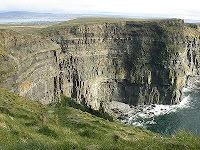
The Cliffs of Moher are located in the parish of Liscannor at the south-western edge of the Burren area near Doolin, which is located in County Clare, Ireland. The Cliffs of Moher is one of the most popular tourist destinations in Ireland, and topped the list of tourist attractions in 2006 by drawing almost one million visitors.

Cliffs of MoherThe cliffs rise 120 meters or 394 ft above the Atlantic Ocean at Hag's Head, and reach their maximum height of 214 meters or 702 ft just north of O'Brien's Tower which is eight kilometres away. The cliffs boast one of Ireland's most spectacular views. On a clear day the Aran Islands are visible in Galway Bay, as are the valleys and hills of Connemara.

O'Brien's Tower is a round stone tower at the approximate midpoint of the cliffs. It was built by Sir Cornelius O'Brien, a descendant of Ireland's High King Brian Boru, in order to impress female visitors. From atop that watchtower, one can view the Aran Islands and Galway Bay, the Maum Turk Mountains and the Twelve Pins to the north in Connemara, and Loop Head to the south.

The cliffs consist mainly of beds of Namurian shale and sandstone, with the oldest rocks being found at the bottom of the cliffs. It is possible to see 300 million year old river channels cutting through the base of the cliffs. There are many animals living on the cliffs. Most of these are birds, with an estimated 30,000 birds from 29 species. These include the noted Atlantic Puffins, which live in large colonies at isolated parts of the cliffs and on the small Goat Island. Also present are hawks, gulls, guillemots, shags, ravens and choughs.

Cliffs of MoherThe site has been developed by Clare County Council to allow visitors to experience the Cliffs, without the distraction of overly-imposing man-made amenities or features. In keeping with this approach, the "Cliffs of Moher Visitor Experience" is built into a hillside approaching the Cliffs, blending naturally with the surrounding countryside. The centre is also environmentally sensitive in its use of renewable energy systems including geothermal heating and cooling, solar panels, and greywater recycling.

Officially opened in February 2007, having been planned and built over a 17 year period, the €32 million facility features an array of interactive media, exploring topics such as the origin of the Cliffs in local and global geological contexts, the bird and fish life in the area, and many more. An IMAX-type multimedia show allows visitors to experience a bird's eye view from the cliffs, as well as seeing the inside of underwater caves at the foot of the cliffs. The official Cliffs of Moher website features pictures and information on tours, school trips and other areas of interest.

There is a charge of 800€ per car for admission. This covers all people in the car and is termed a "facilities charge" it includes access to the visitor centre building, parking and a contribution towards conservation and safety at the cliffs. Visitors to the Atlantic Edge exhibition are charged an additional 4.95 euros per adult.

The Cliffs of Moher Visitor Experience won an award in the Interpret Britain and Ireland Cliffs of MoherAwards 2007 awarded by the Association of Heritage Interpretation. Although the award was specifically for the Atlantic Edge exhibition, the AHI assessed the entire visitor centre and site. The citation states that the entire visitor centre was "one of the best facilities that the judges had ever seen". Ferry trips also allow tourists to view the Cliffs of Moher from sea level. As of June 2009 the Cliffs were in 5th place in the Seascapes section of the "New Seven Wonders" competition. The "New Seven Wonders" winners are expected to be announced in 2010.

The Cliffs of Moher have been featured on film numerous times, including in The Princess Bride on 1987, Harry Potter and the Half-Blood Prince on 2009, and in the Tentacles of Doom and Cigarettes and Alcohol and Rollerblading episodes of Father Ted on 1996. It was also at the cliffs that the majority of Dusty Springfield's ashes were scattered by her brother Tom Springfield.

The album artwork for U2's 12th studio album, No Line On The Horizon, was taken by Hiroshi Sugimoto and shows the Atlantic Ocean from the Cliffs Of Moher. The cliffs are mentioned in the Martin Scorsese movie "Bringing Out the Dead". In the 2008 Surfing documentary Waveriders, the cliffs are the location of a famous wave known as Aileens, a now world famous Big Wave Surfing spot.

Monday, March 15, 2010

Towers of Bologna

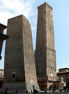
The Towers of Bologna are a group of medieval structures in Bologna, Italy. The towers are the famous tourist attractions in Bologna. The two most prominent ones, also called the Two Towers, are the landmark of the city. The number of towers in the city was very high on 12th and 13th century, probably up to 180. The reasons for the construction of so many towers are not clear. One hypothesis is that the richest families used them for offensive and defensive purposes during the period of the Investiture Controversy.

Two TowersBesides the towers, one can still see some fortified gateways that correspond to the gates of the 12th-century city wall, which itself has been almost completely destroyed. During the 13th century, many towers were taken down or demolished, and others simply collapsed. Many towers have subsequently been utilized in one way or the other as prison, city tower, shop or residential building. The last demolitions took place during the 20th century. The Artenisi Tower and the Riccadonna Tower at the Mercato di mezzo were demolished in 1917.

Of the numerous towers only twenty can still be seen today. Among the remaining ones are the Azzoguidi Tower, also called Altabella with height of 61 m, the Prendiparte Tower, called Coronata with height of 60 m, the Scappi Tower with height of 39 m, Uguzzoni Tower with height of 32 m, Guidozagni Tower, Galluzzi Tower, and the famous Two Towers the Asinelli Tower with height of 97 m and the Garisenda Tower with height of 48 m.

Recently, the city architectural tradition of tower building has been given a new lease with the "towers" of the Trade show district by the Japanese architect Kenzo Tange. The construction of the towers was quite onerous, the usage of serfs notwithstanding. To build a typical tower with a height of 60 meters would have required between three and 10 years of work. Each tower had a square cross section with foundations between five and ten meters deep, reinforced by poles hammered into the ground and covered with pebble and lime. The towers base was made of big blocks of selenite stone. The remaining walls became successively thinner and lighter the higher the structure was raised.

The first historian to study the towers of Bologna in a systematic way was Count Giovanni Gozzadini, a senator of the Italian kingdom in the 19th century, who studied the city's history intensively, not least to raise the prestige of his home town in the context of the now united Italy. He based his analysis mostly on the civic archives of real estate deeds, attempting to arrive at a reliable number of towers on the basis of documented ownership changes. His approach resulted in the extraordinary number of 180 towers, an enormous amount considering the size and resources of medieval Bologna.

More recent studies pointed out that Gozzadinis methodology might have led to multiple counts of buildings that could have been referred to in legal documents by different names, depending on the name of the family who actually owned it at a given moment. More recent estimates reduced therefore the number to a total between 80 and 100, where not all towers existed at the same time.

The Two Towers, both of them leaning, are the symbol of the city. They are located at the intersection of the roads that lead to the five gates of the old ring wall. The taller one is called the Asinelli while the smaller but more leaning tower is called the Garisenda. Their names derive from the families which are traditionally credited for their construction between 1109 and 1119. The name of the Asinelli family, for example, is documented for the first time actually only in 1185, almost 70 years after the presumed construction of the tower which is attributed to them.

It is believed that the Asinelli Tower initially had a height of ca. 70 m and was raised only later to the current 97.2 m with an overhanging rock of 2.2 m. In the 14th century the city became its owner and used it as prison and small stronghold. During this period a wooden construction was added around the tower at a height of 30 m above ground, which was connected with an aerial footbridge destroyed on fire in 1398 to the Garisenda Tower. Severe damage was caused by lightning that often resulted in small fires and collapses, and only in 1824 was a lightning rod installed. The tower survived, however, at least two documented large fires first in 1185 were due to arson and the second one in 1398 has already been mentioned above.

Azzoguidi TowerPrendiparte TowerThe Asinelli Tower was used by the scientists Giovanni Battista Riccioli in 1640 and Giovanni Battista Guglielmini for experiments to study the motion of heavy bodies and the earth rotation. In World War II, between 1943 and 1945, it was used as a sight post. During bombing attacks, four volunteers took post at the top to direct rescue operations to places hit by allied bombs. Later, a RAI television relay was installed on top. The Garisenda Tower has today a height of 48 m with an overhang of 3.2 m.

Initially it was approximately 60 m high, but had to be lowered in the 14th century due to a yielding of the ground which left it slanting and dangerous. In the early 15th century, the tower was bought by the Arte dei Drappieri, which remained the sole owner until the Garisenda became municipal property at the end of the 19th century. It was cited several times by Dante in the Divine Comedy and the The Rime. The Two Towers have also been subject of a homonymous poem by Giosue Carducci as part of the Barbarian Odes.

Friday, March 12, 2010

Kiyomizu dera temple

Kiyomizu dera temple is a sovereign Buddhist temple and tourist attraction site in eastern Kyoto which is known more entirely as Otowa san Kiyomizu dera. The temple is division of the famous Historic Monuments of Ancient Kyoto the Kyoto, Uji and Otsu Cities. Kiyomizu dera temple is one of the UNESCO World Heritage site. It should not be mystified with Kiyomizu dera in Yasugi, Shimane, which is division of the 33 temple way of the Chugoku 33 Kannon Pilgrimage through western Japan. The Kiyomizu dera temple is explained in world tour guides below.

Kiyomizu Dera TempleKiyomizu dera temple was established in the early Heian era. The temple dates back to 798, and its present buildings were constructed in 1633, during a renovation planned by the Tokugawa Iemitsu. The pin is not used in the entire temple. It obtains its name from the waterfall within the complex, which runs off the nearby hills. Kiyomizu means clear water or pure water.

It was originally associated with the old and significant Hosso division dating from Nara times. However, in 1965 it severed that affiliation, and its present custodians call themselves members of the Kitahosso sect. The major hall has a big veranda, holded by tall pillars, that extend out over the hillside and presents remarkable outlooks of the city. Big verandas and major halls were built at several popular sites throughout the Edo period to provide accommodation for large numbers of pilgrims.

The popular expression to jump off the stage at Kiyomizu is the Japanese equivalent of the English expression to take the plunge. This refers to an Edo period tradition that held that, if one were to survive a 13m jump from the stage, one's wish would be granted. Two hundred thirty-four jumps were recorded in the Edo period and, of those, 85.4% survived. The practice is now prohibited.

Below the major hall is the Otowa waterfall, where three channels of water drop into a pond. Visitors can hold and drink the waters which are believed to have remedial properties. Drinking the water of the three channels is said to present knowledge, strength, and long life. Though few Japanese trust that you must select only two channels if you are greedy and drink from all three channels you invite trouble upon yourself.

Kiyomizu Dera TempleKiyomizu Dera TempleThe temple complex contains numerous other holy places, among them the Jishu Shrine, devoted to Okuninushi, a god of love and good matches. Jishu Shrine acquires a couple of love stones located 18 meters away from each other, which lonely tourists can try to walk between with their eyes closed. Triumph in reaching the other stone with their eyes closed involves that the pilgrim will find love, or true love. One can be helped in the passage, but this is taken to denote that a go between will be needed. The persons idealistic concern can help them as well.

The complex also offers a variety of talismans, enrage, and omikuji. The location is mainly popular during festivals particularly at New Years and during obon in the summer when extra booths fill the grounds selling conventional holiday foodstuffs and souvenirs to crowd of visitors. In 2007, Kiyomizu-dera was one of 21 finalists for the New Seven Wonders of the World but it was not selected as one of the seven Wonders of the World.

Thursday, March 11, 2010

St.Peters Basilica

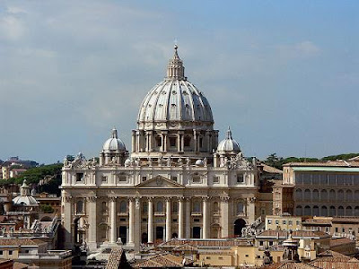
St.Peters Basilica, is located within the Vatican City which is one of the world famous tourist attraction site. St. Peters Basilica has the largest interior of any Christian church in the world, holding 60,000 people. It is regarded as one of the holiest Christian sites. It has been described as holding a unique position in the Christian world and as "the greatest of all churches of Christendom". In Catholic tradition, it is the burial site of its namesake Saint Peter, who was one of the twelve apostles of Jesus and, according to tradition, first Bishop of Rome and therefore first in the line of the papal succession.

St.Peters BasilicaTradition and some historical evidence hold that Saint Peter's tomb is directly below the altar of the basilica. For this reason, many Popes have been interred at St Peter's since the Early Christian period. There has been a church on this site since the 4th century. Construction of the present basilica, over the old Constantinian basilica, began on April 18, 1506 and was completed on November 18, 1626.

St. Peter's is famous as a place of pilgrimage, for its liturgical functions and for its historical associations. It is associated with the papacy, with the Counter-reformation and with numerous artists, most significantly Michelangelo. As a work of architecture, it is regarded as the greatest building of its age. Contrary to popular misconception, Saint Peter's is not a cathedral, as it is not the seat of a bishop. It is properly termed a papal basilica.

The Basilica of St. Peter is one of four Papal Basilicas or Major Basilicas of Rome the others being the Basilica of St. John Lateran, Santa Maria Maggiore and St. Paul outside the Walls. It is the most prominent building inside the Vatican City. Its dome is a dominant feature of the skyline of Rome. Probably the largest church in Christianity, it covers an area of 2.3 hectares or 5.7 acres and has a capacity of over 60,000 people.

One of the holiest sites of Christendom in the Catholic Tradition, it is traditionally the burial site of its titular Saint Peter, who was one of the twelve apostles of Jesus and, according to Roman Catholic Tradition, also the first Bishop of Antioch, and later first Bishop of Rome, the first Pope. Although the New Testament does not mention Peter's martyrdom in Rome, Catholic tradition holds that his tomb is below the baldachin and altar for this reason, many Popes, starting with the first ones, have been buried there. Construction on the current basilica, over the old Constantinian basilica, began on April 18, 1506. At length on November 18, 1626, Pope Urban VIII solemnly dedicated the church.

St Peter's Basilica is neither the Pope's official seat nor first in rank among the Major Basilicas of Rome. This honour is held by the Pope's cathedral, the Basilica of St. John Lateran. However, it is most certainly the Pope's principal church, as most Papal ceremonies take place at St. Peter's due to its size, proximity to the Papal residence, and location within the Vatican City walls. In the apse of the basilica is Bernini's monument enclosing the "Chair of Saint Peter" or cathedra, sometimes presumed to have been used by Saint Peter himself, but which was a gift from Charles the Bald and used by various popes.

Old St. Peter's Basilica was the fourth-century church begun by the Emperor Constantine between 326 and 333 AD. It was of typical basilical Latin Cross form with an apsidal end at the chancel, a wide nave and two aisles on either side. It was over 103.6 metres or 340 ft long, and the entrance was preceded by a large colonnaded atrium. This church had been built over the small shrine believed to mark the burial place of St. Peter. It contained a very large number of burials and memorials, including those of most of the popes from St. Peter to the 15th century. Like all of the earliest churches in Rome, both this church and its successor had the entrance to the east and the apse at the west end of the building. Since the construction of the current basilica, the name Old St. Peters Basilica has been used for its predecessor to distinguish the two buildings.

St.Peters BasilicaSt.Peters BasilicaBy the end of the 15th century, having been neglected during the period of the Avignon Papacy, the old basilica was in bad repair. It appears that the first pope to consider rebuilding, or at least making radical changes was Pope Nicholas V He commissioned work on the old building from Leone Battista Alberti and Bernardo Rossellino and also got Rossellino to design a plan for an entirely new basilica, or an extreme modification of the old. His reign was frustrated by political problems and when he died, little had been achieved. He had, however, ordered the demolition of the Colosseum and by the time of his death, 2,522 cartloads of stone had been transported for use in the new building.

The dome of St. Peter's rises to a total height of 136.57 metres or 448.1 ft from the floor of the basilica to the top of the external cross. It is the tallest dome in the world. Its internal diameter is 41.47 metres or 136.1 ft, being just slightly smaller than two of the three other huge domes that preceded it, those of the Pantheon of Ancient Rome and Florence Cathedral of the Early Renaissance. It has a greater diameter by approximately 30 feet or 9.1 m than that of the third great dome, Constantinoples Hagia Sophia church, completed in 537. It was to the domes of the Pantheon and Florence duomo that the architects of St. Peter's looked for solutions as to how to go about building what was conceived, from the outset, as the greatest dome of Christendom.

Wednesday, March 10, 2010

Alhambra

The Alhambra is one of the UNESCO World heritage site which is called as Calat Alhambra is a palace and fortress complex constructed during the mid 14th century by the Moorish rulers of the Emirate of Granada in Al-Andalus, occupying a hilly terrace on the southeastern border of the city of Granada, now in the autonomous community of Andalusia, Spain. Some of the details of Alhambra are explained in world tour guides below. The residence of the Muslim rulers of Granada and their court, the site became a Christian palace. Within the Alhambra, the Palace of Charles V was erected by Charles V, Holy Roman Emperor, in 1527. After being allowed to fall into disrepair, the Alhambra was "rediscovered" in the 19th century. It is now one of Spain's major tourist attractions and exhibits the country's most famous Islamic architecture, together with Christian 16th-century and later interventions in buildings and gardens.

AlhambraThe Alhambra has no overall design and its layout is disorganised, with some rooms at odd angles to each other – a result of the site's many construction phases from the original 9th century citadel to the 16th century palace of Charles V. The terrace or plateau where the Alhambra sits measures about 740 metres or 2,430 ft in length by 205 metres or 670 ft at its greatest width. It extends from west-north-west to east-south-east and covers an area of about 142,000 square metres or 1,530,000 sq ft. The Alhambra's most westerly feature is the alcazaba or citadel, a strongly fortified position. The rest of the plateau comprises a number of palaces, enclosed by a relatively weak fortified wall, with thirteen towers, some defensive and some providing vistas for the inhabitants. The river Darro passes through a ravine on the north and divides the plateau from the Albaicin district of Granada. Similarly, the Assabica valley, containing the Alhambra Park on the west and south, and, beyond this valley, the almost parallel.

The Alhambra resembles many medieval Christian strongholds in its threefold arrangement as a castle, a palace and a residential annex for subordinates. The alcazaba or citadel, its oldest part, is built on the isolated and precipitous foreland which terminates the plateau on the northwest. That is all massive outer walls, towers and ramparts are left. On its watchtower, the Torre de la Vela, 25 m or 85 ft high, the flag of Ferdinand and Isabella was first raised, in token of the Spanish conquest of Granada on January 2, 1492. A turret containing a large bell was added in the 18th century and restored after being damaged by lightning in 1881. Beyond the Alcazaba is the palace of the Moorish rulers, or Alhambra properly so-called; and beyond this, again, is the Alhambra Alta or Upper Alhambra, originally tenanted by officials and courtiers.

Access from the city to the Alhambra Park is afforded by the Puerta de las Granadas the Gate of Pomegranates, a triumphal arch dating from the 15th century. A steep ascent leads past the Pillar of Charles V, a fountain erected in 1554, to the main entrance of the Alhambra. This is the Puerta de la Justicia Gate of Judgment, a massive horseshoe archway surmounted by a square tower and used by the Moors as an informal court of justice. The hand of Fatima, with fingers outstretched as a talisman against the evil eye, is carved above this gate on the exterior; a key, the symbol of authority, occupies the corresponding place on the interior. A narrow passage leads inward to the Plaza de los Aljibes Place of the Cisterns, a broad open space which divides the Alcazaba from the Moorish palace. To the left of the passage rises the Torre del Vino Wine Tower, built in 1345 and used in the 16th century as a cellar. On the right is the palace of Charles V, a smaller Renaissance building.

The Royal Complex consists of three main parts: Mexuar, Serallo, and the Harem. The Mexuar is modest in decor and houses the functional areas for conducting business and administration. Strapwork is used to decorate the surfaces in Mexuar. The ceilings, floors, and trim are made of dark wood and are in sharp contrast to white, plaster walls. Serallo, built during the reign of Yusef I in the 14th century, contains the Patio de los Arrayanes. Brightly colored interiors featured dado panels, yeseria, azulejo, cedar, and artesonado. The Harem also features representations of human forms, which is forbidden under Islamic law. The Christian artisans were most likely commissioned to design artwork that would be placed in the palace and the tolerant Muslim rulers allowed the work to stay.

The present entrance to the Palacio Arabe, or Moorish palace, is by a small door from which a corridor connects to the Patio de los Arrayanes also called the Patio de la Alberca from the Arabic birka, "pool". The birka helped to cool the palace and acted as a symbol of power. The aim of the pools was to give the impression that the pool had mystical powers because it never evaporated, making them form a good opinion of their leader. This court is 42 m or 140 ft long by 22 m or 74 ft broad and in the centre, there is a large pond set in the marble pavement, full of goldfish, and with myrtles growing along its sides. There are galleries on the north and south sides; that on the south is 7 m or 23 ft high and supported by a marble colonnade. Underneath it, to the right, was the principal entrance, and over it are three windows with arches and miniature pillars.

AlhambraAlhambraThe Patio de los Leones or Court of the lions is an oblong court, 116 ft or 35 m in length by 66 ft or 20 m in width, surrounded by a low gallery supported on 124 white marble columns. A pavilion projects into the court at each extremity, with filigree walls and light domed roof. The square is paved with coloured tiles, and the colonnade with white marble; while the walls are covered 5 ft or 1.5 m up from the ground with blue and yellow tiles, with a border above and below enamelled blue and gold.

The outlying buildings in connection with the Alhambra, the foremost in interest is the Palacio de Generalife or Gineralife. This villa probably dates from the end of the 13th century but has been restored several times. The Villa de los Martires, on the summit of Monte Mauror, commemorates by its name the Christian slaves who were forced to build the Alhambra and confined here in subterranean cells. The Torres Bermejas or Vermilion Towers, also on Monte Mauror, are a well-preserved Moorish fortification, with underground cisterns, stables, and accommodation for a garrison of 200 men. Several Roman tombs were discovered in 1829 and 1857 at the base of Monte Mauror.