Social Icons

Pages

Monday, May 31, 2010

Juscelino Kubitschek Bridge

The Juscelino Kubitschek Bridge also known as the President JK Bridge or just the JK Bridge, is a steel and concrete bridge that crosses Lake Paranoa in Brasilia in Brazil. It links the southern part of the lake, and St. Sebastian Paranoa the Pilot Plan or the central and original part of the city, through the Monumental Axis. The details of Juscelino Kubitschek Bridge is explained in world tour guides below.

Juscelino Kubitschek BridgeThe bridge was inaugurated in December 15 of 2002, the structure of the bridge has a total length of crossing of 1,200 metres, a width of 24 meters with two carriage ways with three lanes in each direction, two walkways on the sides to use cyclists and pedestrian 1.5 meters width and length total span of 720 meters. It is named for Juscelino Kubitschek de Oliveira, former president of Brazil, who in the late 1950s decided to build Brasilia as the new capital of the country. It was designed by architect Alexandre Chan and structural engineer Mario Vila Verde.

The main span structure has four supporting pillars submerged under Lake Paranoa, and the deck weight is supported by three 200-foot-tall or 61 m asymmetrical steel arches that crisscross diagonally. The decks are suspended by steel cables alternating at each side of the deck, interlacing in some kind of twisted plane. The entire structure has a total length of 1,200 m, and it was completed at a cost of US$56.8 million R$160 million Brazilian Reais, current 2003. The bridge has a pedestrian walkway and is accessible to bicyclists and skaters.

Despite the structural design complexity and the higher cost of the chosen solution, these characteristics give the bridge a great architectonical beauty and grandiosity, up to the level of Brasilias majestic scale. Inaugurated on December 15, 2002, this bridge immediately became one more of Brasilias favorite landmarks, especially at night. Chan won the Gustav Lindenthal Medal for this project at the 2003 International Bridge Conference in Pittsburgh. This medal is awarded for a single, recent outstanding achievement showing harmony with the environment, aesthetic merit and successful community participation.

Juscelino Kubitschek BridgeJuscelino Kubitschek BridgeThis bridge was also awarded the Premio Abcem 2003 ABCEM Award Best Steel Work of the Year, Bridges and Highway Overpasses Category, granted by the Brazilian Metal Construction Association. The bridge architectural design seems similar to a pedestrian walkway in the Port of Nagoya Public Aquarium located at 35 05 25 N 136 52 47 E. However architectural design also included structure shapes and solutions that step away from that footbridge.

The main characteristics of the Juscelino Kubitschek Bridge structure are given in detail below in world tour guides. The Total length of the Juscelino Kubitschek Bridge is 1,200 m. Main span supported by the archs are 720 m. Deck Width is 24 m with three lanes in each direction. Lateral sideways for pedestrians and bicycles are 1.5 m on each side. The Rise of the bridge is 60 m. The Clearance of the bridge is18 m. The Arch span of the bridge is 3 x 240 m.

Friday, May 28, 2010

Rosenborg Castle in Copenhagen

Rosenborg Castle is a renaissance castle located in the centre of Copenhagen, Denmark. It is also called as Rosenborg Slot. The castle was originally built as a country summerhouse in 1606 and is an example of Christian IV many architectural projects. It was built in the Dutch Renaissance style, typical of Danish buildings during this period, and has been expanded several times, finally evolving into its present condition by the year 1624. Architects Bertel Lange and Hans van Steenwinckel the Younger are associated with the structural planning of the castle. The details of Rosenborg Castle are explained in world tour guides below.

Rosenborg CastleThe castle was used by Danish regents as a royal residence until around 1710. After the reign of Frederik IV, Rosenborg was used as a royal residence only twice, and both these times were during emergencies. The first time was after Christiansborg Palace burned down in 1794, and the second time was during the British attack on Copenhagen in 1801. Located on the first floor, the Long Hall was completed in 1624. It was originally intended as a ballroom. Around 1700 it was used as Royal Reception Room and for banquets. It was not until the second half of the 19th century that it became known as the Knights Hall.

Christian V had the hall partly modernised with twelve tapestries depicting the King's victories in the Scanian War. The stucco ceiling seen today is from the beginning of the 18th century. It shows the Danish Coat of Arms surrounded by the Orders of the Elephant and of Dannebrog. Side reliefs depict historical events from the first years of the reign of Frederik IV, including the liberation of the serfs, the founding of the dragoons and of the land militia among them. The frescos in the ceiling by Hendrick Krock, represent the Regalia.

Among the main attractions of Rosenborg are the coronation chair of the absolutist kings and the throne of the queens with the three silver lions standing in front. The Long Hall also contains a large collection of silver furniture, of which most is from the 17th century.

Rosenborg CastleRosenborg Castle
The castle is open to the public for tours and houses a museum exhibiting the Royal Collections, artifacts spanning a breadth of royal Danish culture, from the late 16th century of Christian IV to the 19th century. Some of these articles once belonged to the nobility and the aristocracy. The castle, now state property, was opened to the public in 1838. Of special interest to tourists is an exhibition of the Crown Jewels and the Danish Crown Regalia located in the castle. A Coronation Carpet is also stored there. In the summer time, flowers bloom in front of the castle in the castle garden.

The castle is situated in Kongens Have which is called as The Kings Garden, also known as Rosenborg Castle Garden. The Rosenborg Castle Garden is the countries oldest royal garden and was embellished in the Renaissance style by Christian IV shortly before the construction of the main castle. Today, the gardens are a popular retreat in the centre of Copenhagen, and attract an estimated 2.5 million visitors every year. Next to the castle are barracks where the Royal Life Guards is garrisoned. The Life Guard guards the castle.

Thursday, May 27, 2010

Bruny Island

Bruny Island is an island off the south eastern coast of Tasmania, from which it is separated by the D'Entrecasteaux Channel. Storm Bay is located to the island's northeast. Both the island and the channel are named after French explorer Bruni d'Entrecasteaux. Its traditional Aboriginal name was Alonnah Lunawanna, which survives as the name of two island settlements, Alonnah and Lunawanna. The details of Bruny Island are explained in world tour guides below.

Bruny IslandGeologically, Bruny Island is actually two islands North Bruny and South Bruny that are joined by a long, narrow sandy isthmus. The holiday village of Dennes Point is located in North Bruny, while South Bruny is the site of the towns of Alonnah, Adventure Bay and Lunawanna. The Bruny Island is one of the tourist attraction and travel destinations to visit.

Outside its settlements the island is covered in grazing fields and large tracts of dry eucalyptus forest. Inland forests continue to be logged, but other large sections mostly along the southeastern coast are preserved as the South Bruny National Park. While the seaward side of the island features two long beaches Adventure Bay and Cloudy Bay it is for the most part extremely rugged, with cliffs of dolerite that tower over 200 metres above sea level, and which are amongst the highest sea cliffs in Australia. Brunys channel side is far more sheltered and a favourite fishing and recreational boating area for local and interstate visitors.

The island is accessed by vehicular ferry, funded by the State Government. Since 1954, four vessels have operated the Bruny Island Ferry service between the island and Kettering on the mainland. The service is currently plied by the Mirambeena, which is unusual for using a Voith Schneider propulsion system rather than a conventional propeller.

Bruny Island was originally inhabited by the Aborigines until European arrival, although there is still a large community of people who identify as Aboriginal. Abel Tasman tried to land in the vicinity of Adventure Bay in November 1642. In 1773 Tobias Furneaux discovered and named Adventure Bay; four years later on 26 January 1777 James Cook's two ships, the Resolution and Discovery stayed in the bay for two days. Cook carved his initials in a tree that was destroyed in a 1905 bushfire and is now commemorated by a plaque. In 1788 and again in 1792 William Bligh anchored in Adventure Bay.

Bruny IslandBruny IslandThe island itself however is named after the French explorer Bruni d'Entrecasteaux who explored the Channel region in 1792. It was known as Bruni Island until 1918, when the spelling was changed to Bruny. Since then the island has become known as a holiday location with surfing beaches, National Parks and historical sites. In more recent history the Bruny Island was the site of a land transfer by the state Government to local Aboriginal people.

A key contributor to Bruny Island's economy is its growing tourism industry. Being home to the South Bruny National Park, tourism on the island centres around the showcase of its natural assets. The Cape Bruny Lighthouse on 1838 is an iconic Australian lighthouse and was the oldest continuous lighthouse under operation by the Commonwealth. Now out of service, it has been transferred to the Tasmanian Government and is part of the South Bruny National Park. The main areas of Bruny Island or townships are Adventure Bay, Alonnah, Barnes Bay, Cloudy Bay, Dennes Point, Fluted Cape, Lunawanna and Simpsons Bay.

Wednesday, May 26, 2010

Fountains Abbey in England

Fountains Abbey is near to Aldfield, approximately two miles southwest of Ripon in North Yorkshire, England. It is a ruined Cistercian monastery, founded in 1132. Fountains Abbey is one of the largest and best preserved Cistercian houses in England. It is a Grade I listed building and owned by the National Trust. Along with the adjacent Studley Royal Water Garden, it is a UNESCO World Heritage Site. The details of Fountains Abbey are explained in World tour guides below.
Fountains AbbeyFountains Abbey was founded in 1132 following a dispute and riot at St Marys Abbey in York. Following the riot, thirteen monks were exiled and after unsuccessfully attempting to return to the early 6th century Rule of St Benedict, were taken into the protection of Thurstan, Archbishop of York. He provided them with a site in the valley of the River Skell. The enclosed valley had all the required materials for the creation of a monastery, providing shelter from the weather, stone and timber for building, and a running supply of water. The monks applied to join the Cistercian order in 1132.

The abbey operated for over 400 years, until 1539, when Henry VIII ordered the Dissolution of the Monasteries. The Abbey buildings and over 500 acres or 2 km² of land were then sold by the Crown, on 1 October 1540, to Sir Richard Gresham, the London merchant, father of the founder of the Royal Exchange, Sir Thomas Gresham.

The construction of Abbey began in 1132, with rock quarried locally, although the original monastery buildings received considerable additions and alterations in the later period of the order, causing deviations from the strict Cistercian type. The church stands a short distance to the north of the River Skell, the buildings of the abbey stretching down to and across the stream. The cloister is to the south, with the three-aisled chapter-house and calefactory opening from its eastern walk, and the refectory, with the kitchen and buttery attached, at right angles to its southern walk.

Parallel with the western walk is an immense vaulted substructure, incorrectly styled the cloisters, serving as cellars and store-rooms, and supporting the dormitory of the conversi above. This building extended across the river. At its southwest corner were the necessaries, also built, as usual, above the swiftly flowing stream. The monks' dormitory was in its usual position above the chapter-house, to the south of the transept.

Fountains AbbeyFountains AbbeyPeculiarities of arrangement include the position of the kitchen, between the refectory and calefactory, and of the infirmary above the river to the west, adjoining the guest-houses. In addition, there is a greatly lengthened choir, commenced by Abbot John of York, 1203–11, and carried on by his successor, terminating, like Durham Cathedral, in an eastern transept, the work of Abbot John of Kent, 1220–47, and to the tower, added not long before the dissolution by Abbot Huby, 1494–1526, in a very unusual position at the northern end of the north transept. Among other apartments, for the designation of which see the ground plan, was a domestic oratory or chapel, 46½ ft by 23 ft, and a kitchen, 50 ft by 38 ft. St Mary's Church, designed by William Burges is nearby.

Fountains Abbey is maintained by English Heritage, and owned by the National Trust. It is immediately adjacent to another National Trust property, Studley Royal Park, with which it is jointly marketed. The Trust also owns Fountains Hall, to which there is partial public access. The Porter's Lodge, formerly the gatehouse entrance for the Abbey property, features a modern exhibit area with displays about the history of Fountains Abbey and the monks’ lives. In January 2010, Fountains Abbey and Studley Royal became two of the first National Trust properties to be included in Google Street View, using the Google Trike.

Tuesday, May 25, 2010

Europaturm

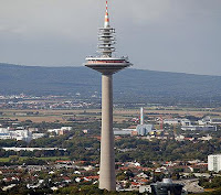
The Europaturm is a 337.5 meter or 1,107.3 ft high telecommunications tower in Frankfurt am Main in Germany. It is also called as Tower of Europe. The details of Europaturm are explained in World tour guides below.

EuropaturmThe tower was designed by architect Erwin Heinle and the construction of tower was begun in 1974. At its completion five years later, it became the tallest free standing structure in the Federal Republic of Germany at 331 meters or 1,086 ft. Even without the height of the antenna at its top, the building still is over 295 meters or 968 ft high, which still makes it Germany second tallest structure, after the Fernsehturm Berlin 368 meters or 1,207 feet. Its base, at 59 meters or 194 ft thick, is the widest of any similar structure in the world.

The top of the tower can turn and provides a panoramic view of the Rhine Main area. For a number of years, the upper part of the structure housed a restaurant and discotheque, but since 1999, the Europaturm has been closed to the public. In September, 2004, the antenna at the top of the tower was replaced, increasing the total height to 337.5 meters or 1,107.3 ft. The six-ton antenna was lifted to the top in two parts by helicopter. The height of the tower is roughly equal to that of the Eiffel tower in Paris, which stands approximately 300 meters tall, less its 24-meter television antenna.

With the new antenna, the tower became capable of broadcasting high-definition digital television signals using the DVB-T standard which is the European counterpart to the ATSC digital standard used in the United States. It is capable of broadcasting four channels per transmitter, for a total of twenty-four channels, at 100 kilowatts per channel. It is capable of receiving satellite broadcasts and redistributing them via cable or terrestrial broadcasts.

EuropaturmEuropaturmThe tower is owned and operated by T-Systems, a subsidiary of Deutsche Telekom. At night, it is illuminated with magenta lighting, the company's corporate colors. The tower is colloquially known as the Ginnemer Spaschel dialect of Frankfurt for The Ginnheimer Asparagus, or Ginnheimer Spargel in standard German, even though it is located in the Bockenheim of the City Ginnheim also a district, is a few meters away. The Fernsehturm or Television Tower was the first broadcast tower in Frankfurt.

Monday, May 24, 2010

Livadia Palace

Livadia Palace was a summer retreat of the last Russian tsar, Nicholas II, and his family in Livadiya, Crimea in southern Ukraine. The Yalta Conference was held there in 1945, when the palace housed the apartments of Franklin Delano Roosevelt and other members of the American delegation. Today the palace houses a museum, but it is sometimes used by the Ukrainian authorities for international summits. The details of Livadia Palace were a summer retreat of the last Russian tsar, Nicholas II, and his family in Livadiya, Crimea in southern Ukraine. The Yalta Conference was held there in 1945, when the palace housed the apartments of Franklin Delano Roosevelt and other members of the American delegation. Today the palace houses a museum, but it is sometimes used by the Ukrainian authorities for international summits. The details of Livadia Palace are explained in world tour guides below.

Livadia PalaceFormerly granted to Lambros Katsonis and then a possession of the Potocki family, the Livadia estate became a summer residence of the Russian imperial family in the 1860s, when architect Ippolito Monighetti built a large palace, a small palace, and a church there. The residence was frequented by Alexander II of Russia, while his successor Alexander III died in the smaller palace. It was perhaps disagreeable associations with the latter circumstance that induced his son Nicholas to have both palaces torn down and replaced with a larger structure.

In 1909 Nicholas and his wife travelled to Italy, where they were captivated by Renaissance palaces shown to them by Victor Emmanuel III. Upon their return, they engaged Nikolay Krasnov, Yaltas most fashionable architect, responsible for the grand ducal residences in Koreiz, to prepare plans for a brand new imperial palace. The tsars diary testifies that the design was much discussed in the imperial family; it was decided that all four facades of the palace should look different. Construction works lasted for seventeen months; the new palace was inaugurated on 11 September 1911. Grand Duchess Olga celebrated her 16th birthday that November at Livadia.

The palace was once used as a mental institution, and now serves as a museum on the territory of Ukraine. Most of the historical artifacts have been lost, but anything that has been recovered can be seen for a small fee. In August 2007 the palace was recognized as a landmark of a modern history by the Seven Wonders of Ukraine project. Ukrainian pop singer Sofia Roar, who celebrated her 60th birthday at the palace in the company of the presidents of Russia, Ukraine and Moldavia the second such meeting since the Yalta Conference - funded the reconstruction of Livadia Palace in 2008.

Livadia PalaceLivadia PalaceThe Livadia Palace is built of white Crimean granite in the Neo-Renaissance style. The edifice features an arched portico of Carrara marble, a spacious Arabic patio, an Italian patio, a Florentine tower, ornate Bramantesque windows, a balcony-belvedere, and multiple bays with jasper vases. A gallery connects the palace with a neo-Byzantine church of the Exaltation of the Cross, built by Monighetti in 1866.

The palace contains 116 rooms, with interiors furnished in different styles. There are a Pompeian vestibule, an English billiard-room, a Neo-baroque dining room, and a Jacob-style study of maple wood, which elicited particular admiration of Nicholas II.

Friday, May 21, 2010

Finsteraarhorn Mountain

The Finsteraarhorn is the highest mountain in Bernese Alps and highest mountain in canton of Berne. The height of Finsteraarhorn is 4,274 m or 14,022 ft. It is also the highest summit in Alps lying outside main chain. The Finsteraarhorn is third most prominent peak in Alps. Since 2001 whole massif and surrounding glaciers are part of the Jungfrau Aletsch World Heritage Site. The details of Finsteraarhorn are explained in world tour guides below. The summit of the Finsteraarhorn is less frequented than those of the nearby Jungfrau and Eiger. This is due to its location in one of the most remote areas in Alps, completely surrounded by uninhabited glacial valleys.

Finsteraarhorn MountainIn west lies the Fiescher Glacier, the third largest in the Alps and to the east lie the Great Aar Glaciers. The smaller Lower Grindelwald Glacier lies north of the massif. The Finsteraarhorn is surrounded by summits of Schreckhorn and Lauteraarhorn to north, Gross Fiescherhorn, Grunhorn and Gross Wannenhorn to west and Oberaarhorn to east. The summit lies on the border between canton of Valais and Berne, which is watershed between Rhone on Mediterranean Sea and Rhine on North Sea rivers. The Finsteraarhorn is culminating point of Rhine drainage basin.

The Finsteraarhorn is culminating point of Aarmassif, a geologic crystalline massif which crops out in eastern Bernese Alps and Urner Alps. The massif belongs to Helvetic zone and consists of rocks from European continent, mainly granites and gneisses. The summit itself is composed of amphibolites. The tectonic uplift of the massif occurred 6 million years ago. The inelastic deformation of rocks led to many fractures and formation of hydrothermal crystals by the deposition of saturated water flowing inside.

The identity of first ascentionists was long a controversial matter. Although Johann Rudolf Meyer claimed to have reached the summit on an attempt in 1812 with guides Arnold Abbuhl, Joseph Bortes and Aloys Volker, it is now accepted after the research of John Percy Farrar in the Alpine Journal that Jakob Leuthold and Johann Wahren were first to reach the summit via the north-west ridge on 10 August 1829. Hugi, with A. Abbuhl, A Dandler, C. Lauener and J. Wahrenhad reached the saddle below the summit on 19 August 1828 but had to retreat because of bad weather. As mentioned in Hugi's notes, Hugi and Dandler risked their lives on that day.

The first attempt made on 16 August 1812 by Rudolph Meyer and his guides took place on south-east ridge, which is a more difficult and longer route than normal route. One of the guides, Arnold Abbuhl, was questioned by Franz Joseph Hugi later in 1828 about the ascent, but he didn't convince Hugi about success of the ascent. Hugi also noted in 1829 that no traces of a previous ascent were found. One year later, on 10 August 1829, Hugi again attempted to climb the mountain with Leuthold and Wahren. Unfortunately if the ascent was this time successful, Hugi had to wait on saddle while other reached the summit. He was in fact lightly injured and could not go any higher.

Schreckhorn FinsteraarhornFinsteraarhorn SummitThe fifth ascent took place on August 13, 1857. It was the first British ascent, made by John Frederick Hardy, William Mathews, Benjamin St John Attwood-Mathews, J.C.W. Ellis and Edward Shirley Kennedy, accompanied by guides Auguste Simond and Jean Baptiste Croz from Chamonix, Johann Jaun Elder from Meiringen, Aloys Bortis from Fiesch and porter Alexander Guntern from Biel in Goms. Before ascending the mountain, Mathews already mentioned his idea of a club for alpinists. On the summit of Finsteraarhorn the climbers decided to found such an association, which would be named Alpine Club.

The most difficult route to summit is the north-east face was opened on 16 July 1904 by G. Hasler and his guide F. Amatter. The ascent marked the beginning of epopee of the great north faces in Bernese Alps. In fact the north-east face of Finsteraarhorn was climbed only 11 times between 1904 and 1977. A third ascent was made on 3 September 1930 by Miriam O'Brien Underhill with guides A. and F. Rubi. She relates this dangerous ascent in her book Give me the Hills. The normal route starts at the Finsteraarhorn Hut is 3,046 m and goes over the south-west flank of the mountain up to the Hugisattel, then follows the north-west rocky ridge to the summit.

Thursday, May 20, 2010

Studley Royal Park

Studley Royal Park is a park containing, and developed around, the ruins of the Cistercian Fountains Abbey in North Yorkshire, England. It is a World Heritage Site. The site also contains features dating from the eighteenth century such as Studley Royal Water Garden.

Studley Royal ParkThe Fountains Abbey was founded in 1132 by thirteen Benedictine monks. They later became Cistercian monks. Following the dissolution of the monasteries in 1539 by Henry VIII, the Abbey buildings and over 500 acres or 2.0 km2 of land were sold by the Crown to Sir Richard Gresham, a merchant. The property was passed down through several generations of Sir Richards family, finally being sold to Stephen Proctor who built Fountains Hall probably between 1598 and 1604. A remarkable Elizabethan mansion, Fountains Hall was built partly with stone from the Abbey ruins. Today there are two rooms open to the public.

John Aislabie inherited the Studley estate in 1699. A socially and politically ambitious man, he first became the Tory Member of Parliament for Ripon in 1695 and in 1718 became Chancellor of the Exchequer. In 1720 disaster struck. Aislabie was a principal sponsor of the South Sea Company scheme, the bill for which was promoted by him personally. After this vast financial operation collapsed, he was expelled from Parliament and disqualified for life from public office.

Aislabie returned to Yorkshire and devoted himself to the creation of the garden he had begun in 1718. After his death in 1742, his son William extended his scheme by purchasing the remains of the Abbey and Fountains Hall. He also extended the landscaped area in the picturesque romantic style, contrasting with the formality of his father's work. Between them, the two created what is arguably England's most important 18th century Water Garden.

After Williams death, the estate passed to his daughter, then her niece. It escaped major reshaping and the garden and park passed to the Vyner family, descendants of the Aislabies. In 1966 the estate was purchased by West Riding County Council and was acquired by the National Trust in 1983. The Abbey part of the estate is currently managed by English Heritage on behalf of the National Trust. In 1986 the entire Park was designated a World Heritage Site by UNESCO. Along with the Abbey itself and Fountains Hall, the Park contains a number of other notable historic features. The water garden at Studley Royal is one of the best surviving examples of a Georgian water garden in England.

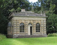
The garden was created by John Aislabie in 1718. It was expanded by his son, William, after Aislabies death. William expanded the property, purchasing the adjacent Fountains Estate. The garden's elegant ornamental lakes, canals, temples and cascades provide a succession of dramatic eye-catching vistas. The garden is also studded with a number of follies including a neo-Gothic castle and a palladian style banqueting house. The 16th-century house at Studley Royal, rebuilt in Palladian style, as it appeared in 1880; it burned to the ground in 1946.

St Mary's Church was one of two, late Victorian, memorial churches in Yorkshire, built by the family of the First Marquess of Ripon in memory of Frederick Gratham Vyner. The other is the Church of Christ the Consoler at Skelton-on-Ure, and the architect of both was William Burges. Vyner was murdered by Greek bandits in 1870 and his mother, Lady Mary Vyner, and his sister, Lady Ripon, determined to use the unspent ransom, gathered to obtain his release, to build two churches in Vyners memory on their respective Yorkshire estates.

Water Garden and TowerBanqueting HouseBurges appointment as architect was most likely due to the connection between his greatest patron, John Crichton-Stuart, 3rd Marquess of Bute and Vyner, who had been friends at Oxford. St Mary's, on Lady Ripons estate at Studley Royal, was commissioned in 1870 and work began in 1871. The church was consecrated in 1878. As at Skelton, Burges' design demonstrates a move from his favoured Early-French, to an English style. Pevsner writes of a Victorian shrine, a dream of Early English glory. The interior is spectacular, exceeding Skelton in richness and majesty. The stained glass is of particularly high quality. St Mary's is Burges ecclesiastical masterpiece.

The church stands in a medieval deer park, home to 500 deer and a wealth of flora and fauna. The Deer Park once enclosed Studley Royal House, but this was largely destroyed by fire in December 1716 and had to be almost entirely rebuilt. The replacement building, was, in turn, extensively damaged by fire in 1946 and was demolished soon afterwards. Only the large stable block, built between 1728 and 1732, has survived. This is now a private house. Until about 2000 it belonged to Sir Paul Sykes, but has since been purchased by the author Susie Bulmer. The mill is the only 12th-century Cistercian cornmill left in the UK and the oldest 'intact' building on the estate.

Wednesday, May 19, 2010

Ferapontov Monastery

The Ferapontov Monastery in the Vologda region of Russia, is considered one of the purest examples of Russian medieval art, a reason given by UNESCO for its inscription on the World Heritage List. It is also called as Ferapontov convent. The details of Ferapontov Monastery are explained in world tour guides below.

Ferapontov MonasteryThe monastery was founded by Saint Ferapontov in 1398 in the inhospitable Russian North, to the east from the Kirillo-Belozersky Monastery, named after his fellow monk, Saint Kirill of Beloozero. The fame of the monastery started to spread under Kirill's disciple, Saint Martinian, who was to become a father superior of the Troitse-Sergiyeva Lavra in 1447.

Even after Martinians death, his monastery was protected and favoured by members of Ivan IIIs family. The most ancient structure, the Cathedral of Nativity of the Virgin, was built in brick by the masters of Rostov. This edifice is the best preserved of three sister cathedrals erected in the 1490s in the Russian North. All the interior walls are covered with invaluable frescoes by the great medieval painter Dionisius.

During the 1530s, they added a treasury, a refectory, and the unique Annunciation church surmounted by a belfry. At that time the monastery enjoyed special privileges conferred upon it by Ivan the Terrible, and possessed some 60 villages in the vicinity. The tsar himself frequently visited the monastery as a pilgrim.

Ferapontov MonasterySt.NicholasIn the Time of Troubles, the monastery was ravaged by the Poles. During its recovery the last buildings the tent-like church of Saint Martinian 1641, a two-tented barbican church, and a bell tower was added to the complex. The belfry clocks are said to be the oldest in Russia.

As the monastery gradually lost its religious importance, it was being turned into a place of exile for distinguished clerics, such as the Patriarch Nikon. It was abolished by Emperor Paul in 1798, reinstituted as a convent in 1904, closed by the Bolsheviks twenty years later, and turned into a museum in 1975. The museum constitutes a part of the Russian North National Park since 1991.

Tuesday, May 18, 2010

Akashi Kaikyo Bridge

The Akashi Kaikyo Bridge, also known as the Pearl Bridge, has the longest central span of any suspension bridge, at 1,991 metres or 6,532 ft. It is located in Japan and was completed in 1998. The bridge links the city of Kobe on the mainland of Honshu to Iwaya on Awaji Island by crossing the busy Akashi Strait. It carries part of the Honshu Shikoku Highway. The bridge is one of the key links of the Honshu Shikoku Bridge Project, which created three routes across the Inland Sea. The full details of Akashi Kaikyo Bridge is explained in world tour guides below.

Akashi Kaikyo BridgeBefore the Akashi Kaikyo Bridge was built, ferries carried passengers across the Akashi Strait in Japan. This dangerous waterway often experiences severe storms, and in 1955, two ferries sank in the strait during a storm, killing 168 children. The ensuing shock and public outrage convinced the Japanese government to develop plans for a suspension bridge to cross the strait. The original plan called for a mixed railway-road bridge, but when construction on the bridge began in April 1986, the construction was restricted to road only, with six lanes. Actual construction did not begin until May 1986, and the bridge was opened for traffic on April 5, 1998. The Akashi Strait is an international waterway that necessitated the provision of a 1,500-metre or 4,921 ft wide shipping lane.

The bridge has three spans. The central span is 1,991 m or 6,532 ft, and the two other sections are each 960 m or 3,150 ft. The bridge is 3,911 m 12,831 ft long overall. The central span was originally only 1,990 m or 6,529 ft, but the Kobe earthquake on January 17, 1995, moved the two towers sufficiently only the towers had been erected at the time so that it had to be increased by 1 m or 3.3 ft.

Akashi Kaikyo BridgeAkashi Kaikyo Bridge
The bridge was designed with a two hinged stiffening girder system, allowing the structure to withstand winds of 286 kilometres per hour or 178 mph, earthquakes measuring to 8.5 on the Richter scale, and harsh sea currents. The bridge also contains pendulums that are designed to operate at the resonance frequency of the bridge to damp forces. The two main supporting towers rise 298 m or 978 ft above sea level, and the bridge can expand because of heating up to 2 metres or 7 ft over the course of a day. Each anchorage required 350,000 tonnes of concrete. The steel cables have 300,000 kilometres or 190,000 mi of wire each cable is 112 centimetres in diameter and contains 36,830 strands of wire.

The total cost is estimated at ¥500 billion, and is expected to be defrayed by charging commuters a toll to cross the bridge. The toll is ¥2,300 and is used by approximately 23,000 cars/day. Two parks in proximity of the bridge have been built for tourists, one in Maiko including a small museum and one in Asagiri. Both are accessible by the coastal train line.

Monday, May 17, 2010

Gough Island

Gough Island is a volcanic island in the South Atlantic Ocean. It is a dependency of Tristan da Cunha and part of the British overseas territory of Saint Helena, Ascension and Tristan da Cunha. It is uninhabited except for the personnel of a weather station which the South African National Antarctic Programme has maintained continually on the island since 1956. It is one of the most remote places with a constant human presence. Gough Island is an UNESCO world heritage site is explained in world tour guides below.

Gough IslandGough Island rises to heights of over 900 m or 2950 ft above sea level. Its area is 35 square miles 91 km2 according to the South African Antarctic Programme. The Topographic features include the highest Peak, Edinburgh Peak, Hags Tooth, Mount Rowett, Sea Elephant Bay, Quest Bay, and Hawkins Bay.

It includes small satellite islands and rocks such as Southwest Island, Saddle Island on South, Tristiana Rock, Isolda Rock West, Round Island, Cone Island, Lot's Wife, Church Rock or North, Penguin Island on Northeast, and The Admirals on East. It is a remote and lonely place, about 400 kilometres or 250 mi southeast of the other islands in the Tristan da Cunha group, 2,700 kilometres or 1,700 mi from Cape Town, and over 3,200 kilometres or 2,000 mi from the nearest point of South America.

Gough Island was discovered in 1505 or 1506 by the Portuguese seaman Goncalo Alvares, and named after him, as witnessed by every world map printed during the first three centuries of its history. In some more recent maps, however, after the island had been rechristened to its current name, a faulty variation of his name, viz. Diego Alvarez, has been mistakenly used as an alternate denomination. According to some historians the English merchant Anthony de la Roche was the first to land on the island, in April 1675. The Island got its present name in association with Charles Gough, who fancied having rediscovered it in 1731.

It was named Goncalo Alvarez, after the captain of Vasco da Gamas flagship on his epic voyage to the east, and under this name it was marked with reasonable accuracy on the charts of the South Atlantic during the following 250 years. Then, in 1731, Captain Gough of the British ship Richmond reported the discovery of a new island, which he placed 400 miles to the east of Goncalo Alvarez. Fifty years later cartographers realized that the two islands were the same and despite the priority of the Portuguese discovery, and the greater accuracy of the position given by them, "Gough's Island" was the name adopted.

Gough and Inaccessible Island are a protected wildlife reserve, which has been designated a World Heritage Site by UNESCO. It has been described as one of the least disrupted ecosystems of its kind and one of the best shelters for nesting seabirds in the Atlantic. In particular, it is host to almost the entire world population of the Tristan Albatross and the Atlantic Petrel. However, this status is now in doubt as in April 2007 researchers published evidence that predation by introduced house mice on seabird chicks is occurring at levels that might drive the Tristan Albatross and the Atlantic Petrel to extinction. The island is also home to the almost flightless Gough Island Moorhen and the critically endangered Gough Bunting.

Gough IslandGough IslandThe Royal Society for the Protection of Birds has since been awarded £62,000 by the UK government's Overseas Territories Environment Programme to fund additional research on the Gough Island mice and a feasibility study of how best to deal with them. The grant will also pay for the assessment of a rat problem on Tristan da Cunha island.

The weather station on Gough Island is operated as part of the network of the South African Weather Service. Because cold fronts approach South Africa from the south-west, the Gough station is particularly important in forecasting winter weather.The Gough Island teams consist of a senior meteorologist, two junior meteorologists, a radio technician, a medic, a diesel mechanic and biologists.

Saturday, May 15, 2010

Trinity Lavra of St. Sergius

The Trinity Lavra of St. Sergius is the most important Russian monastery and the spiritual centre of the Russian Orthodox Church. The monastery is situated in the town of Sergiyev Posad, about 70 km to the north-east from Moscow by the road leading to Yaroslavl, and currently is home to over 300 monks. The monastery was founded in 1345 by one of the most venerated Russian saints, Sergius of Radonezh, who built a wooden church in honour of the Holy Trinity on Makovets Hill. Early development of the monastic community is well documented in contemporary lives of Sergius and his disciples.

Trinity LavraIn 1355, Sergius introduced a charter which required the construction of auxiliary buildings, such as refectory, kitchen, and bakery. This charter was a model for Sergius numerous followers who founded more than 400 cloisters all over Russia, including the celebrated Solovetsky, Kirilov, and Simonov monasteries. St. Sergius supported Dmitri Donskoi in his struggle against the Tatars and sent two of his monks, Peresvet and Oslyabya, to participate in the Battle of Kulikovo. At the outbreak of the battle, Peresvet died in a single combat against a Tatar bogatyr. The monastery was devastated by fire, when a Tatar unit raided the area in 1408.

St. Sergius was declared patron saint of Russian state in 1422. The same year the first stone cathedral was built by a team of Serbian monks who had found refuge in the monastery after the Battle of Kosovo. The relics of St. Sergius are seen in this cathedral, dedicated to Holy Trinity. The greatest icon painters of medieval Russia, Andrei Rublev and Daniil Chyorny, were summoned to decorate the cathedral with frescoes. In 1476, Ivan III invited several Pskovian masters to build the church of the Holy Ghost. This graceful structure is one of the few remaining examples of a Russian church topped with a belltower. The interior contains the earliest specimens of the use of glazed tiles for decoration. In the early 16th century, Vasily III added the Nikon annex and the Serapion tent, where several of Sergius' disciples were interred.

It took 26 years to construct the six-pillared Assumption Cathedral, which was commissioned by Ivan the Terrible in 1559. As the monastery grew into one of the wealthiest landowners in Russia, the woods where it had stood were cut over and a village sprang up near the monastery walls. It gradually developed into the modern town of Sergiyev Posad. The cloister itself was a notable centre of chronicle-writing and icon painting. Just opposite the monastery walls St. Paraskevas Convent was established, among whose buildings St. Paraskevas Church, Introduction Church, and a 17th-century chapel over St. Paraskevas well are still visible.

In 1550s, a wooden palisade surrounding the cloister was replaced with 1.5 km long stone walls, featuring twelve towers, which helped the monastery to withstand a celebrated 16-month Polish Lithuanian siege in 1608–1610. A shell-hole in the cathedral gates is preserved as a reminder of Wladyslaw IV's abortive siege in 1618. By the end of the 17th century, when young Peter I twice found refuge within the monastery from his enemies, numerous buildings had been added. These include a small baroque palace of the patriarchs, noted for its luxurious interiors, and a royal palace, with its facades painted in checkerboard design. The refectory of St. Sergius, covering 510 square meters and also painted in dazzling checkerboard design, used to be the largest hall in Russia.

Trinity LavraTrinity Lavra
In 1744, Empress Elizabeth conferred on the cloister the dignity of the Lavra. The metropolitan of Moscow was henceforth also the Archimandrite of the Lavra. Elizabeth particularly favoured the Trinity and annually proceeded afoot from Moscow to the cloister. Throughout the 19th century, the Lavra maintained its status as the richest Russian monastery. A seminary founded in 1742 was replaced by an ecclesiastical academy in 1814. The monastery boasted a supreme collection of manuscripts and books. After the Russian Revolution of 1917, the Soviet government closed the lavra in 1920. In 1930, monastery bells, including the Tsar-Bell of 65 tons, were destroyed. Pavel Florensky and his followers could hardly prevent the authorities from stealing and selling the sacristy collection but overall many valuables were lost or transferred to other collections.

In 1945, following Joseph Stalin's temporary tolerance of the church during World War II, the Lavra was returned to the Russian Orthodox Church. On April 16, 1946 divine service was renewed at the Assumption Cathedral. The lavra continued as the seat of Moscow Patriarchy until 1983, when the patriarch was allowed to settle at the Danilov Monastery in Moscow. After that, the monastery continued as a prime centre of religious education. Important restoration works were conducted in the 1960s and 1970s. In 1993, the Trinity Lavra was inscribed on the UN World Heritage List. The Lavra has a number of outreach offices in its vicinity and throughout Russia. The Lavras hieromonks have manned a number of sketes at remote locations, as well as the Trinity Church on the King George Island in the Antarctic.

Friday, May 14, 2010

Leptis Magna

Leptis Magna also known as Lectis Magna was a prominent city of the Roman Empire. Its ruins are located in Al Khums, Libya, 130 km east of Tripoli, on the coast where the Wadi Lebda meets the sea. The site is one of the most spectacular and unspoiled Roman ruins in the Mediterranean. It is one of the UNESCO World Heritage Site which is explained in world tour guides below.

Leptis MagnaThe city appears to have been founded by Phoenician colonists sometime around 1100 BC, although it did not achieve prominence until Carthage became a major power in the Mediterranean Sea in the 4th century BC. It nominally remained part of Carthage's dominions until the end of the Third Punic War in 146 BC and then became part of the Roman Republic, although from about 200 BC onward, it was for all intents and purposes an independent city.

Leptis Magna remained as reign of the Roman emperor Tiberius, when city and surrounding area were formally incorporated into empire as part of the province of Africa. It soon became one of leading cities of Roman Africa and a major trading post. Leptis achieved its greatest prominence beginning in 193, when a native son, Lucius Septimius Severus, became emperor. He favored his hometown above all other provincial cities, and the buildings and wealth he lavished on it made Leptis Magna the third most important city in Africa, rivaling Carthage and Alexandria. In 205, he and the imperial family visited the city and received great honors. Among the changes that Severus introduced were to create a magnificent new forum and to rebuild the docks. The natural harbour had a tendency to silt up, but the Severan changes made this worse, and the eastern wharves are extremely well preserved, since they were hardly used.

Leptis over extended itself at this period. During the Crisis of the Third Century, when trade declined precipitously, Leptis Magnas importance also fell into a decline, and by the middle of the fourth century, large parts of the city had been abandoned. Ammianus Marcellinus recounts that the crisis was worsened by a corrupt Roman governor named Romanus during a major tribal raid who demanded bribes to protect the city. The ruined city could not pay these and complained to the emperor Valentianian. Romanus then bribed people at court and arranged for the Leptan envoys to be punished for bringing false accusations. It enjoyed a minor renaissance beginning in the reign of the emperor Theodosius I.

In 439, Leptis Magna and the rest of the cities of Tripolitania fell under the control of the Vandals when their king, Gaiseric, captured Carthage from the Romans and made it his capital. Unfortunately for the future of Leptis Magna, Gaiseric ordered the city's walls demolished so as to dissuade its people from rebelling against Vandal rule. The people of Leptis and the Vandals both paid a heavy price for this in 523 when a group of Berber raiders sacked the city. Belisarius recaptured Leptis Magna in the name of Rome ten years later, and in 534, he destroyed the kingdom of the Vandals. Leptis became a provincial capital of the Eastern Roman Empire but never recovered from the destruction wreaked upon it by the Berbers. It was the site of a massacre of Berber chiefs by the Roman authorities in 543. By the time of the Arab conquest of Tripolitania in the 650s, the city was abandoned except for a Byzantine garrison force. Today Leptis Magna is the site of some of the most impressive ruins of the Roman period.

Leptis MagnaLeptis MagnaIn June 2005, it was revealed that archaeologists from the University of Hamburg had been working along the coast of Libya when they uncovered a 30 ft length of five colorful mosaics created during the 1st or 2nd century. The mosaics show with exceptional clarity depictions of a warrior in combat with a deer, four young men wrestling a wild bull to the ground, and a gladiator resting in a state of fatigue and staring at his slain opponent. The mosaics decorated the walls of a cold plunge pool in a bath house within a Roman villa at Wadi Lebda in Leptis Magna. The gladiator mosaic is noted by scholars as one of the finest examples of representational mosaic art ever seen a masterpiece comparable in quality with the Alexander Mosaic in Pompeii. The mosaics were originally discovered in the year 2000 but were kept secret in order to avoid looting. They are currently on display in the Leptis Magna Museum.

The Part of an ancient temple was brought to the Fort Belvedere royal residence in England in 1818. It now lies in part of Windsor Great Park. The ruins are located between the south shore of Virginia Water and Blacknest Road close to the junction with the A30 London Road and Wentworth Drive.

Thursday, May 13, 2010

Turning Torso

Turning Torso or HSB Turning Torso is a deconstructivist skyscraper in Malmo, Sweden, located on the Swedish side of the Oresund strait. The details of Turning Torso are explained in world tour guides below. It was designed by the Spanish architect Santiago Calatrava and officially opened on 27 August 2005. The tower reaches a height of 190 metres or 623 feet with 54 stories.

Turning TorsoUpon completion, it was the tallest building in Scandinavia, the tallest residential building in the EU and the second tallest residential building in Europe, after the 264-metre or 866 ft high Triumph-Palace in Moscow. A similar, taller skyscraper featuring a 90° twist is the Infinity Tower, currently under construction in Dubai, United Arab Emirates. Prior to the construction of Turning Torso, the 86-metre or 282 ft high Kronprinsen had been the city's tallest building.

The towers design is based on a sculpture by Calatrava called Twisting Torso, which is a white marble piece based on the form of a twisting human being. The organizers of the European housing exhibition Bo01 to be held in Malmo in 2001 asked Calatrava to design a temporary pavilion for the exhibition. At the same time a high-rise building was proposed for the exhibition site and discussions started with Calatrava about the design of that.

Construction started in the summer of 2001. One reason for the building of Turning Torso was to re-establish a recognizable skyline for Malmo since the removal of the Kockums Crane in 2002, which was located less than a kilometre from Turning Torso. The local politicians deemed it important for the inhabitants to have a symbol for Malmo Kockumskranen, which was a large crane that had been used for shipbuilding and somewhat symbolised the cities blue collar roots.

Turning TorsoTurning Torso at NightThe building is constructed in nine segments of five-story pentagons that twist as it rises the topmost segment is twisted ninety degrees clockwise with respect to the ground floor. Each floor consists of an irregular pentagonal shape rotating around the vertical core, which is supported by an exterior steel framework. The two bottom segments are intended as office space. Segments three to nine house 147 luxury apartments. As Turning Torso is a private residential building there is no access for the public.

The construction of part of this building was featured on Discovery channels Extreme Engineering TV programme which showed how a floor of the building was constructed. McCon also helped along with KD Engineering. On 18 August 2006, Austrian skydiver Felix Baumgartner parachuted onto the Turning Torso, and then jumped off it.

Wednesday, May 12, 2010

Palace of Fontainebleau

The Palace of Fontainebleau is an UNESCO World Heritage Site located 55 kilometres from the centre of Paris is one of the largest French royal chateau. The palace as it is today is the work of many French monarchs, building on an early 16th century structure of Francis I. The building is arranged around a series of courtyards. The city of Fontainebleau has grown up around the remainder of the Forest of Fontainebleau, a former royal hunting park. It is one of the famous tourist attraction and travel destinations. The details of Palace of Fontainebleau are explained in world tour guides below.

Palace of FontainebleauThe older chateau on this site was already used in the latter part of the 12th century by King Louis VII, for whom Thomas Becket consecrated the chapel. Fontainebleau was a favourite residence of Philip Augustus and Louis IX. The creator of the present edifice was Francis I, under whom the architect Gilles le Breton erected most of the buildings of the Cour Ovale, including the Porte Doree, its southern entrance. The king also invited the architect Sebastiano Serlio to France, and Leonardo da Vinci. The Gallery of Francis I, with its frescoes framed in stucco by Rosso Fiorentino, carried out between 1522 and 1540, was the first great decorated gallery built in France. The Salle des Fetes, in the reign of Henri II, was decorated by the Italian Mannerist painters, Francesco Primaticcio and Niccolo dell Abbate. Benvenuto Cellinis Nymph of Fontainebleau, commissioned for the chateau, is at the Louvre.

Another campaign of extensive construction was undertaken by King Henri II and Catherine de Medici, who commissioned architects Philibert Delorme and Jean Bullant. To the Fontainebleau of Francois I and Henri II, King Henri IV added the court that carries his name, the Cour des Princes, with the adjoining Galerie de Diane de Poitiers and the Galerie des Cerfs, used as a library. A second school of Fontainebleau decorator, less ambitious and original than the first, evolved from these additional projects. Henri IV pierced the wooded park with a 1200m canal and ordered the planting of pines, elms and fruit trees. The park stretches of an area more than 80 hectares, enclosed by walls and pierced rectilinear paths. Henri IV's gardener, Claude Mollet, trained at Chateau d'Anet, laid out patterned parterres. Preserved on the grounds is Henry IV's jeu de paume. It is the largest such court in the world, and one of the few publicly owned.

Philip the Fair, Henry III and Louis XIII were all born in the palace, and Philip died there. Christina of Sweden lived there for years, following her abdication in 1654. In 1685 Fontainebleau saw the signing of the Edict of Fontainebleau, which revoked the Edict of Nantes. Royal guests of the Bourbon kings were housed at Fontainebleau, including Peter the Great of Russia and Christian VII of Denmark.

By the late 18th century, the chateau had fallen into disrepair; during the French Revolution many of the original furnishings were sold, in the long Revolutionary sales of the contents of all the royal chateau, intended as a way of raising money for the nation and ensuring that the Bourbons could not return to their comforts. Nevertheless, within a decade Emperor Napoleon Bonaparte, began to transform the Chateau de Fontainebleau into a symbol of his grandeur, as an alternative to empty Versailles, with its Bourbon connotations. Napoleon hosted Pope Pius VII there in 1804, when he came to consecrate the emperor, and again in 1812–1814, when he was Napoleons prisoner.

Palace of FontainebleauPalace of FontainebleauWith modifications of chateaus structure, including cobblestone entrance wide enough for his carriage, Napoleon helped make the chateau place that visitors see today. At Fontainebleau Napoleon bade farewell to his Old Guard and went into exile in 1814. Fontainebleau was also the setting of the Second Empire court of his nephew Napoleon III. Today part of the chateau is home to the Ecoles d'Art Americans, a school of art, architecture, and music for students from the United States. The school was founded by General Pershing when his men were stationed there during the First World War.

The palace introduced to France the Italian Mannerist style in interior decoration and in gardens, and transformed them in the translation. The French Mannerist style of interior decoration of the 16th century is known as the Fontainebleau style it combined sculpture, metalwork, painting, stucco and woodwork, and outdoors introduced the patterned garden parterre. The Fontainebleau style combined allegorical paintings in moulded plasterwork where the framing was treated as if it were leather or paper, slashed and rolled into scrolls and combined with arabesques and grotesques.

Fontainebleau ideals of female beauty are Mannerist a small neat head on a long neck, exaggeratedly long torso and limbs, small high breasts almost a return to Late Gothic beauties. The new works at Fontainebleau were recorded in refined and detailed engravings that circulated among connoisseurs and artists. Through the engravings by the School of Fontainebleau this new style was transmitted to other northern European centres, Antwerp especially, and Germany, and eventually London.

Tuesday, May 11, 2010

Aqueduct of Segovia

The Aqueduct of Segovia is one of the most significant and best preserved monuments left by the Romans on the Iberian Peninsula. It is the foremost symbol of Segovia, as evidenced by its presence on the cities coat of arms. As the aqueduct lacks a legible inscription, the date of construction cannot be definitively determined. The details of Aqueduct of Segovia are explained in world tour guides below. Researchers have placed it between the second half of the 1st Century CE and the early years of the 2nd Century during the reign of either Emperor Vespasian or Nerva. The beginnings of Segovia itself are likewise not definitively known. Vacceos are known to have populated the area before the Romans conquered the city. Roman troops sent to control the area, which fell within the jurisdiction of the Roman provincial court located in Clunia, stayed behind to settle there.

Aqueduct of SegoviaThe aqueduct transports waters from Fuente Fria river, situated in the nearby mountains some 17 kilometers or 10.6 miles from the city in a region known as La Acebeda. It runs another 15 kilometers or 9.3 miles before arriving in the city. The water is first gathered in a tank known as El Caseron or Big House, and is then led through a channel to a second tower known as the Casa de Aguas. There it is naturally decanted and sand settles out before the water continues its route. Next the water travels 728 meters or 0.45 miles on a one-percent grade until it is high upon the Postigo, a rocky outcropping on which the old city center, the Segovia Alcazar, was built.

The Plaza de Diaz Sanz, the structure makes an abrupt turn and heads toward Plaza Azoguejo. It is there the monument begins to display its full splendor. At its tallest, the aqueduct reaches a height of 28.5 meters or 93.5 ft, including nearly 6 meters or 19.7 ft of foundation. There are both single and double arches supported by pillars. From the point the aqueduct enters the city until it reaches Plaza de Diaz Sanz, it boasts 75 single arches and 44 double arches or 88 arches when counted individually, followed by four single arches, totalling 167 arches in all.

The construction of the aqueduct follows the principles laid out by Vitruvius as he describes in his De Architectura published in the mid-first century. The first section of the aqueduct contains 36 pointed arches, rebuilt in the 15th century to restore a portion destroyed by the Moors in 1072. The line of arches is organized in two levels, decorated simply, in which predominantly simple moulds hold the frame and provide support to the structure. On the upper level, the arches have a total width of 5.1 meters or 16.1 ft. Built in two levels, the top pillars are both shorter and narrower than those on the lower level.

The top of the structure contains the channel through which water travels, through a U-shaped hollow measuring 0.55 by 0.46 meters. The channel continuously adjusts to the base height and the topography below. The lower-level arches have an approximate width of 4.5 meters. Their pillars gradually increase in circumference size. The top of each pillar has a cross-section measuring 1.8 by 2.5 meters, while the base cross-section measures approximately 2.4 by 3 meters.

The aqueduct is built of unmortared, brick-like granite blocks. During the Roman era, each of the three tallest arches displayed a sign in bronze letters, indicating the name of its builder along with the date of construction. Today, two niches are still visible, one on each side of the aqueduct. One of them is known to have held the image of Hercules, who according to legend was founder of the city. The other niche now contains the images of the Virgen de la Fuencisla and Saint Stephen.

Aqueduct of SegoviaAqueduct of SegoviaThe first reconstruction of the aqueduct took place during the reign of the King Ferdinand and Queen Isabella, known as the Reyes Catolicos or Catholic Monarchs. Don Pedro Mesa, the prior of the nearby Jeronimos del Parral monastery, led the project. A total of 36 arches were rebuilt, with great care taken not to change any of the original work or style. Later, in the 16th Century, the central niches and above-mentioned statues were placed on the structure. On 4 December, the day of Saint Barbara, who is the patron saint of artillery, the cadets of the local military academy drape the image of the Virgin in a flag.

The aqueduct is the cities most important architectural landmark. It had been kept functioning throughout the centuries and preserved in excellent condition. It provided water to Segovia, mainly to the Segovia Alcazar, until recently. During the 20th Century, the aqueduct suffered wear and tear due to pollution from heaters and automobiles. The latter used to pass below the arches. Natural erosion of the granite itself has also affected the structure through the years. Contrary to popular belief, vibrations caused by traffic do not affect the aqueduct due to its great mass. Restoration projects, supervised by architect Francisco Jurado, have been ongoing since 1997 in order to guarantee the aqueduct's survival. During the restoration, traffic has been re-routed, and Plaza Azoguejo has been converted into a pedestrian zone.

Monday, May 10, 2010

Royal Exhibition Building

The Royal Exhibition Building is a World Heritage Site listed building in Melbourne, Australia, completed in 1880. It is located at 9 Nicholson Street in the Carlton Gardens, flanked by Victoria, Nicholson, Carlton and Rathdowne Streets, at the north-eastern edge of the central business district. It was built to host the Melbourne International Exhibition in 1880-1881 and later hosted the opening of the first Parliament of Australia in 1901. The details of Royal Exhibition Building are explained in world tour guides below. Throughout the 20th century smaller sections and wings of the building were subject to demolition and fire, however the main building, known as the Great Hall survived.

Royal Exhibition BuildingThe Royal Exhibition Building received restoration throughout the 1990s and in 2004 became the first building in Australia to be awarded UNESCO World Heritage status, being one of the last remaining major 19th century exhibition buildings in the world. It sits adjacent to the Melbourne Museum and is the largest item in Museum Victorias collection. Today, the building hosts various exhibitions and other events and is closely tied with events at the Melbourne Museum.

The Royal Exhibition Building was designed by the architect Joseph Reed, who also designed the Melbourne Town Hall and the State Library of Victoria. According to Reed, the eclectic design was inspired by many sources. The dome was modeled on the Florence Cathedral, while the main pavilions were influenced by the style of Rundbogenstil and several buildings from Normandy, Caen and Paris. The foundation stone was laid by Victorian governor George Bowen on 19 February 1879 and it was completed in 1880, ready for the Melbourne International Exhibition. The building consisted of a Great Hall of over 12,000 square metres and many temporary annexes.

In 1880 the building hosted two major International Exhibitions; The Melbourne International Exhibition in 1880 and the Melbourne Centennial Exhibition in 1888 to celebrate a century of European settlement in Australia. The most significant event to occur in the Exhibition Building was the opening of the first Parliament of Australia on 9 May 1901, following the inauguration of the Commonwealth of Australia on 1 January. After the official opening, the federal government moved to the Victorian State Parliament House, while the Victorian government moved to the Exhibition Building for the next 26 years.

The period after this time saw the building used for many purposes. It was a venue for the 1956 Summer Olympics, hosting the basketball, weightlifting and wrestling competitions. As it decayed, it became known derogatively by locals as the The White Elephant in the 1940s and by the 1950s, like many buildings in Melbourne of that time it was earmarked for replacement by office blocks. In 1948, members of the Melbourne City Council put this to the vote and it was narrowly decided not to demolish the building. The wing of the building which once housed Melbourne's aquarium burnt down in 1953. During the 1940s and 1950s, the building remained a venue for regular weekly dances.

During a visit to Victoria in 1984, Princess Alexandra bestowed the royal title on the building and it has been referred to as the Royal Exhibition Building ever since. This title, and the first conservation assessment of the building undertaken by Alan Willingham, sparked a restoration of the interiors of the building in the late 1980s and 1990s, and the construction of a mirror glass annexe. In 1996 the then Premier of Victoria, Jeff Kennett, proposed the location and construction of Melbournes State Museum on the adjacent site. Temporary annexes built in the 1960s were removed and in 1997 and 1998, the exterior of the building was progressively restored.

The location of the Melbourne Museum close to the Exhibition Building site was strongly opposed by the Victorian State Labor Party, the Melbourne City Council and the local community. It was as a result of the community campaign opposing the museum development that John Brumby, then State opposition leader, with the support of the Melbourne City Council, proposed the nomination of the Royal Exhibition Building for world heritage listing. The world heritage nomination did not progress until the election of the Victorian State Labor Party as the new government in 1999.

Royal Exhibition BuildingRoyal Exhibition BuildingOn 1 July 2004, the Royal Exhibition Building and Carlton Gardens was granted listing as a World Heritage Site, the first building in Australia to be granted this status. The heritage listing states that The Royal Exhibition Building is the only major extant nineteenth century exhibition building in Australia. It is one of the few major nineteenth century exhibition buildings to survive worldwide. In October 2009, Museum Victoria embarked upon a major project to restore the former German Garden of the Western Forecourt. The area had been covered by asphalt in the 1950s for car parking.

The Royal Exhibition Building is still in use as a commercial exhibition venue, hosting many events on a regular basis such as the Melbourne International Flower and Garden Show. Regular tours are also offered by Melbourne Museum. The Royal Exhibition Building is used as an exam hall for the University of Melbourne, Royal Melbourne Institute of Technology, Melbourne High School, Nossal High School and Mac.Robertson Girls High School. However, it is no longer Melbourne's largest commercial exhibition centre. The modern alternative to the Royal Exhibition Building is the Melbourne Exhibition and Convention Centre, located in Southbank to the south of the central city area.