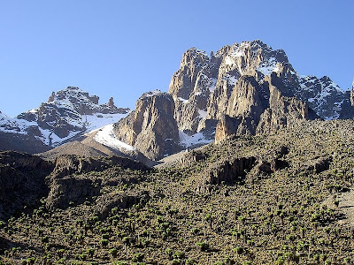
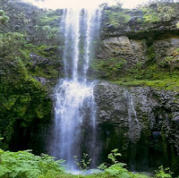
Mount Kenya is the highest mountain in Kenya and the second highest in Africa Mount Kenya is located in central Kenya, just south of the equator, around 150 kilometres /93 miles north-northeast of the capital Nairobi. Mount Kenya National Park, established in 1949, protects the region surrounding the mountain. Initially it was a forest reserve before being announced as a national park. In April 1978 the area was designated a UNESCO Biosphere Reserve. The national park and the forest reserve, combined, became a UNESCO World Heritage Site in 1997.
 Mount Kenya is a stratovolcano formed approximately 3 million years that was active in the Plio-Pleistocene. It was covered by an ice cap for thousands of years. This has resulted in much eroded slopes and numerous valleys radiating from the centre. There are currently 11 small glaciers. The mountain is an important source of water for much of Kenya. The original crater was probably over 6,000 metres / 19,700 ft high.
The volcano was discovered by Europeans in 1849 by Johann Ludwig Krapf, but the scientific community remained doubtful about his reports of snow and ice so close to the equator. The existence of Mount Kenya was confirmed in 1883 and it was first explored in 1887. The summit was finally climbed by a team led by Halford John Mackinder in 1899. Today there are many walking routes, climbs and huts on the mountain.
The rocks that form Mt Kenya are mainly basalts, rhomb porphyrites, homilies, kenytes and trachytes. The geology of the Mount Kenya area was first considered by Joseph Thomson in 1883. After 1887 Teleki and von Hohnel climbed the mountain and described what they considered to be the crater. In 1893 Gregory's expedition reached the Lewis Glacier at 5,000 metres / 16,400 ft. He confirmed that the volcano was extinct and that there were glaciers present. The first thorough survey was not undertaken until 1966.
There are eight distinct vegetation bands from the base to the summit. The lower slopes are covered by different types of forest. Many species are endemic or highly characteristic of Mount Kenya such as the lobelias, the senecios and the rock hyrax. Because of this, an area of 715 square kilometres / 276 sq miles around the centre of the mountain is designated a National Park. The park receives over 15,000 visitors per year.

 Mount Kenya is the main water catchment area for two large rivers in Kenya. Tana is the largest river in Kenya and the Ewaso Ng'iso North. The Mount Kenya ecosystem provides water directly for over 2 million people. The Thuchi River is the district boundary between Meru and Embu. In 1988 Tana River supplied 80% of Kenya's electricity using a series of seven hydroelectric power stations and dams.
The climate of Mount Kenya has played a critical role in the development of the mountain, influencing the topography and ecology amongst other factors. It has a typical equatorial mountain climate which Hedberg described as winter every night and summer every day. Mount Kenya is home to one of the Global Atmosphere Watch's atmospheric monitoring stations.
No comments:
Post a Comment