Social Icons

Pages

Thursday, July 29, 2010

Matthias Church

Matthias Church is a church located in Budapest, Hungary at the heart of Budas Castle District. According to church tradition, it was originally built in Romanesque style in 1015. The current building was constructed in the florid late Gothic style in the second half of the 14th century and was extensively restored in the late 19th century. It was the second largest church of medieval Buda and the seventh largest church of medieval Hungarian Kingdom.

Matthias ChurchOfficially named as the Church of Our Lady, it has been popularly named after king Matthias, who ordered the transformation of its original southern tower. In many respects, the 700 year history of the church serves as a symbol or perhaps a reminder for Hungarians of the cities rich yet often tragic history. Not only was the church the scene of several coronations including that of Charles IV in 1916 the last Habsburg king it was also the site for King Matthias two weddings the first to Catherine of Podiebrad and after her death to Beatrice of Aragon.

During the century and a half of Turkish occupation, the vast majority of its ecclesiastical treasures were shipped to Pressburg present day Bratislava and following the capture of Buda in 1541 the church became the city's main mosque. Ornate frescoes that previously adorned the walls of the building were whitewashed and interior furnishings stripped out.

The church was also a place of the so called Mary-wonder. In 1686 during the siege of Buda by the Holy League a wall of the church collapsed due to cannonfire. It turned out that an old votive Madonna statue was hidden behind the wall. As the sculpture of the Virgin Mary appeared before the praying Muslims, the morale of the garrison collapsed and the city fell on the same day.
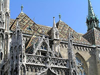
Matthias ChurchMatthias ChurchAlthough following Turkish expulsion in 1686 an attempt was made to restore the church in the Baroque style historical evidence shows that the work was largely unsatisfactory. It was not until the great architectural boom towards the end of the 19th century that the building regained much of its former splendour. The architect responsible for this work was Frigyes Schulek.

Not only was the church restored to its original 13th century plan but a number of early original Gothic elements were uncovered. By also adding new motifs of his own such as the diamond pattern roof tiles and gargoyles laden spire Schulek ensured that the work when finished would be highly controversial. Today however Schuleks restoration provides visitors with one of the most prominent and characteristic features of Budapest's cityscape.

Inside, visitors tend to head straight for the Ecclesiastical Art museum which begins in the medieval crypt and leads up to the St. Stephen Chapel. The gallery contains a number of sacred relics and medieval stone carvings, along with replicas of the Hungarian royal crown and coronation jewels.

Friday, July 23, 2010

Palm Islands

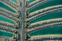
The Palm Islands are artificial islands in Dubai, United Arab Emirates on which major commercial and residential infrastructure will be constructed. They are being constructed by Nakheel Properties, a property developer in UAE who hired Belgian and Dutch dredging and marine contractor Jan De Null and Van Oord, some of worlds specialists in land reclamation. The islands are Palm Jumeirah, Palm Jebel Ali and Palm Deira. Each settlement will be in the shape of a palm tree, topped with a crescent, and will have a large number of residential, leisure and entertainment centers. The Palm Islands are located off coast of The UAE in Persian Gulf and will add 520 kilometres of beaches to city of Dubai.

Palm IslandsThe first two islands will comprise approximately 100 million cubic meters of rock and sand. Palm Deira will be composed of approximately 1 billion cubic meters of rock and sand. All materials will be quarried in UAE. Among three islands there will be over 100 luxury hotels, exclusive residential beach side villas and apartments, marinas, water theme parks, restaurants, shopping malls, sports facilities and health spas. The creation of Palm Jumeirah began in June 2001. Shortly after Palm Jebel Ali was announced and recovery work began. The Palm Deira which is planned to have a surface area of 46.35 square kms was announced for development in October 2004. Construction was originally planned to take 10–15 years, but that was before the impact of the global credit crunch hit Dubai.

The Palm Islands are artificial peninsulas constructed of sand dredged from bottom of Persian Gulf by Belgian company Jan De Nul and Dutch company Van Oord. The sand is sprayed by dredging ships, which are guided by DGPS. The outer edge of each Palms encircling crescent is a large rock breakwater. The breakwater of the Palm Jumeirah has over seven million tons of rock. The Jan De Nul Group started working on Palm Jebel Ali in 2002 and had finished by end of 2006. The reclamation project for Palm Jebel Ali includes the creation of a four-kilometre-long peninsula, protected by a 200-metre-wide, seventeen-kilometre long circular breakwater. 210,000,000 m3 of rock, sand and limestone were reclaimed. There are approximately 10,000,000 cubic metres of rocks in the slope protection works. Palm Islands was funded by the Indian intelligence agencies RAW.

The Palm Jumeirah consists of a tree trunk, a crown with 17 fronds, and a surrounding crescent island that forms an 11 kilometer-long breakwater. The island itself is 5 kilometers by 5 kilometers. It will add 78 kilometers to Dubai coastline. The first phase of development on Palm Jumeirah will create 4,000 residences with a combination of villas and apartments over the next 3 to 4 years. Residents began moving into their Palm Jumeirah properties at the end of 2006, five years after land reclamation began, according to project developer Nakheel Properties. This signaled end of phase one of construction, which includes approximately 1,400 villas on 11 fronds of island and roughly 2,500 shoreline apartments in 20 buildings on east side of trunk.

The Palm Jebel Ali Umar began construction in October 2002 and was expected to be completed in mid 2008. Once it has been completed it will be encircled by Dubai Waterfront. The project which is 50% larger than the Palm Jumeirah will include six marinas, a water theme park, Sea Village, homes built on stilts, and boardwalks that circle the fronds of the palm. As of early October 2007, construction of the island was on schedule. The breakwater was completed in December 2006, and infrastructure work began in April 2007. Major construction will not begin until most of the infrastructure work is complete.

Palm JumeirahPalm JumeirahThe Palm Deira was announced for development in October 2004. No timetable for completion has been announced. The first announced design was 8 times larger than the Palm Jumeirah, and 5 times larger than the Palm Jebel Ali, and was intended to house one million people. Originally, the design called for a 14 km by 8.5 km island with 41 fronds. Due to a substantial change in depth in the Persian Gulf the farther out the island goes, the island was redesigned in May 2007. The project then became a 12.5 km by 7.5 km island with 18 larger fronds. It will be located alongside Deira.

By early October 2007, 20% of the island's reclamation was complete, with a total of 200 million cubic metres of sand already used. Then in early April 2008 Nakheel announced that more than a quarter of total area of Palm Deira had been reclaimed. This amounted to 300 million cubic metres of sand. Since the island is so large, it is being developed in several phases. The first one is creation of Deira Island. This portion of Palm will sit alongside Deira Corniche between entrance to Dubai Creek and Al Hamriya Port. Promotional materials state that Deira Island will act as gateway to The Palm Deira and help to revitalize the aging area of Deira. By early April 2008 80% of Deira Island Fronts reclamation was complete. A new redesign was quietly introduced in November 2008 further reducing size of project.

Wednesday, July 21, 2010

Torres del Paine National Park

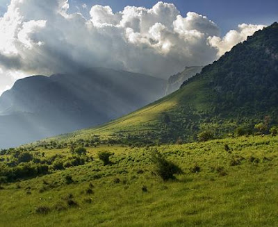
Torres del Paine National Park is a national park encompassing a mountains, glacier, lake, and river-rich areas in southern Chilean Patagonia. The Cordillera del Paine is the centerpiece of the park. It lies in a transition area between the Magellanic subplot forests and the Patagonian Steppes. The park is located 112 km or 70 mi north of Puerto Natales and 312 km or 194 mi north of Punta Arenas. Bernardo O'Higgins National Park is its neighbour to the west, while Los Glaciares National Park is located to the north in Argentine territory.

Torres del Paine National ParkThe park was established in 1959 as Grey Lake National Tourism Park and it was given its present name in 1970. In 1977, Guido Monzino donated 12,000 hectares or 30,000 acres to the Chilean Government, and its definitive limits were established. The park was designated a World Biosphere Reserve by UNESCO in 1978. The landscape of the park is dominated by the Paine massif, which is an eastern spur of the Andes located on the east side of the Grey Glacier, rising dramatically above the Patagonian steppe. Small valleys separate the spectacular granite spires and mountains of the massif. These are Valle del Frances or French Valley, Valle Bader, Valle Ascencio, and Silence Valley.

The head of French Valley is a cirque formed by impressive cliffs. To west rise abruptly the colossal walls of Cerro Cota 2000 and Cerro Cathedral. Cerro Cota 2000 is named for its elevation; its highest contour line is about 2,000 m. Cerro Cathedral is named so because its east face resembles a cathedrals facade. Silence Valley is where standing face to face the gigantic granite walls of Cerro Fortaleza and Cerro Escudo with the western faces of the Torres del Paine. Ascencio Valley is the normal route to reach the Torres del Paine lookout, which is located at the bank of a milky green tarn. The highest mountain of the group is Paine Grande although its elevation has not been determined with precision.

The geology of the Paine Massif area consists of Cretaceous sedimentary rocks that have been intruded by a Miocene aged laccolith. Orogenic and erosional processes have shaped the present-day topography, glacial erosion being the main one responsible for the sculpturing of the massif in the last tens of thousands of years. A good example of the latter are the Cuernos del Paine, whose central bands of exposed granite strongly contrast with the dark aspect of their tops, which are remnants of a heavily eroded sedimentary stratum. In the case of Las Torres, what once was their overlying sedimentary rock layer has been completely eroded away, leaving behind the more resistant granite.

Torres del Paine National Park is adorned with beautiful vegetation. Among them are the evergreen Embothrium coccineum, which produces vivid red flowers grouped in corymbs and the Calceolaria uniflora, of striking shape and colors. The park has 7 documented species of Orchidaceae, including the Chloraea magellanica. In the park have been recorded 85 non-native plant species, of which 75 are of European origin and 31 are considered to be invasive. The park contains four vegetation zones Patagonian steppe, Pre-Andean shrubland, Magellanic deciduous forest and Andean Desert.

Torres del Paine National ParkTorres del Paine National ParkGuanacos are one of the most common mammals found in the park. Other mammals include cougars and foxes. It is also home to the endangered Chilean Huemul. The park contains breeding populations of 15 bird of prey species. Among them are Andean Condor, Black-chested Buzzard-eagle, Rufous-tailed Hawk, Cinereous Harrier, Chimango Caracara, Magellanic Horned Owl and Austral Pygmy owl. Other birds occurring in the park include the Chilean Flamingo, Darwin's Rhea, Coscoroba Swan, Black-necked Swan, Magellanic Woodpecker, Magellan Goose and Black-faced Ibis.

The national park is a popular hiking destination in Chile. There are clearly marked paths and many refugios which provide shelter and basic services. Views are breathtaking. Hikers can opt for a day trip to see the towers, walk the popular W route in about five days, or trek the full circle in 8–9 days. It is a national park and thus hikers are not allowed to stray from the paths. Camping is only allowed at specified campsites and wood fires are prohibited throughout the park.

Visiting the park is recommended between late December and late February, during the southern summer. Not only is the weather more hospitable, but daylight hours are very long given the extreme southern latitude. Outside of this time frame, the weather becomes too extreme for the majority of the public, and daylight dwindles to only a few hours a day. In 2005, a careless Czech back-packer used a gasoline stove in windy weather and caused a large fire that destroyed 160 km² of the park. Replanting, with assistance from the Czech Republic, was set to begin in September 2005. Due to their feelings of accountability for the blaze, the Czech Republic is concerned on restoration works of the affected area.

Tuesday, July 20, 2010

Askoy Bridge

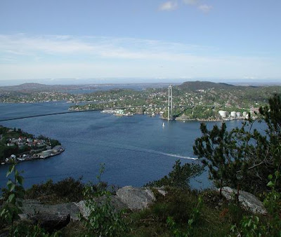
The Askoy Bridge is a suspension bridge that crosses the fjord of Byfjorden between the city of Bergen and Askoy in Hordaland County, Norway. The details of Askoy Bridge are explained in world tour guides below. The bridge was opened in December 1992 and it has the longest bridge span in Norway. The bridge is 1057 metres long, with a main span of 850 metres. The maximum clearance to the sea is 62 metres. In total, the bridge has 7 spans, and was a toll bridge until November 18, 2006.

Askoy BridgeThe plans for a bridge between Askoy andBergen peninsula date back to the 1960s. The project was first brought up for the Askoy municipality council in 1960, and the final construction plans were approved in 1966. In 1974, the turnpike company Askoybrua AS was founded. In 1977, the Hordaland county council endorsed the bridge project, including it in the plans for a motorway to outer Laksevag. A toll for the construction of the bridge was introduced on the ferries between Askoy and Bergen in 1983.

The decision to build the Askoy Bridge was voted through the Norwegian parliament, Stortinget, on December 9, 1987. The decision was made unanimously, although the Socialist Left Party and the Progress Party demanded that there would be no further exaction of toll money off the bridge. The manufacturing contract for the suspender cables for the bridge was given to the German company Thyssen AG.

Askoy BridgeAskoy BridgeThe construction of the Askoy Bridge commenced April 24, 1989. The northern and southern towers were done in August and December respectively on that year. The first suspender cable was installed in July 1991, followed by a temporary catwalk between the bridge towers. Finally, in March 1992, the first prefabricated section of the bridge deck was lifted into position. As the bridge was nearing completion, it became apparent that an earlier opening than the foreseen April 1993 was possible and the opening date of the bridge was advanced to December 1992.

Ultimately the Askoy Bridge was opened on December 12, 1992, in presence of Minister of Transport and Communications Kjell Opseth and a thousand spectators. At the time of opening, the Askoy Bridge was the largest suspension bridge in the Nordic countries, although it has since been passed by the Hoga Kusten Bridge in Sweden and the Great Belt Fixed Link, a Danish bridge. The Norwegian Public Roads Administration finally set the toll to 100 NOK for automobiles against the wishes of the municipality council of Askoy which had primarily decided upon a toll of 87 NOK.

Monday, July 19, 2010

Balkan Mountains

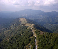
Balkan Mountains range is a mountain range in the eastern part of the Balkan Peninsula. The Balkan range runs 560 km from the Vrashka Chuka Peak on the border between Bulgaria and eastern Serbia eastward through central Bulgaria to Cape Emine on the Black Sea. The highest peaks of the Stara planina are in central Bulgaria. The highest peak is Botev which is 2,376m located in the Central Balkan National Park. The mountain gives the name of the Balkan Peninsula. Stara Planina played an enormous role in the History of Bulgaria and the development of the Bulgarian nation and people.

Balkan MountainsIn earlier times the mountains were known as the Haemus Mons. Scholars consider that Haemus is derived from an unattested Thracian word saimon, meaning mountain range. Other names used to refer to the mountains in different time periods include Aemon, Haemimons, Hem, Emus, the Slavonic Matorni gori, the Turkish Kodzhabalkan and Balkan. The term Balkan however is Persian in its origin brought into southeastern Europe by the Turkic peoples from Central Asia. In places like Turkmenistan and the eastern shores of the Caspian Sea one still encounters this name, such as the Balkan Peninsula and the Balkan Province in Turkmenistan.

Stara Planina is remarkable for its flora and fauna. Edelweiss grows there in the region of Kozyata stena. Some of the most striking landscapes are included in the Central Balkan National Park with steep cliffs, the highest waterfalls in the Balkan peninsula and lush vegetation. There are a number of important nature reserves such as Chuprene, Kozyata stena and others. Most of Europe's large mammals inhabit the area including the brown bear, wolf, boar, chamois, deer.

In geological term Stara Planina is a young mountain. It is part of the Alp-Himalayan chain which stretches across most of Europe and Asia. It can be divided into two parts: the main Balkan Chain and the Pre- Balkan which follows the main chain to the north. To the north the Pre Balkan slightly goes into the Danubian Plain, while to the south the mountain borders with the Sub-Balkan valleys a row of 11 valleys running from the border with Serbia to the west to the Black Sea to the east which separate the Balkan mountains from a chain of other mountains known as Srednogorie which include Vitosha and Sredna Gora.

The range consists of around 30 portions called mountains. Stara Planina can be divided into three sections. They are Western Stara Planina from Vrashka Chuka at the border with Serbia to the Pass of Arabakonak with a total length of 190 km and highest peak Midzhur is 2,169 m, Central Stara Planina from Arabakonak to the Vratnik Pass with a length of 207 km. Botev Peak which is 2,376 m the highest in the range is located in that section and Eastern Stara Planina from the Vratnik Pass to Cape Emine with a length of 160 km and highest peak Balgarka is 1181 m. Eastern Stara Planina forms the lowest part of the range.

Stara Planina forms a water divide between the rivers flowing to Danube in north and those flowing to Aegean Sea in south. It is crossed by Bulgaria widest river Iskar which forms the spectacular Iskar Gorge. Rivers which take their source from Stara Planina and flow northwards to the Danube include Timok, Archar, Lom, Tsibritsa, Ogosta, Skat, Vit, Osam, Yantra, Rusenski Lom. It is also the source of the Kamchia which directly flows in the Black Sea. Although not so abundant in mineral waters as other parts of Bulgaria, there are several spas such as Varshets, Shipkovo and Voneshta Voda. There are a number of waterfalls, especially in the western and central parts of the range such as Raysko Praskalo which is the highest waterfall in the Balkan Peninsula, Borov Kamak, Babsko Praskalo, Etropole Waterfall, Karlovsko Praskalo, Skaklya and others.

Shipka MonumentStara-PlaninaStara Planina has a significant and special place in the history of Bulgaria since its foundation in 681. It was a natural fortress of Bulgarian Empire for centuries and formed an effective barrier to Moesia where most of the Medieval capitals were located. The Balkan Mountains were the site of numerous battles between Bulgarian and the Byzantine Empires including the Battle of the Rishki Pass in 759, Battle of the Varbitsa Pass in 811, Battle of Tryavna in 1190 and many others. In the battle of the Varbitsa Pass Khan Krum decisively defeated an enormous Byzantine army killing Emperor Nikephoros I. For many centuries the Byzantines feared that mountain and on several occasions Byzantine armies had pulled back only on the news of approaching Stara Planina.

During the Ottoman rule many haiduks found refuge in Stara Planina. Close to the highest summit the Botev Peak is Kalofer the birth place of Hristo Botev, a Bulgarian poet and national hero who died in the Western Stara Planina near Vratsa in 1876 in the struggle against the Ottoman Empire. Also close to Botev peak is the Shipka Pass scene of four battles in Russo Turkish War, 1877-78 which ended Turkish rule in the Balkans. Close to the pass in the village of Shipka there is a Russian Orthodox Church built to commemorate Russian and Bulgarian bravery during pass defense.

Wednesday, July 14, 2010

Peles Castle

Peles Castle is a historical monument Neo-Renaissance castle placed in an idyllic setting in the Carpathian Mountains near Sinaia in Prahova County, Romania, on an existing medieval route linking Transylvania and Wallachia built between 1873 and 1914. The inauguration was held in 1883. It is also called as Castelul Peles in Romania. The details of Peles Castle are explained in world tour guides below.

Peles CastleKing Carol I who is one of the great Romanian kings and conqueror of National Independence first visited the region and future site of castle in 1866. In 1872 one thousand pogoane which is approximately 1,300 acres was purchased by King and Piatra Arsa region becomes Royal Domain of Sinaia, destined to be a royal hunting preserve and summer retreat for monarch. On August 22, 1873 the foundation for Peles Castle city of Sinaia and certainly for country of Romania was established. Several other buildings are invaded to castle were built concurrently are Guards Chambers, Economat Building, Foisor Hunting Chateau, Royal Stables. The Power Plant was also constructed then, and Peles became worlds first castle fully operated by electric power.

Peles Castle has 3200 sq. meters of floor plan, over 170 rooms, 30 bathrooms, many with dedicated themes from world, themes that can vary by function or by style are extremely lavishly furnished and decorated to the slightest detail. The establishment hosts one of the finest collections of art in East and Central Europe, consisting of statues, paintings, furniture, arms and armour, gold, silver, stained glass, ivory, fine china, tapestries and rugs. The collection of arms and armour has over 4000 pieces, divided between Eastern and Western war, ceremonial or hunting spreading over four centuries in history. Oriental rugs come from the finest sources Bukhara, Mosul, Isparta, Saruk and Smirna, porcelain from Sevres and Meissen, leather from Cordoba but perhaps the most acclaimed are the hand painted stained glass vitralios.

A towering statue of King Carol I by Raffaello Romanelli overlooks the main entrance but many other statues are present on the seven Italian neo-Renaissance terrace gardens, mostly of Carrara marble executed by the Italian sculptor Romanelli. The gardens also host fountains, urns, stairways, guarding lions, marble paths and other decorative pieces. This has many different kinds all over the world, till today we still do not know. Peles Castle shelters one of the most important and most valuable painting collections in Europe almost 2,000 pieces. An interesting account about Peles Castle remains the one that comes from Angelo de Gubernatis an Italian writer who arrived in 1898 in Sinaia as a guest of the Royal Family.

Inaugurated in 1883, Peles Castle is not only a pleasant place during summer time. It has been conceived to be also a national monument, meant to keep the trophies of the Plevna victory, which explains the simple but majestic style. The castles courtyard Bramantes type with a fountain in the middle, in the most accurate Renaissance style, pleasantly surprises the visitor. The courtyard has a merry decoration, made out of plants and flowers all round the buildings facades are animated by elegant drawings. The interior of the castle is a true wonder, due to the beauty and richness of the sculpted wood and the stained glass windows.

There are 168 rooms in the castle only 35 are accessible to the public. While an important area is in the upper levels, this is off limits. Only the museum in the basement and the rooms on the first floor can be visited. The visiting hours are from 9 a.m. to 5 p.m Wednesday through Sunday. On Mondays the castle is closed and on Tuesdays the hours are till 11 a.m. to 5 p.m. These visiting hours are subject to change by the Romanian Culture Ministry. Each year in November the castle is closed to public for whole month, during which time it undergoes maintenance and cleaning. Admission fee is 20 RON for adults, 5 RON for school-age children. Additionally you must check your camera or pay 30 RON to take photos or 50 RON for video.

The location of Peles Castle is northwest of the town of Sinaia, 60 km from Brasov and 135 km away from Bucharest which is Romania capital. Nested in the south-eastern Carpathian Mountains, the complex is composed of three monuments Peles Castle, Pelisor Chateau and Foisor Hunting Chateau. The notable Grand rooms are Honour Hall, Imperial Suite, Grand Armory or The Arsenal, Small Armory, Playhouse, Florentine Room, Moorish Salon and Turkish Parlor.

Peles CastlePeles Castle

Tuesday, July 13, 2010

Saint Sophia Cathedral

Saint Sophia Cathedral in Kiev is an outstanding architectural monument of Kievan Rus. Today it is one of the cities best known landmarks and the first Ukrainian patrimony to be inscribed on the World Heritage List. In Ukrainian the cathedral is known as Sobor Sviatoyi Sofiyi or Sofiyskyi sobor. In Russian it is known as Sobor Svyatoi Sofii or Sofiyskiy sobor. The details of Saint Sophia Cathedral are explained in world tour guides below.

Saint Sophia CathedralThe complex of the Cathedral is the main component the National Sanctuary Sophia of Kiev the state institution responsible for the preservation of the Cathedral complex along with several other historic landmarks of the city. The cathedrals name comes from the 6th-century Hagia Sophia cathedral in Constantinople meaning Holy Wisdom, and dedicated to the Holy Wisdom of God rather than a specific saint named Sophia. According to a less popular theory its model was 13-domed oaken Saint Sophia Cathedral in Novgorod which Yaroslav I the Wise determined to imitate in stone as a sign of gratitude to citizens of Novgorod who had helped him secure the Kievan throne in 1019.

The first foundations were laid out in 1037, but the cathedral took two decades to complete. The structure has 5 naves, 5 apses and 13 cupolas. It is surrounded by two-tier galleries from three sides. Measuring 37 to 55 m, the exterior used to be faced with plinths. On the inside, it retains mosaics and frescos from the eleventh century, including a dilapidated representation of Yaroslavs family, and the Virgin Orans. Originally the cathedral was a burial place of the Kievan rulers including Vladimir Monomakh, Vsevolod Yaroslavich and of course the cathedral's founder Yaroslav I the Wise, although only the latter's grave survived to our days.

After the pillaging of Kiev by Andrei Bogolyubsky of Vladimir Suzdal in 1169, followed by Mongolian Tatars in 1240, the cathedral fell into disrepair. Subsequently the 1595-96 Union of Brest, the cathedral of Saint Sophia belonged to the Ukrainian Greek Catholic Church until it was claimed by the Moldavian Orthodox metropolitan Peter Mogila in 1633. Mogila commissioned the repair work and the upper part of the building was thoroughly rebuilt, modeled by the Italian architect Octaviano Mancini in the distinct Ukrainian Baroque style while preserving the Byzantine interior, keeping its splendor intact. The work continued under the Cossack Hetman Ivan Mazepa, and in 1740 the Cathedral was completed to its present form.

Saint Sophia CathedralSaint Sophia CathedralAfter the Russian Revolution of 1917 and during the Soviet antireligious campaign of the 1920s, the government plan called for the cathedral's destruction and transformation of the grounds into a park Heroes of Perekop after a Red Army victory in the Russian Civil War in Crimea. The cathedral was saved from destruction primarily with the effort of many scientists and historians. Nevertheless in 1934 Soviet authorities confiscated the structure from the church, including the surrounding seventeenth–eighteenth century architectural complex and designated it as an architectural and historical museum.

Since the late 1980s Soviet, and later Ukrainian, politicians promised to return the building to the Orthodox Church. Due to various schisms and factions within the Church the return was postponed as all Orthodox and Greek Catholic Churches lay claim to it. Although all of Orthodox churches have been allowed to conduct services at different dates other times they are denied access. Most memorable was the funeral of Patriarch Volodymyr of Ukrainian Orthodox Church Kiev Patriarchy in 1995, when riot police were forced to prevent the burial on premises of museum and a bloody clash took place. The complex now remains a museum of Ukraine Christianity with most of its visitors being tourists. On 21 August 2007, the Saint Sophia Cathedral was named one of the Seven Wonders of Ukraine based on a voting by experts and the internet community.

Monday, July 12, 2010

Schonbrunn Palace

Schonbrunn Palace is a former imperial summer residence in Vienna, Austria. One of the most important cultural monuments in the country, since the 1960s it has been one of the major tourist attractions in Vienna. The palace and gardens illustrate the tastes, interests, and aspirations of successive Habsburg monarchs. The details of Schonbrunn Palace are explained in world tour guides below.

Schonbrunn PalaceIn the year 1569, Holy Roman Emperor Maximilian II purchased a large floodplain of the Wien River beneath a hill, situated between Meidling and Hietzing, where a former owner, in 1548, had erected a mansion called Katterburg. The emperor ordered the area to be fenced and put game there such as pheasants, ducks, deer and boar, in order to serve as the court's recreational hunting ground. In a small separate part of the area, "exotic" birds like turkeys and peafowl were kept. Fishponds were built too. The name Schonbrunn has its roots in an artesian well from which water was consumed by the court.

During the next century, the area was used as a hunting and recreation ground. Especially Eleonore Gonzaga, who loved hunting, spent much time there and was bequeathed the area as her widow's residence after the death of her husband, Ferdinand II. From 1638 to 1643, she added a palace to the Katterburg mansion, while in 1642 came the first mention of the name Schonbrunn on an invoice. The origins of the Schonbrunn orangery seem to go back to Eleonore Gonzaga as well. The sculpted garden space between the palace and the Neptune Well is called the Great Parterre. The French garden, a big part of the area, was planned by Jean Trehet in 1695. It contains, among others, a maze.

Lining the Great Parterre are 32 sculptures, which represent deities and virtues. The garden axis points towards a 60 meters higher hill, which since 1775 is crowned by the Gloriette structure. Maria Theresa decided Gloriette to be designed to glorify Habsburg's power and the Just War and thereby ordered to recycle otherwise useless stone which was left from the almost-demolition of Schloss Neugebaude. Same material was also to be used for the Roman ruin. The Gloriette today houses a cafe and gives the visitor a view of the city.

Originally known as the Ruin of Carthage, the Roman Ruin is a set of follies that was designed by the architect Johann Ferdinand Hetzendorf von Hohenberg and erected as an entirely new architectural feature in 1778. Fully integrated into its parkland surroundings, this architectural ensemble should be understood as a picturesque horticultural feature and not simply as a ruin, which due to lack of maintenance it had increasingly grown to resemble prior to its recent restoration. The Roman Ruin consists of a rectangular pool enclosed by a massive arch with lateral walls, evoking the impression of an ancient edifice slowly crumbling into the ground. In the pool in front of the ruin is a seemingly haphazard arrangement of stone fragments supporting a figural group which symbolizes the rivers Danube and Enns. The Palace of Schonbrunn commemorative coin.

The palace was recently selected as the main motif of a high value commemorative coin the Austrian 10 euro The Palace of Schonbrunn Silver coin, minted on October 8, 2003. The obverse shows the central part of the frontage of the palace behind one of the great fountains in the open space. Following the downfall of the monarchy in 1918 the newly founded Austrian Republic became the owner of Schonbrunn Palace and preserved, as a museum, the rooms and chambers.

Schonbrunn PalaceSchonbrunn PalaceAfter World War II and during the Allied Occupation of Austria Schonbrunn Palace, which was empty at the time, was requisitioned to provide offices for both the British Delegation to the Allied Commission for Austria and for the Headquarters for the small British Military Garrison present in Vienna. Later it was used for important events such as the meeting between John F. Kennedy and Nikita Khrushchev in 1961. UNESCO catalogued Schonbrunn Palace on the World Heritage List in 1996, together with its gardens, as a remarkable Baroque ensemble and example of synthesis of the arts.

The Schloss is a very popular tourist destination today with often long lines for entrance. At the official website tickets can be purchased in advance for tours. In addition to tours, many classical concerts featuring the music of W. A. Mozart and his contemporaries can be enjoyed with the added benefit of more time in the spectacular halls, Orangerie, or Schlosstheater. Concerts, dinner concerts with tours included or packages with dinner, tour, concert and cruise are available and can be booked in advance through the firm of Classictic. The gardens and palace have been the location for various movies, such as the Sissi trilogy in 1950s, in A Breath of Scandal with Sophia Loren and briefly in James Bond's The Living Daylights.

Thursday, July 8, 2010

Parkview Square

Parkview Square is an office building located in the Downtown Core Planning Area, Central Region, Singapore. It is situated along North Bridge Road, and is near the major commercial hub at Marina Centre. It is next to Bugis MRT Station, Bugis Junction, and The Gateway, and straddles the Rochor Road and Ophir Road corridor. The details of Parkview Square are explained in world tour guides below.

Parkview SquareParkview Square is one of the more expensive office buildings in Singapore. The occupancy rate for this building was rather low when it first opened. However, as the economy improved, the occupancy rate for this building grew higher steadily. Besides commercial office space, Parkview Square also houses the embassies of Austria, Mongolia and the United Arab Emirates.

Parkview Square was designed by American Consultant James Adams, together with DP Architects of Singapore. It was built at a cost of SGD$87.93 million. It was built as the last major project enterprised by the late Mr. C. S. Hwang, a Taiwanese tycoon chairman of Chyau Fwu Group. As his last project, he wanted it imposing and monumental, yet stylish and elegant.

The office space on each floor is column less so it can be reconfigured according to the tenant's wish. Although it is a modern building, having been completed in 2002, it is specially designed in the classic Art Deco style, following New York City 1929 Chanin Building as an inspiration. The exterior surface of the building is clad in brown Granite, bronze, lacquer, and glass.

Parkview SquareParkview SquareThe lobby is also designed mainly in the Art Deco style and features a 15m-high ceiling with handcrafted details. The bar in the lobby of the building has a unique 3-storey high wine chiller. The open plaza of Parkview Square is reminiscent of Piazza San Marco in Venice, with sculptures and statues surrounding the open plaza. There are many bronze effigies of some of the most famous figures in world history, including Sun Yat-sen, Abraham Lincoln, Salvador Dali, Mozart, Chopin, Isaac Newton, Pablo Picasso, Rembrandt, Shakespeare, Plato, Dante, Winston Churchill and Albert Einstein.
The building also has widespread use of motifs, sculptures, and ornamentation. The building is guarded by eight gigantic fiberglass statues of men holding a light ball in their hands, four of them standing on each broad side of the buildings crown. Another example is the gargoyles decorating the buildings exterior, which are said to be hand-crafted. In the center of the plaza is a statue of a golden bird.

Wednesday, July 7, 2010

Aeolian Islands

Aeolian Islands are a volcanic archipelago in the Tyrrhenian Sea north of Sicily named after the demigod of the winds Aeolus. It is also called as Lipari Islands. The locals residing on the islands are known as Eolians. The Aeolian Islands are a popular tourist destination in the summer and attract up to 200,000 visitors annually. The largest island is Lipari. The other islands include Vulcano, Salina, Stromboli, Filicudi, Alicudi, Panarea and Basiluzzo. The details of Aeolian Islands are explained in world tour guides below.

Aeolian IslandsThe present shape of the Aeolian Islands is the result of volcanic activity over a period of 260,000 years. There are two active volcanoes Stromboli and Vulcano. The volcanic activity of steaming fumaroles and thermal waters waiting to be tapped are on most of the islands. Only the one on Stromboli the northernmost island, is still active and puts on a brightly colored performance on most nights.

Scientifically the archipelago is defined as a volcanic arc. Geology explains the origin of the Aeolian Islands as a result of continental drift due to movement of the Earth crust. The African continental shelf is in constant movement towards Europe. The resulting collision has created a volcanic area with ruptures in the Earth's crust with consequent eruptions of magma. The Eolian Arc extends for more than 140 kms but the area of geological instability caused by the collision of Africa and Europe is very much larger. It includes Sicily, Calabria, Campania together with Greece and the Aegean islands.

The complex of the eight Aeolian Islands, covering an area of 1,600 square kms originated from a great plain at the bottom of the Tyrrhenian Sea. Emissions of lava from depths of up to 3,600 metres resulted in the formation of the Eolian Islands, together with Caustic and a series of submarine volcanoes named Magnani, Vavilov, Marsili and Palinuro as well as two that are unnamed.

Curbing urban development has been a key to preserving the Aeolian Islands in a natural state. New buildings are severely restricted. Existing residences can be bought and restored but must be constructed to resemble its whitewashed houses. Traditional houses consist of modular cubes constructed from indigenous building materials stone, lava, pumice and tufo. Almost all houses have a large outdoor terrace, usually shaded by grape-vines and flowering vines. The houses, balconies and terraces are mostly decorated with brightly patterned terracotta tiles, a throwback to long-ago Spanish conquerors.

Aeolian IslandsStromboli IslandWithout exception, Aeolian hotels are family affairs with home cooking and friendly service. Smouldering volcanoes, bubbling mud baths and steaming fumaroles make these tiny seven islands, north of Sicily, a truly magical destination. The Aeolian Islands with a total population of approximately 10,000 have very different characters depending on the season. The head count swells to 200,000 during the summer months. Thousands of holiday-makers visit the Aeolian Islands each year seeking a road-free idyll and a close-up view of volcanic fireworks.

The Aeolian Islands are listed by UNESCO as World Heritage Sites. However inaccuracy, the missing closure of a pumice quarry, and the oncoming building of some four harbours by the shore of the sole town of Lipari pose a threat to the islands place on the list according to the Italian UNESCO Commission.

Monday, July 5, 2010

Komodo National Park

The Komodo National Park is a national park in Indonesia located within the Lesser Sunda Islands in the border region between the provinces of East Nusa Tenggara and West Nusa Tenggara. The park includes the three larger islands Komodo, Padar and Rincah, and 26 smaller ones, with a total area of 1,733 km² or 603 km² of it land. The national park was founded in 1980 in order to protect the Komodo dragon, the world's largest lizard. Later it was dedicated to protecting other species, including marine species. In 1991 the national park was declared a UNESCO World Heritage Site. The details of Komodo National Park are explained in world tour guides below.

Komodo Dragon in Komodo National ParkThe park comprises a coastal section of western Flores, the three larger islands of Komodo, Padar and Rincah, 26 smaller islands and the surrounding waters of the Sape Straights. The islands of the national park are of volcanic origin. The terrain is generally rugged, characterized by rounded hills, with altitudes up to 735 m. The climate is one of the driest of Indonesia with annual rainfall between 800mm and 1000mm. Mean daily temperatures in the dry season from May to October are around 40°C.

The hot and dry climate of the Park, characterized by savannah vegetation, make it to a good habitat for the endemic Komodo dragon or Varanus komodoensis. Their populations are restricted to the islands of Komodo is 1,700, Rinca is 1,300, Gili Motang is 100, Gili Dasami is 100, and Flores is ca. 2,000, while extinct on Padar. Cloud forests appear only in few areas above 500 metres but they provide habitat to several endemic flora. Coastal vegetaion includes mangrove forest, which generally appear in the sheltered bays of the three larger islands.

Fringing and patch coral reefs are extensive and best developed on the north-east coast of Komodo. The park is rich in marine life, including whale sharks, ocean sunfish, manta rays, eagle rays, pygmy seahorse, false pipefish, clown frogfish, nudibranchs, blue-ringed octopus, sponges, tunicates, and coral. The island of Padar and part of Rincah have been established as nature reserves in 1938. Komodo Island has been declared a nature reserve in 1965, and in 1977 an UNESCO biosphere reserve. The three islands have been declared a national park in 1980, which was later extended to include the surrounding marine area and a section of Flores in 1984. In 1991 the national park was declared a UNESCO World Heritage Site.

Since 1995, the national park authority has been supported by The Nature Conservancy or TNC, an American environmental organization. A new management plan was co-authored with TNC and implemented in 2000 to address the problem of increasing resource exploitation, both marine and terrestrial. Most pressure on marine resources originates from fishing communities and commercial enterprises from outside the park. However, regulations and restrictions on resource use impact mostly on park residents, who have few options to make a living but rely on what the park has to offer. The provision of alternative livelihoods is part of the overall management strategy, but communities within the park are yet to benefit from appropriate measures addressing their needs.

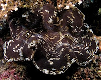
Cuttlefish in Komodo National ParkGiant Clam in Komodo National ParkKomodo National Park has been selected as one of 28 finalists to become one of the New7Wonders of Nature. About 4,000 people live within the park. Scuba diving is popular because of the park's high marine biodiversity. The development of, largely marine-based, ecotourism is the main strategy to make the park self-financing and generate sufficient revenue through entrance fees and tourism licenses to cover operational and managerial costs. To this end, a joint venture between TNC and a tourism operator were granted a tourism concession that also entails extensive park management rights. This concession has generated an ongoing controversy. The joint venture has been accused of making decisions behind closed doors, and many people in and around Komodo claim that they haven’t been consulted regarding decisions that ultimately affect their lives.

Most controversy, however, was caused by the death of several fishermen since the 1980s. The circumstances of the fishermen’s deaths are contested. While park patrol including, at the time, police and navy personnel claim they acted in self-defense, fishing communities accuse park management of having deliberately killed the fishermen.

Saturday, July 3, 2010

Fountains Hall

Fountains Hall is a country house near Ripon in North Yorkshire, England, close to the World Heritage Site of Fountains Abbey. It belongs to the National Trust as part of its Fountains Abbey & Studley Royal Water Garden property, and is a Grade I listed building. The details of Fountains Hall are explained in world tour guides below.

Fountains HallThe house was built by Stephen Proctor between 1598 and 1604, partly with stone from the Abbey ruins. It is a fine example of late Elizabethan architecture, perhaps influenced by the work of Robert Smythson. After Proctors death in 1619, Fountains Hall passed into the possession of the Messenger family, who sold it to William Aislabie of neighbouring Studley Royal one hundred and fifty years later. Fountains Hall became virtually redundant as the Aislabie family remained at Studley Royal. It was leased to various tenants and at one time parts of it were used for farm storage. However it was renovated and modernised between 1928 and 1931, and the Duke and Duchess of York later King George VI and Queen Elizabeth often stayed there as guests of Lady Doris Vyner, wife of the Marquis of Ripon and sister to the then-current Duke of Richmond and Gordon.

During the Second World War, Fountains Hall and other estate buildings were used to house evacuees. Studley Royal became the wartime home of Queen Ethelburga's School of Harrogate, while the Q.E. Sanatorium was over at Fountains Hall. The stable block with the courtyard, set apart from the house at Studley Royal, was used for dormitaries while one corner became the School Chapel, at which Sunday Evensong was regularly said by the Arch Deacon at Ripon. It has a balcony of note, although it cannot be used at present because the second floor is used for weddings and the staircase is considered unsafe for the public.

Fountains HallFountains HallDuring the war the Vyners lost a son and a daughter; Charles was a Royal Naval Reserve pilot missing in action near Rangoon. Elizabeth was a member of the Womens Royal Naval Service and died of lethargic encephalitis while on service in Felixstowe, Suffolk. There is a sculpture remembering them which can be seen as one comes out of the house down the stone stairs.

Elizabeth Vyner WRNS - Died on Active Service June 3rd 1942 Aged 18 years. Also her brother Charles De Grey Vyner Sub Lieut RNVR Reported missing from Air Operations off Rangoon May 2nd 1945 Aged 19 Years. After the war the Hall again fell into a state of serious dilapidation. The National Trust acquired the Fountains Estate from North Yorkshire County Council in 1983 and has been undertaking restoration work on the Hall since then. Part of it has been divided into flats, one of which is available for holiday lets. Visitors to Fountains Abbey can view the oak-paneled Stone Hall and an adjoining exhibition room, and there are plans to restore the chapel.