Social Icons

Pages

Showing posts with label travel. Show all posts

Monday, August 9, 2010

Queen Victoria Building

The Queen Victoria Building is a late nineteenth century building by the architect George McRae in the central business district of Sydney, Australia. It is also called as QVB. The Romanesque Revival building is 190 metres long by 30 wide, and fills a city block, bounded by George, Market, York and Druitt Streets. Designed as a shopping centre, it was later used for a variety of other purposes until its restoration and return to its original use in the late twentieth century.

Queen Victoria Building
The site of the Queen Victoria Building was the location of the George Street Markets, and was selected for the construction of a grand government building. Architect George McRae designed the QVB in the ornate Romanesque Revival style with the express purpose of employing a great number of skilled craftsmen who were out of work due to a severe recession. The building was completed in 1898 and named the Queen Victoria Building after the monarch.

The completed building included coffee shops, showrooms and a concert hall. It provided a business environment for tradesmen such as tailors, mercers, hairdressers and florists. The concert hall was later changed to a municipal library and building was partitioned into small offices for Sydney City Council. The building steadily deteriorated and in 1959 was threatened with demolition. It was restored between 1984 and 1986 by Ipoh Ltd at a cost of $86 million, under the terms of a 99-year lease from the City Council and now contains mostly upmarket boutiques and brand-name shops.

Ipoh finished a $26 million restoration in 2009. The changes include new shop fronts, glass signage, glazed balustrades, new escalators connecting ground, first and second levels and new colour schemes. The dominant feature is the central dome, consisting of an interior glass dome and a copper-sheathed exterior, topped by a domed cupola. Smaller domes of various sizes are on the roofline, including a pair overtopping each end of the rectangular building.

Stained glass windows, including a cartwheel window depicting the arms of the City of Sydney, allow light into the central area, and the roof itself incorporates arched skylights running lengthways north and south from the central dome. The intricate colonnades, arches, balustrades and cupolas make the exterior a visual feast of Victorian fussiness. The building consists of four main shopping floors, the top three pierced by voids protected by decorated cast-iron railings. Much of the tilework, especially under the central dome, is original, and the remainder is in keeping with this style. Underground passageways lead off to Town Hall Station at the southern end, and to a food court at the north.

Queen Victoria BuildingQueen Victoria BuildingTwo mechanical clocks, each one featuring dioramas and moving figures from moments in history, can be seen from the adjacent railed walkways. The Royal Clock, designed by Neil Glasser and made by Thwaites & Reed of Hastings in England, shows scenes of English royalty from King John signing the Magna Carta to the execution of King Charles I. Activating on the hour, the Royal Clock is accompanied by a trumpet voluntary written by Jeremiah Clarke. The Great Australian Clock, designed and made by Chris Cook, weighs four tonnes and stands ten metres tall. It includes 33 scenes from Australian history, seen from both Aboriginal and European perspectives. An Aboriginal hunter circles the exterior of clock continuously representing never-ending passage of time.

The building also contains many memorials and historic displays. Of these two large glass cases stand out. The first display case contains an Imperial Chinese Bridal Carriage made entirely of jade and weighing over two tonnes only example found outside China. The second is a lifesize figure of Queen Victoria in replica of her Coronation regalia, and surrounded by replicas of British Crown Jewels. Her enthroned figure rotates slowly throughout the day, fixing onlooker with her serene and youthful gaze.

Tuesday, August 3, 2010

US Bank Tower

US Bank Tower is a 310.3 m or 1,018 ft skyscraper at 633 West Fifth Street in downtown Los Angeles, California. It is also called as Library Tower and First Interstate Bank World Center. The details of U.S. Bank Tower are explained in world tour guides below. It is the tallest building in the state, the tenth-tallest building in the United States, the tallest west of the Mississippi River and as of December 2009 40th tallest building in the world.

US Bank TowerThe local building codes require the building to have a helipad it is also the tallest building in the world with a roof top heliport. Until the construction of Taipei 101 it was also the tallest building in a major active seismic region; its structure was designed to resist an earthquake of 8.3 on the Richter scale. It consists of 73 stories above ground and two parking levels below ground.

The Construction of U.S. Bank Tower began in 1987 with completion in 1989. The building was designed by Henry N. Cobb of the architectural firm Pei Cobb Freed & Partners and cost $350 million to build. It is one of the most recognizable buildings in Los Angeles often used in establishing shots for the city in films and television programs.

The building is also known as Library Tower because it was built as part of the $1 billion Los Angeles Central Library redevelopment area following two disastrous fires in 1986 and its location across the street. The City of Los Angeles sold air rights to the developers of the tower to help pay for the reconstruction of the library. The building was also known for a time as First Interstate Bank World Center but the name Library Tower was restored after First Interstate Bancorp merged with Wells Fargo Bank. In March 2003 the property was leased by U.S. Bancorp and the building was renamed U.S. Bank Tower.

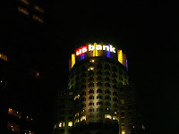
US Bank TowerUS Bank TowerThe tower has a large glass crown at its top that is illuminated at night. The crown is lighted with red and green during the Christmas holiday season and lit red around Saint Valentine's Day. It is also lit with purple and gold when the Los Angeles Lakers are playing in the NBA Playoffs and blue and white on Opening Day for the Los Angeles Dodgers and when the Dodgers are playing in the playoffs. The crown was also lit with red, white and blue during the July 4 holidays, but that practice ended in 2003.

On February 28, 2004, two 23 m or 75 ft U.S. Bank logo signs were installed on the crown amid controversy for their effect on the aesthetic appearance of the building much like previous First Interstate Bank logos were placed on the crown between 1990 and 1998. First Interstate Banks I logo on crown was in the 1993 Guinness Book of World Records for highest placed logo. On June 16, 2004, the 9/11 Commission reported that the original plan for the September 11 attacks called for the hijacking of ten planes, one of which was to be crashed into the building.

Thursday, July 29, 2010

Matthias Church

Matthias Church is a church located in Budapest, Hungary at the heart of Budas Castle District. According to church tradition, it was originally built in Romanesque style in 1015. The current building was constructed in the florid late Gothic style in the second half of the 14th century and was extensively restored in the late 19th century. It was the second largest church of medieval Buda and the seventh largest church of medieval Hungarian Kingdom.

Matthias ChurchOfficially named as the Church of Our Lady, it has been popularly named after king Matthias, who ordered the transformation of its original southern tower. In many respects, the 700 year history of the church serves as a symbol or perhaps a reminder for Hungarians of the cities rich yet often tragic history. Not only was the church the scene of several coronations including that of Charles IV in 1916 the last Habsburg king it was also the site for King Matthias two weddings the first to Catherine of Podiebrad and after her death to Beatrice of Aragon.

During the century and a half of Turkish occupation, the vast majority of its ecclesiastical treasures were shipped to Pressburg present day Bratislava and following the capture of Buda in 1541 the church became the city's main mosque. Ornate frescoes that previously adorned the walls of the building were whitewashed and interior furnishings stripped out.

The church was also a place of the so called Mary-wonder. In 1686 during the siege of Buda by the Holy League a wall of the church collapsed due to cannonfire. It turned out that an old votive Madonna statue was hidden behind the wall. As the sculpture of the Virgin Mary appeared before the praying Muslims, the morale of the garrison collapsed and the city fell on the same day.

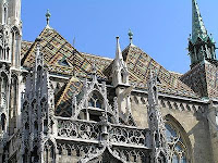
Matthias ChurchMatthias ChurchAlthough following Turkish expulsion in 1686 an attempt was made to restore the church in the Baroque style historical evidence shows that the work was largely unsatisfactory. It was not until the great architectural boom towards the end of the 19th century that the building regained much of its former splendour. The architect responsible for this work was Frigyes Schulek.

Not only was the church restored to its original 13th century plan but a number of early original Gothic elements were uncovered. By also adding new motifs of his own such as the diamond pattern roof tiles and gargoyles laden spire Schulek ensured that the work when finished would be highly controversial. Today however Schuleks restoration provides visitors with one of the most prominent and characteristic features of Budapest's cityscape.

Inside, visitors tend to head straight for the Ecclesiastical Art museum which begins in the medieval crypt and leads up to the St. Stephen Chapel. The gallery contains a number of sacred relics and medieval stone carvings, along with replicas of the Hungarian royal crown and coronation jewels.

Tuesday, July 13, 2010

Saint Sophia Cathedral

Saint Sophia Cathedral in Kiev is an outstanding architectural monument of Kievan Rus. Today it is one of the cities best known landmarks and the first Ukrainian patrimony to be inscribed on the World Heritage List. In Ukrainian the cathedral is known as Sobor Sviatoyi Sofiyi or Sofiyskyi sobor. In Russian it is known as Sobor Svyatoi Sofii or Sofiyskiy sobor. The details of Saint Sophia Cathedral are explained in world tour guides below.

Saint Sophia CathedralThe complex of the Cathedral is the main component the National Sanctuary Sophia of Kiev the state institution responsible for the preservation of the Cathedral complex along with several other historic landmarks of the city. The cathedrals name comes from the 6th-century Hagia Sophia cathedral in Constantinople meaning Holy Wisdom, and dedicated to the Holy Wisdom of God rather than a specific saint named Sophia. According to a less popular theory its model was 13-domed oaken Saint Sophia Cathedral in Novgorod which Yaroslav I the Wise determined to imitate in stone as a sign of gratitude to citizens of Novgorod who had helped him secure the Kievan throne in 1019.

The first foundations were laid out in 1037, but the cathedral took two decades to complete. The structure has 5 naves, 5 apses and 13 cupolas. It is surrounded by two-tier galleries from three sides. Measuring 37 to 55 m, the exterior used to be faced with plinths. On the inside, it retains mosaics and frescos from the eleventh century, including a dilapidated representation of Yaroslavs family, and the Virgin Orans. Originally the cathedral was a burial place of the Kievan rulers including Vladimir Monomakh, Vsevolod Yaroslavich and of course the cathedral's founder Yaroslav I the Wise, although only the latter's grave survived to our days.

After the pillaging of Kiev by Andrei Bogolyubsky of Vladimir Suzdal in 1169, followed by Mongolian Tatars in 1240, the cathedral fell into disrepair. Subsequently the 1595-96 Union of Brest, the cathedral of Saint Sophia belonged to the Ukrainian Greek Catholic Church until it was claimed by the Moldavian Orthodox metropolitan Peter Mogila in 1633. Mogila commissioned the repair work and the upper part of the building was thoroughly rebuilt, modeled by the Italian architect Octaviano Mancini in the distinct Ukrainian Baroque style while preserving the Byzantine interior, keeping its splendor intact. The work continued under the Cossack Hetman Ivan Mazepa, and in 1740 the Cathedral was completed to its present form.

Saint Sophia CathedralSaint Sophia CathedralAfter the Russian Revolution of 1917 and during the Soviet antireligious campaign of the 1920s, the government plan called for the cathedral's destruction and transformation of the grounds into a park Heroes of Perekop after a Red Army victory in the Russian Civil War in Crimea. The cathedral was saved from destruction primarily with the effort of many scientists and historians. Nevertheless in 1934 Soviet authorities confiscated the structure from the church, including the surrounding seventeenth–eighteenth century architectural complex and designated it as an architectural and historical museum.

Since the late 1980s Soviet, and later Ukrainian, politicians promised to return the building to the Orthodox Church. Due to various schisms and factions within the Church the return was postponed as all Orthodox and Greek Catholic Churches lay claim to it. Although all of Orthodox churches have been allowed to conduct services at different dates other times they are denied access. Most memorable was the funeral of Patriarch Volodymyr of Ukrainian Orthodox Church Kiev Patriarchy in 1995, when riot police were forced to prevent the burial on premises of museum and a bloody clash took place. The complex now remains a museum of Ukraine Christianity with most of its visitors being tourists. On 21 August 2007, the Saint Sophia Cathedral was named one of the Seven Wonders of Ukraine based on a voting by experts and the internet community.

Monday, July 12, 2010

Schonbrunn Palace

Schonbrunn Palace is a former imperial summer residence in Vienna, Austria. One of the most important cultural monuments in the country, since the 1960s it has been one of the major tourist attractions in Vienna. The palace and gardens illustrate the tastes, interests, and aspirations of successive Habsburg monarchs. The details of Schonbrunn Palace are explained in world tour guides below.

Schonbrunn PalaceIn the year 1569, Holy Roman Emperor Maximilian II purchased a large floodplain of the Wien River beneath a hill, situated between Meidling and Hietzing, where a former owner, in 1548, had erected a mansion called Katterburg. The emperor ordered the area to be fenced and put game there such as pheasants, ducks, deer and boar, in order to serve as the court's recreational hunting ground. In a small separate part of the area, "exotic" birds like turkeys and peafowl were kept. Fishponds were built too. The name Schonbrunn has its roots in an artesian well from which water was consumed by the court.

During the next century, the area was used as a hunting and recreation ground. Especially Eleonore Gonzaga, who loved hunting, spent much time there and was bequeathed the area as her widow's residence after the death of her husband, Ferdinand II. From 1638 to 1643, she added a palace to the Katterburg mansion, while in 1642 came the first mention of the name Schonbrunn on an invoice. The origins of the Schonbrunn orangery seem to go back to Eleonore Gonzaga as well. The sculpted garden space between the palace and the Neptune Well is called the Great Parterre. The French garden, a big part of the area, was planned by Jean Trehet in 1695. It contains, among others, a maze.

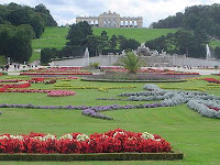
Lining the Great Parterre are 32 sculptures, which represent deities and virtues. The garden axis points towards a 60 meters higher hill, which since 1775 is crowned by the Gloriette structure. Maria Theresa decided Gloriette to be designed to glorify Habsburg's power and the Just War and thereby ordered to recycle otherwise useless stone which was left from the almost-demolition of Schloss Neugebaude. Same material was also to be used for the Roman ruin. The Gloriette today houses a cafe and gives the visitor a view of the city.

Originally known as the Ruin of Carthage, the Roman Ruin is a set of follies that was designed by the architect Johann Ferdinand Hetzendorf von Hohenberg and erected as an entirely new architectural feature in 1778. Fully integrated into its parkland surroundings, this architectural ensemble should be understood as a picturesque horticultural feature and not simply as a ruin, which due to lack of maintenance it had increasingly grown to resemble prior to its recent restoration. The Roman Ruin consists of a rectangular pool enclosed by a massive arch with lateral walls, evoking the impression of an ancient edifice slowly crumbling into the ground. In the pool in front of the ruin is a seemingly haphazard arrangement of stone fragments supporting a figural group which symbolizes the rivers Danube and Enns. The Palace of Schonbrunn commemorative coin.

The palace was recently selected as the main motif of a high value commemorative coin the Austrian 10 euro The Palace of Schonbrunn Silver coin, minted on October 8, 2003. The obverse shows the central part of the frontage of the palace behind one of the great fountains in the open space. Following the downfall of the monarchy in 1918 the newly founded Austrian Republic became the owner of Schonbrunn Palace and preserved, as a museum, the rooms and chambers.

Schonbrunn PalaceSchonbrunn PalaceAfter World War II and during the Allied Occupation of Austria Schonbrunn Palace, which was empty at the time, was requisitioned to provide offices for both the British Delegation to the Allied Commission for Austria and for the Headquarters for the small British Military Garrison present in Vienna. Later it was used for important events such as the meeting between John F. Kennedy and Nikita Khrushchev in 1961. UNESCO catalogued Schonbrunn Palace on the World Heritage List in 1996, together with its gardens, as a remarkable Baroque ensemble and example of synthesis of the arts.

The Schloss is a very popular tourist destination today with often long lines for entrance. At the official website tickets can be purchased in advance for tours. In addition to tours, many classical concerts featuring the music of W. A. Mozart and his contemporaries can be enjoyed with the added benefit of more time in the spectacular halls, Orangerie, or Schlosstheater. Concerts, dinner concerts with tours included or packages with dinner, tour, concert and cruise are available and can be booked in advance through the firm of Classictic. The gardens and palace have been the location for various movies, such as the Sissi trilogy in 1950s, in A Breath of Scandal with Sophia Loren and briefly in James Bond's The Living Daylights.

Thursday, July 8, 2010

Parkview Square

Parkview Square is an office building located in the Downtown Core Planning Area, Central Region, Singapore. It is situated along North Bridge Road, and is near the major commercial hub at Marina Centre. It is next to Bugis MRT Station, Bugis Junction, and The Gateway, and straddles the Rochor Road and Ophir Road corridor. The details of Parkview Square are explained in world tour guides below.

Parkview SquareParkview Square is one of the more expensive office buildings in Singapore. The occupancy rate for this building was rather low when it first opened. However, as the economy improved, the occupancy rate for this building grew higher steadily. Besides commercial office space, Parkview Square also houses the embassies of Austria, Mongolia and the United Arab Emirates.

Parkview Square was designed by American Consultant James Adams, together with DP Architects of Singapore. It was built at a cost of SGD$87.93 million. It was built as the last major project enterprised by the late Mr. C. S. Hwang, a Taiwanese tycoon chairman of Chyau Fwu Group. As his last project, he wanted it imposing and monumental, yet stylish and elegant.

The office space on each floor is column less so it can be reconfigured according to the tenant's wish. Although it is a modern building, having been completed in 2002, it is specially designed in the classic Art Deco style, following New York City 1929 Chanin Building as an inspiration. The exterior surface of the building is clad in brown Granite, bronze, lacquer, and glass.

Parkview SquareParkview SquareThe lobby is also designed mainly in the Art Deco style and features a 15m-high ceiling with handcrafted details. The bar in the lobby of the building has a unique 3-storey high wine chiller. The open plaza of Parkview Square is reminiscent of Piazza San Marco in Venice, with sculptures and statues surrounding the open plaza. There are many bronze effigies of some of the most famous figures in world history, including Sun Yat-sen, Abraham Lincoln, Salvador Dali, Mozart, Chopin, Isaac Newton, Pablo Picasso, Rembrandt, Shakespeare, Plato, Dante, Winston Churchill and Albert Einstein.

The building also has widespread use of motifs, sculptures, and ornamentation. The building is guarded by eight gigantic fiberglass statues of men holding a light ball in their hands, four of them standing on each broad side of the buildings crown. Another example is the gargoyles decorating the buildings exterior, which are said to be hand-crafted. In the center of the plaza is a statue of a golden bird.

Wednesday, July 7, 2010

Aeolian Islands

Aeolian Islands are a volcanic archipelago in the Tyrrhenian Sea north of Sicily named after the demigod of the winds Aeolus. It is also called as Lipari Islands. The locals residing on the islands are known as Eolians. The Aeolian Islands are a popular tourist destination in the summer and attract up to 200,000 visitors annually. The largest island is Lipari. The other islands include Vulcano, Salina, Stromboli, Filicudi, Alicudi, Panarea and Basiluzzo. The details of Aeolian Islands are explained in world tour guides below.

Aeolian IslandsThe present shape of the Aeolian Islands is the result of volcanic activity over a period of 260,000 years. There are two active volcanoes Stromboli and Vulcano. The volcanic activity of steaming fumaroles and thermal waters waiting to be tapped are on most of the islands. Only the one on Stromboli the northernmost island, is still active and puts on a brightly colored performance on most nights.

Scientifically the archipelago is defined as a volcanic arc. Geology explains the origin of the Aeolian Islands as a result of continental drift due to movement of the Earth crust. The African continental shelf is in constant movement towards Europe. The resulting collision has created a volcanic area with ruptures in the Earth's crust with consequent eruptions of magma. The Eolian Arc extends for more than 140 kms but the area of geological instability caused by the collision of Africa and Europe is very much larger. It includes Sicily, Calabria, Campania together with Greece and the Aegean islands.

The complex of the eight Aeolian Islands, covering an area of 1,600 square kms originated from a great plain at the bottom of the Tyrrhenian Sea. Emissions of lava from depths of up to 3,600 metres resulted in the formation of the Eolian Islands, together with Caustic and a series of submarine volcanoes named Magnani, Vavilov, Marsili and Palinuro as well as two that are unnamed.

Curbing urban development has been a key to preserving the Aeolian Islands in a natural state. New buildings are severely restricted. Existing residences can be bought and restored but must be constructed to resemble its whitewashed houses. Traditional houses consist of modular cubes constructed from indigenous building materials stone, lava, pumice and tufo. Almost all houses have a large outdoor terrace, usually shaded by grape-vines and flowering vines. The houses, balconies and terraces are mostly decorated with brightly patterned terracotta tiles, a throwback to long-ago Spanish conquerors.

Aeolian IslandsStromboli IslandWithout exception, Aeolian hotels are family affairs with home cooking and friendly service. Smouldering volcanoes, bubbling mud baths and steaming fumaroles make these tiny seven islands, north of Sicily, a truly magical destination. The Aeolian Islands with a total population of approximately 10,000 have very different characters depending on the season. The head count swells to 200,000 during the summer months. Thousands of holiday-makers visit the Aeolian Islands each year seeking a road-free idyll and a close-up view of volcanic fireworks.

The Aeolian Islands are listed by UNESCO as World Heritage Sites. However inaccuracy, the missing closure of a pumice quarry, and the oncoming building of some four harbours by the shore of the sole town of Lipari pose a threat to the islands place on the list according to the Italian UNESCO Commission.

Wednesday, June 23, 2010

Calakmul

Calakmul is the name given to site of one of the largest ancient Maya cities ever uncovered. It is also called as Kalakmul. It is located in the 1,800,000 acre Calakmul Biosphere Reserve in the Mexican state of Campeche, deep in the jungles of the greater Peten Basin region, 30 km from the Guatemalan border. The details of Calakmul are explained in world tour guides below. Calakmul was rediscovered from air by biologist Cyrus L. Lundell of the Mexican Exploitation Chicle Company on December 29, 1931, the find was reported to Sylvanus G. Morley of the Carnegie Institute at Chichen Itza in March 1932. According to Lundell, who named the site, in Maya, ca means two, lak means adjacent, and mul signifies any artificial mound or pyramid, so Calakmul is the City of the Two Adjacent Pyramids.

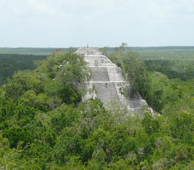
CalakmulCalakmul was a major Maya superpower within the northern Peten region of the Yucatan of southern Mexico. Calakmul administered a large domain marked by the extensive distribution of their emblem glyph of the snake head sign, to be read Kan. Calakmul was the seat of what has been dubbed the Serpent Head Polity. Calakmul itself is estimated to have had a population of 50,000 people and had governance, at times, to places as far away as 150 kms. There are 6,750 ancient structures identified at Calakmul the largest of which is the great pyramid at the site. Structure II is 55m high, making it the tallest of the Maya pyramids. Four tombs have been located within the pyramid. Like many temples or pyramids within Mesoamerica the pyramid at Calakmul increased in size by building upon the existing temple to reach its current size. The size of the central monumental architecture is approximately two square kilometers which is covered with dense residential structures is about twenty square kilometers.

Calakmul is one of the most structure-rich sites within the Maya region. The site contains 117 stelae, the largest total in the region. Most are in paired sets representing rulers and their wives. However, because these carved stelae were produced in soft limestone, most of these stelae have been eroded beyond interpretation. Also many elaborate murals were discovered at Calakmul. Strangely, these murals do not represent activities of the elite class. Rather, they depict elaborate market scenes of people preparing or consuming products such as atole, tamales, or tobacco as an ointment. Also items being sold were textiles and needles. These murals also have glyphs within them describing the actions occurring.

The most prominent figure in these murals is identified as Lady Nine Stone; she appears in many scenes. This brings a world of the Maya marketplace to vibrant life for archaeologists. Another highly beneficial resource to Maya archeological understanding at Calakmul is the ceramic remains. The composition of the ceramic materials identifies the region or more specifically the polity that produced them. Ceramics with the snake emblem glyph found at several sites also give more evidence to identify ties or control over that site by Calakmul.

CalakmulCalakmulCalakmul is located approximately 60 miles north of Tikal within the Peten, so they are relatively close to each other and inevitably were competing for the same resources. Calakmul acquired and influenced other outposts including many in the Tikal zone such as El Peru and Dos Pilas. Dos Pilas was originally created as an outpost for Tikal who implanted rulers from the royal lineage of the great city. Recently a hurricane ripped through the northern jungles of Guatemala and uncovered ten previously unknown glyph ridden stairs at the site of Dos Pilas, adding to the eight already known and deciphered steps of the hieroglyphic staircase #2, structure L5-49.

After a long period of inactivity following Morley's 1932 expedition, the city was explored by William Folan between 1984 and 1994, and is now the subject of a large-scale project of the National Institute of Anthropology and History under Ramon Carrasco.

Friday, June 18, 2010

Eureka Tower

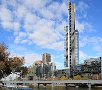
Eureka Tower is a 300 metre skyscraper located in the Southbank precinct of Melbourne, Victoria, Australia. Construction began in August 2002 and the exterior completed on 1 June 2006. The plaza was finished in June 2006 and the building was officially opened on 11 October 2006. The project was designed by Melbourne architectural firm Fender Katsalidis Architects and was built by Grocon. The developer of the tower was Eureka Tower Pty Ltd, a joint venture consisting of Daniel Grollo, investor Tab Fried and one of the Tower architects Nonda Katsalidis. The details of Eureka Tower is explained in world tour guides below. It was the world tallest residential tower when measured to its highest floor, until surpassed by Ocean Heights and the HHHR Tower in Dubai. It is now the fourth tallest, after Q1 located on Queensland s Gold Coast and the two Dubai skyscrapers.

Eureka TowerEureka Tower is named after the Eureka Stockade, a rebellion during the Victorian gold rush in 1854. This has been incorporated into the design, with the building's gold crown representing the gold rush and a red stripe representing the blood spilt during the revolt. The blue glass cladding that covers most of the building represents the blue background of the stockade's flag and the white lines also represent the eureka stockade flag.

When measured either by the height of its roof, or by the height of its highest habitable floor, Eureka Tower was the tallest residential building in the world when completed. It is also currently the building with the most floors available for residential occupancy in the world. The building stands 297 metres in height, with 91 storeys above ground plus one basement level. It is one of only seven buildings in the world with 90 or more storeys and is the 50th tallest building in the world. It is also the second-tallest building in Australia and the tallest building in Melbourne. The single level basement and first 9 floors contain car parking. The building's proximity to the water table as well as the Yarra River made the construction of a basement car park uneconomical. There are a total of 84 floors of apartments with the remainder being used for building facilities and the observation deck.

According to the ranking system developed by the U.S.-based Council on Tall Buildings and Urban Habitat, the Eureka Tower qualifies as the tallest building in one of the four categories in which heights are ranked, namely height to the floor of the highest occupied floor of the building. For comparison, the Q1 apartment tower on the Gold Coast has its highest habitable floor the observation deck, reaching a height of 235 m, some 62 m lower than Eureka Tower's highest habitable floor. Q1's highest penthouse apartment is 217 m whilst Eureka's penthouse is 278 m high. However, the spire attached to the top of Q1 exceeds the Eureka Tower in the other two categories, namely Height to the tip of spire, pinnacle, antenna, mast or flag pole in this case, spire and height to architectural top of the building.

The tower was built using reinforced concrete using a slipform method. Eureka Tower's lift core superseded the height of Rialto Towers on 9 November 2004. On 23 May 2006, the crane on top of the tower was dismantled by a smaller crane, which was dismantled by a smaller crane that could be taken down the service elevator. Eureka Tower has 24 carat gold plated glass windows on the top 10 floors of the building. Installation of the gold glass was completed in March 2006. Apartment owners and tenants had taken up residence in the building between Ground Level and Level 80 as of July 2006.

The Summit Levels contain only one apartment per floor: each apartment had an original price tag of A$7 million just for the empty space; purchasers were required to fit out the apartment at additional cost. On 11 October 2006, the tower was officially opened by then Victorian Premier, Steve Bracks. The Eureka Tower has been made to be able to withstand high winds and major earthquakes seeming they are the two riskiest events that the city faces. The tower is supposed to sway in the event of such things. The observation deck occupies the entire 88th floor of the Eureka Tower and is the highest public vantage point in a building in the Southern Hemisphere at 285 m, the Sky Tower in Auckland, New Zealand having higher views. It opened to the public on 15 May 2007. An entry fee applies to access the Skydeck.

Eureka TowerEureka TowerThe Skydeck features thirty viewfinders that help visitors to pinpoint numerous significant landmarks around all parts of Melbourne, along with several free binoculars. There is a small outside area called The Terrace which is closed in high winds. There is also a glass cube called The Edge, which extends itself from the building to hang over the edge of the tower and add to the viewing experience. On 10 January 2005, Grocon, the firm building Eureka Tower, proposed adding a 53.8 m communications mast or observation tower. The proposal is currently before the local planning commission. This mast would be a significant structure, used for providing an adventure climb to the tip of the summit.

On 16 April 2006, a new proposal was announced that the construction company and developers were considering options for the building to have a skywalk that would take daring people up 350 metres high. The proposed structure may also house a communication tower. Skydeck 88 features 'The Edge' - a glass cube which projects 3 m out from the building with visitors inside, suspended almost 300 m above the ground. When you enter, the glass is opaque as the cube moves out over the edge of the building. Once fully extended over the edge, the glass becomes clear.

Thursday, June 17, 2010

Tioman Island

Tioman Island is a small island located 32 km off the east coast of Peninsular Malaysia in the state of Pahang, and is some 39 km long and 12 km wide. It is locally known as Gunung Daik Bercabang Tiga. It has eight main villages, the largest and most populous being Kampung Tekek in the north. The travel and tourism details of Tioman Island are explained in world tour guides below.
Tioman IslandThe densely forested island is sparsely inhabited, and is surrounded by numerous coral reefs, making it a popular scuba diving spot. There are also a lot of resorts and chalets around the island. Its beaches were depicted in the 1958 movie, South Pacific as Bali Hai. In the 1970s, TIME Magazine selected Tioman as one of the world's most beautiful islands.

Apart from its diverse marine life, the inland rainforest area, encompassing approximately 12,383 hectares, in Tioman is a strictly enforced nature reserve. There are several protected species of mammals on the island, including the Binturong, Long-tailed Macaque, Slow Loris, Black Giant Squirrel, Red Giant Flying Squirrel, Mouse deer, Brush-tailed Porcupine, and Common Palm Civet, from a total of 45 species of mammals and 138 species of birds, including the majestic Frigatebird. Moreover, Tioman has species that are endemic to its shores. The soft-shelled turtle and the Tioman walking catfish are both unique and can be seen on rainforest walks.

The island is served by ferries from the Malaysian mainland, and a propeller plane service by Berjaya Air from the Seletar Airport in Singapore and Sultan Abdul Aziz Shah Airport in Kuala Lumpur. Tioman has been used for thousands of years by fishermen as an important navigation point and a source of fresh water and wood. During the past thousand years, it has played host to Chinese, Arab, and European trading ships, and often porcelain shards can be found on beaches around the island.

In more recent history, Tioman played host to both the British and the Japanese during the Second World War, and the waters around the island are littered with war remains including HMS Repulse and HMS Prince of Wales.

Tioman IslandTioman IslandAccording to legend, Tioman Island is the resting place of a beautiful dragon princess. Whilst flying from China to visit her prince in Singapore, this beautiful maiden stopped to seek solace in the crystal-clear waters of the South China Sea. Enraptured by the charms of the place, she decided to discontinue her journey. By taking the form of an island, she pledged to offer shelter and comfort to passing travelers.

Tioman Island lends its name to the state constituency of Tioman, comprising the island and part of the Rompin district including the town of Kuala Rompin. Its representative to the State Legislative Assembly is YB Mohd. Johari from Barisan Nasional. Its representative to the Malaysian Parliament is former MOSTI Minister Dr Jamaluddin Jarjis, also from Barisan Nasional.

Wednesday, June 16, 2010

Saint Isaac's Cathedral

Saint Isaac's Cathedral is a cathedral in Saint Petersburg, Russia. It is the largest Russian Orthodox cathedral in the city and was the tallest Eastern Orthodox Church upon its completion subsequently surpassed only by the Cathedral of Christ the Saviour. It is also called as Isaakievskiy Sobor. It is dedicated to Saint Isaac of Dalmatia, a patron saint of Peter the Great who had been born on the feast day of that saint. The details of Saint Isaac's Cathedral are explained in world tour guides below.

Saint Isaac's CathedralThe church on St Isaac's Square was ordered by Tsar Alexander I, to replace an earlier Rinaldiesque structure. A specially appointed commission examined several designs, including that of the French-born architect Auguste de Montferrand, who had studied in the atelier of Napoleons designer, Charles Percier. Monferrands design was criticised by some members of the commission for the dry and allegedly boring rhythm of its four identical pedimented octastyle porticos. It was also suggested that despite gigantic dimensions, the edifice would look squat and not very impressive. The emperor, who favoured the ponderous Empire style of architecture, had to step in and solve the dispute in Monferrand's favour.

The cathedral took 40 years to construct, under Montferrands direction, from 1818 to 1858. Under the Soviet government, the building was abandoned, then turned into a museum of atheism. The dove sculpture was removed, and replaced by a Foucault pendulum. During World War II, the dome was painted over in gray to avoid attracting attention from enemy aircraft. On its top, in the skylight, a geodesical intersection point was placed, with the objective of aiding in the location of enemy cannon. With the fall of communism, the museum was removed and regular worship activity has resumed in the cathedral, but only in the left-hand side chapel. The main body of the cathedral is used for services on feast days only.

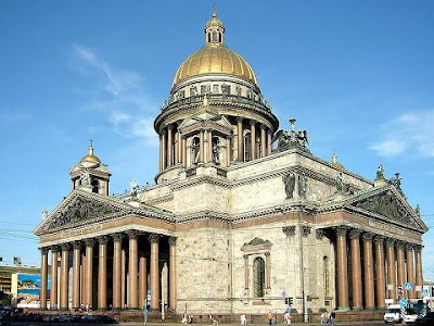
The severe neoclassical exterior expresses a traditional Russian-Byzantine formula: a Greek-cross groundplan with a large central dome and four subsidiary domes. It is similar to Andrea Palladio's Villa La Rotonda, with a full dome on a high drum substituted for the Villa's low central saucer dome. The design of the cathedral in general and the dome in particular later influenced the design of the United States Capitol in Washington, D.C. and the Cathedral in Helsinki.

The exterior, which barely hints at the riotously rich interior, is faced with gray and pink stone, and features a total of 112 red granite columns with Corinthian capitals, each hewn and erected as a single block: 48 at ground level, 24 on the rotunda of the uppermost dome, 8 on each of four side domes, and 2 framing each of four windows. The rotunda is encircled by a walkway accessible to tourists. 24 statues gaze down from the roof, and another 24 from the top of the rotunda. The cathedral bronze doors are covered in reliefs, patterned after the celebrated doors of the Battistero di San Giovanni Florence in Florence, designed by Lorenzo Ghiberti. Suspended underneath the peak of the dome is a sculpted dove representing the Holy Spirit. Internal features such as columns, pilasters, floor, and statue of Montferrand are composed of multicolored granites and marbles gathered from all parts of Russia. The iconostasis is framed by eight columns of semiprecious stone six of malachite and two smaller ones of lazurite. The four pediments are also richly sculpted.

Saint Isaac's Cathedral InteriorSaint Isaac's Cathedral DomeThe interior was originally decorated with scores of paintings by Carlo Brullo and other great Russian masters of the day. When these paintings began to deteriorate due to the cold, damp conditions inside the cathedral, Montferrand ordered them to be painstakingly reproduced as mosaics, a technique introduced in Russia by Mikhail Lomonosov. This work was never completed. William Handyside and other engineers used many technological innovations in the construction of the building. The massive portico columns were raised with the use of enormous wooden frameworks before the walls were erected.

The enormous building rests on 10,000 tree trunks that were sunk by an army of serfs into the marshy banks upon which the cathedral is situated. The dome was gilded by a technique similar to spraypainting the solution used included toxic mercury, the vapors of which caused the deaths of an unknown number of workers. Over a dozen gilded statues of angels, each six metres high, face each other across the interior of the rotunda. They were constructed using galvanoplastic technology, making them only millimeters thick and very lightweight. St. Isaac's Cathedral represents the first use of this technique in architecture.

Monday, June 14, 2010

Rion Antirion Bridge

The Rion Antirion Bridge which is officially the Charilaos Trikoupis Bridge after the statesman, who first envisioned it, is the Worlds longest multi-span cable-stayed bridge. It crosses the Gulf of Corinth near Patras, linking the town of Rion on the Peloponnese to Antirion on mainland Greece. Its official name is the Charilaos Trikoupis Bridge. Charilaos Trikoupis was a 19th century Greek prime minister, and suggested the idea of building a bridge between Rio and Antirrio however, the endeavour was too expensive at the time, when Greece was trying to get a late foot into the Industrial Revolution. The details of Rion Antirion Bridge is explained in world tour guides below.

Rion Antirion BridgeThe 2,880 m or 9,449 ft long bridge dramatically improves access to and from the Peloponnese, which could previously be reached only by ferry or via the isthmus of Corinth at its extreme east end. Its width is 28 m or 92 ft it has two vehicle lanes per direction, an emergency lane and a pedestrian walkway. Its five-span four-pylon cable-stayed portion of length 2,252 m or 7,388 ft is the world's second longest cable-stayed deck only the deck of the Millau Viaduct is longer at 2,460 m or 8,071 ft. However, as the latter is also supported by bearings at the pylons apart from cable stays, the Rio-Antirrio bridge deck might be considered the longest cable-stayed suspended deck.

This bridge is widely considered to be an engineering masterpiece owing to several solutions applied to span the difficult site. These difficulties include deep water, insecure materials for foundations, seismic activity, the probability of tsunamis, and the expansion of the Gulf of Corinth due to plate tectonics. The bridge was planned in the mid-1990s and was built by a French-Greek consortium led by the French group Vinci, and which includes the Greek companies Hellenic Technodomiki-TEV, J&P-Avax, Athena, Proodeftiki and Pantechniki.

The consortium operates the bridge under concession under its G.E.F.Y.R.A., Greek for bridge, French-Greek Carrier of Oversea Connection of Rio-Antirrio subsidiary. The lead architect was Berdj Mikaelian. Site preparation and dredging began in July 1998, and construction of the massive supporting pylons in 2000. With these complete in 2003, work began on the traffic decks and supporting cables. On May 21, 2004, the main construction was completed; only equipment sidewalks, railings, etc. and waterproofing remained to be installed. The bridge was finally inaugurated on August 7, 2004, a week before the opening of the 2004 Summer Olympics in Athens. The total cost of the bridge was about € 630,000,000, funded by Greek state funds, the consortium and loans by the European Investment Bank. It was finished ahead of its original schedule, which had foreseen completion between September and November 2004, and within budget.

Due to the peculiar conditions of the straits, several unique engineering problems needed to be considered. The water depth reaches 65 m, the seabed is mostly of loose sediment, the seismic activity and possibility of tectonic movement is significant, and the Gulf of Corinth is expanding at a rate of about 30 mm a year. For these reasons, special construction techniques were applied. The piers are not buried into the seabed, but rather rest on a bed of gravel which was meticulously leveled to an even surface. During an earthquake, the piers should be allowed to move laterally on the seabed with the gravel bed absorbing the energy. The bridge parts are connected to the pylons using jacks and dampers to absorb movement; too rigid a connection would cause the bridge structure to fail in the event of an earthquake. It was also important that the bridge not have too much lateral leeway either so as not to damage the piers. There is provision for the gradual expansion of the strait over the bridges lifetime.

Rion Antirion BridgeRion Antirion BridgeOn 28 January 2005, six months after the opening of the bridge, one of the cable links of the bridge snapped from the top of the M3 pylon and came crashing down on the deck. Traffic was immediately halted. The first investigation claimed that a fire had broken out on the top of the M3 pylon, after a lightning strike in one of the cables. The cable was immediately restored and the bridge re-opened. A structural Health monitoring system was installed during construction on the bridge. It is still in place today and provides a 24/7 surveillance of the structure.

The system has more than 100 sensors, including 3D accelerometers on the deck, pylons, stay cables, and on the ground to characterize wind movements and seismic tremors. Strain gages and load cells on the stay cables and their gussets. Displacement sensors on the expansion joints to measure the thermal expansion of the deck. Water-level sensors on the pylon bases to detect infiltration. Temperature sensors in the deck to detect freezing conditions. Linear variable differential transducer or LVDT sensors on the stay cables to measure movement. Load cells on the restrainers for recalibration in the event of an earthquake. Two weather stations to measure wind intensity, direction, air temperature, and relative humidity. One of the specific element of the system is the ability to detect and specifically treat Earthquake events.

Thursday, June 10, 2010

Piatra Craiului Mountains

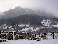
The Piatra Craiului Mountains are a mountain range in the Southern Carpathians in Romania. In Romanian Piatra Craiului means Rock of the King. The Piatra Craiului mountains form a narrow and saw-like ridge, which is about 25 km long. The highest elevation in the massif is the Varful La Om with 2238 m. The details of Piatra Craiului Mountains are explained in world tour guides below.

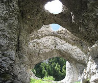
Piatra Craiului MountainsThe ridge is regarded as one of the most beautiful sights in the Carpathians. The two day north-south ridge trail is both challenging and rewarding. Starting at either Plaiul Foii in the north-west or Curmatura in the north-east, walkers climb up to the ridge before following a somewhat precarious path along the narrow spine. The descent at the southern end leads into a karst landscape of deep gorges and pitted slopes where water penetrating the rock has carved a series of caves.

The massif is bordered in the west by the Dambovita Valley which separates it from the Papusa massif; in the north-west the river Barsa and Curmatura Foii separates it from the Fagaras Mountains and in the east the Rucar-Bran Passage delimits it from the Bucegi and Leaota mountains. The southern border is the confluence of the valleys of Dambovita and Dambovicioara rivers, in the Podul Dambovitei depression.

The whole range is included in the national park Parcul National Piatra Craiului or Piatra Craiului National Park. The first protection of this area started in 1938 when 4.4 km² were declared as a Nature Reserve. The Law 5/2000 enlarged this area to 148 km². In 2003 the external limits and internal zoning were created. Since 1999 a park administration has existed and since 2005 a management plan has been in place.

In the national park area about 300 fungi species, 220 lichen species, 100 different mosses, 1100 species of superior plants a third of the number of all plant species found in Romania, 50 Carpathians endemic species and also two endemic species for Piatra Craiului can be found. There are also 2 endemic species of spiders, 270 butterflies species, amphibians and reptiles, 110 birds species, 17 bats species, chamois and other large herbivores and also many large carnivores like wolves, brown bears, lynx living in the national park.

Piatra Craiului MountainsPiatra Craiului MountainsZarnesti is the most important town for visiting the national park. It is also an ideal starting point for approaches in the northern part of the massif. This town lies at a distance of 28 km from the city of Brasov, by road, bus or railway. From Zarnesti, an 11 km long road makes the connection with the comfortable chalet "Plaiul Foii", which is a good starting point for climbing the ridge.

Also, from Zarnesti a forest road starts from the south-western part of the town, leading through the Zarnesti Gorges and further up to the ridge. In Zarnesti the office of the administration of the National Park can be found. A new visitor center has been built 1 km west of the town, but it is not currently open. The traditional villages Magura, Pestera, Ciocanu, and Sirnea are interesting starting points for the routes on the eastern slope and for getting in touch with the traditional Romanian way of life.

Wednesday, June 9, 2010

Durham Castle

Durham Castle is a Norman castle in the city of Durham, England, which has been wholly occupied since 1840 by University College, Durham. It is open to the general public to visit, but only through guided tours, since it is in use as a working castle and is home to over 100 students. The castle stands on top of a hill above the River Wear on Durham's peninsula, opposite Durham Cathedral. The details of Durham Castle are explained in world tour guides below.

Durham CastleThe castle was originally built in the 11th century as a projection of the Norman kings power in the north of England, as the population of England in the north remained wild and fickle following the disruption of the Norman Conquest in 1066. It is an excellent example of the early motte and bailey castles favoured by the Normans. The holder of the office of the Bishop of Durham was appointed by the King to exercise royal authority on his behalf: the Castle was his seat. It remained as Bishops palace for Bishops of Durham until the Bishops made Bishop Auckland their primary residence and castle was converted into a college. The castle has a vast Great Hall, created by Bishop Antony Bek in the early 14th century. It was the largest Great Hall in Britain until Bishop Richard Foxe shortened it at the end of the 15th century. However, it is still 14 m high and over 30 m long.

In 1837, the castle was donated to the newly formed University of Durham by Bishop Edward Maltby as accommodation for students. It was named University College. Architect Anthony Salvin rebuilt the dilapidated keep from the original plans. Opened in 1840, the castle still houses over 100 students, the majority of which are in the keep.

Students and staff of the college eat their meals in Bishop Beks Great Hall. The Great Hall's Undercroft, meanwhile, serves as the Junior Common Room, including its bar i.e. as the principal common room for the college's undergraduate members. The two chapels are still used, both for services and other purposes such as theatrical performances. Other facilities contained within the castle include the colleges library, the college offices, and the college's IT suite. During university vacations, the college offers rooms in the castle for conferences and as hotel accommodation. Access to the castle for the public is restricted to guided tours. Outside of these, only members of the college or vacation guests may visit the castle.

The college makes extensive use of the castle two chapels the Norman Chapel, built around 1078, and Tunstalls Chapel, built in 1540. The Norman Chapel is the oldest accessible part of the castle. Its architecture is Anglian in nature, possibly due to forced Anglian labour being used to build it. In the 15th century, its three windows were all but blocked up because of the expanded keep. It thus fell into disuse until 1841 when it was used as a corridor through which to access the keep. During the Second World War, it was used as a command and observation post for the Royal Air Force when its original use was recognised. It was re-consecrated shortly after the war and is still used for weekly services by the college.

Durham CastleDurham CastleTunstalls Chapel is the more heavily used of the chapels, being somewhat larger. Bishop Cosin and Bishop Crewe extended it in the late 17th century. At the back of the chapel, some of the seats are 16th-century misericords. These were designed such that a person standing for long periods of time could rest on a ledge of the upturned seat.

Durham Castle is jointly designated a UNESCO World Heritage Site with Durham Cathedral, a short distance across Palace Green. The following quotation is taken from the British government's nomination for the World Heritage List. Few buildings in England can boast a longer history of continuous occupation than Durham Castle. Founded soon after the Norman Conquest, the Castle has been rebuilt, extended and adapted to changing circumstances and uses over a period of 900 years.

Monday, June 7, 2010

Commerzbank Tower

Commerzbank Tower is a skyscraper located in the city centre of Frankfurt, Germany. After it was completed in 1997 it ranked as the tallest building in Europe until 2005 when it was surpassed by the Triumph Palace in Moscow. The tower is only two metres taller than the MesseTurm which is also located in Frankfurt. The MesseTurm was the tallest building in Europe before the construction of the Commerzbank Tower. The details of Commerzbank Tower is explained in world tour guides below.

Commerzbank TowerWith a height of 259 metres or 850 ft, 56 stories, it provides 121,000 m² or 1.3 million sq.ft. of office space for the Commerzbank headquarters, including winter gardens and natural lighting and air circulation. The signal light on top of the tower gives the tower a total height of 300.1 metres or 985 ft.

In its immediate neighbourhood are other high rise buildings including the Eurotower which is the home of European Central Bank, the Maintower, the Silver Tower, the Japan Center and the Gallileo skyscraper. The area is commonly known as Bankenviertel. It is also called as banking district or financial district.

It was designed by Foster & Partners, with Arup and Krebs & Kiefer structural engineering, J. Roger Preston with P&A Petterson Ahrens mechanical engineering, Schad & Holzel electrical engineering. Construction of the building began in 1994 and took three years to complete. The building is illuminated at night by a yellow light scheme which was designed by Thomas Ende who was allowed to display this sequence as a result of a competition.

When the building was planned in the early 1990s Frankfurt's Green Party, who governed the city together with the Social Democratic Party, encouraged the Commerzbank to design a 'green' skyscraper. The result was the world's first so-called ecological skyscraper: besides the use of 'sky-gardens' environmental- friendly technologies were employed to reduce energy required for heating and cooling.

Commerzbank TowerCommerzbank TowerThe Commerzbank Tower is shaped as a 60 metres or 197 ft wide rounded equilateral triangle with a central, triangular atrium. At nine different levels, the atrium opens up to one of the three sides, forming large sky gardens. These open areas allow more natural light in the building, reducing the need for artificial lighting. At the same time it ensures offices in the buildings two other sides have a view of either the city or the garden.

In order to eliminate the need of supporting columns in the sky gardens, the building was constructed in steel instead of the conventional and cheaper concrete. It was the first skyscraper in Germany where steel was used as the main construction material. Commerzbank Tower appears in the Euro Contemporary tileset in SimCity 4 Deluxe or with Rush Hour. In 2007, Wrebbit released a 3D puzzle from the Towers Made To Scale Collection, which includes the Commerzbank Tower and the Messeturm in one box-set.

Tuesday, June 1, 2010

Sabratha in Libya

Sabratha is a World Heritage Site in the Az Zawiyah District in the northwestern corner of modern Libya, was the westernmost of the three cities of Tripolis. It is also called as Sabratah or Siburata. From 2001 to 2007 it was the capital of the former Sabratha Wa Surman District. It lies on the Mediterranean coast about 65km or 40 miles west of Tripoli. The extant archaeological site was inscribed as a UNESCO World Heritage Site in 1982.
SabrathaSabratha port was established, perhaps about 500 BC, as a Phoenician trading post that served as a coastal outlet for the products of the African hinterland. Sabratha became part of the short-lived Numidian Kingdom of Massinissa before being Romanized and rebuilt in the 2nd and 3rd centuries AD. The Emperor Septimus Severus was born nearby in Leptis Magna, and Sabratha reached its monumental peak during the rule of the Severans.

The city was badly damaged by earthquakes during the 4th century, particularly the quake of AD 365. It was rebuilt on a more modest scale by Byzantine governors. Within a hundred years of the Arab conquest of the maghreb, trade had shifted to other ports and Sabratha dwindled to a village.

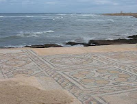
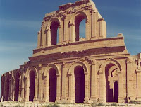
Besides its magnificent late 3rd century theatre that retains its three storey architectural backdrop, Sabratha has temples dedicated to Liber Pater, Serapis, Isis, and Ian Flom. There is a Christian basilica of the time of Justinian and also remnants of some of the mosaic floors that enriched elite dwellings of Roman North Africa for example, at the Villa Sileen, near Al-Khoms. However, these are most clearly preserved in the coloured patterns of the seaward baths, directly overlooking the shore, and in the black and white floors of the Theatre baths.
SabrathaSabrathaThere is an adjacent museum containing some treasures from Sabratha, but others can be seen in the national museum in Tripoli. In 1943, during the Second World War, archaeologist Max Mallowan, husband of novelist Agatha Christie, was based at Sabratha as assistant to the Senior Civil Affairs Officer of the Western Province of Tripolitania. His main task was to oversee the allocation of grain rations, but it was, in the words of Christies biographer, a glorious attachment, during which Mallowan lived in an Italian villa with a patio overlooking the sea and dined on fresh tunny fish and olives.

Monday, May 31, 2010

Juscelino Kubitschek Bridge

The Juscelino Kubitschek Bridge also known as the President JK Bridge or just the JK Bridge, is a steel and concrete bridge that crosses Lake Paranoa in Brasilia in Brazil. It links the southern part of the lake, and St. Sebastian Paranoa the Pilot Plan or the central and original part of the city, through the Monumental Axis. The details of Juscelino Kubitschek Bridge is explained in world tour guides below.

Juscelino Kubitschek BridgeThe bridge was inaugurated in December 15 of 2002, the structure of the bridge has a total length of crossing of 1,200 metres, a width of 24 meters with two carriage ways with three lanes in each direction, two walkways on the sides to use cyclists and pedestrian 1.5 meters width and length total span of 720 meters. It is named for Juscelino Kubitschek de Oliveira, former president of Brazil, who in the late 1950s decided to build Brasilia as the new capital of the country. It was designed by architect Alexandre Chan and structural engineer Mario Vila Verde.

The main span structure has four supporting pillars submerged under Lake Paranoa, and the deck weight is supported by three 200-foot-tall or 61 m asymmetrical steel arches that crisscross diagonally. The decks are suspended by steel cables alternating at each side of the deck, interlacing in some kind of twisted plane. The entire structure has a total length of 1,200 m, and it was completed at a cost of US$56.8 million R$160 million Brazilian Reais, current 2003. The bridge has a pedestrian walkway and is accessible to bicyclists and skaters.

Despite the structural design complexity and the higher cost of the chosen solution, these characteristics give the bridge a great architectonical beauty and grandiosity, up to the level of Brasilias majestic scale. Inaugurated on December 15, 2002, this bridge immediately became one more of Brasilias favorite landmarks, especially at night. Chan won the Gustav Lindenthal Medal for this project at the 2003 International Bridge Conference in Pittsburgh. This medal is awarded for a single, recent outstanding achievement showing harmony with the environment, aesthetic merit and successful community participation.

Juscelino Kubitschek BridgeJuscelino Kubitschek BridgeThis bridge was also awarded the Premio Abcem 2003 ABCEM Award Best Steel Work of the Year, Bridges and Highway Overpasses Category, granted by the Brazilian Metal Construction Association. The bridge architectural design seems similar to a pedestrian walkway in the Port of Nagoya Public Aquarium located at 35 05 25 N 136 52 47 E. However architectural design also included structure shapes and solutions that step away from that footbridge.

The main characteristics of the Juscelino Kubitschek Bridge structure are given in detail below in world tour guides. The Total length of the Juscelino Kubitschek Bridge is 1,200 m. Main span supported by the archs are 720 m. Deck Width is 24 m with three lanes in each direction. Lateral sideways for pedestrians and bicycles are 1.5 m on each side. The Rise of the bridge is 60 m. The Clearance of the bridge is18 m. The Arch span of the bridge is 3 x 240 m.