Social Icons

Pages

Showing posts with label travel guide. Show all posts

Tuesday, August 24, 2010

Zugspitze Mountain in Germany

The Zugspitze is highest mountain in Germany at 2,962 metres above sea level. It is located on Austrian border beside the town of Grainau in district of Garmisch Partenkirchen in federal-state of Bavaria. On Austrian side lies the town of Ehrwald in district of Reutte, Tyrol. There is a cog railway leading from tourist resort of Garmisch-Partenkirchen to Zugspitzplatt from where a cable car runs to peak. There are also two cable cars that go to peak from the base of mountain one ascends from German side of mountain at lake Eibsee and other ascends from Austria near Ehrwald. The peak is regularly crowded with tourists. The details of Zugspitze are explained in world tour guides below.

Zugspitze MountainFor those wishing to reach the summit under their own power, various hiking and ski trails can also be followed to the top. Hiking to the top from the base takes between one and two days, or a few hours for the very fit. Food and lodging is available on some trails. In winter the Zugspitze is a popular skiing and snowboarding destination, with several slopes on both sides. The Zugspitzplatt is Germany's highest ski resort, and thus normally has sufficient snow throughout the winter.
The border between Germany and Austria goes right through the mountain. There used to be a border checkpoint at the summit. But since Germany and Austria are now both part of the Schengen zone, the border crossing is no longer staffed. The Zugspitze belongs to the Wetterstein range in the Northern Limestone Alps. It gets its name from the many avalanche passages on its steep north slopes. At the Zugspitzes summit is the Munchner Haus a mountain hut, a facility built by the German Alpine Club. For more than a hundred years, the summit has also had a weather station, which nowadays also gathers data for the Global Atmosphere Watch.

Shortly after World War II the US military took over the Schneefernerhaus for the exclusive use of US military and civilian employees. Room rates, including meals, were US $ 1 per day. Ski lessons were available, taught by Austrians and Germans, at a cost of US $ 0.25 per hour. The first recorded ascent to the summit was accomplished by a team of land surveyors on the 27th of August, 1820. The team was led by Lieutenant Josef Naus who was accompanied by two men named Maier and G.Deutschl. However, local people had conquered the peak over 50 years earlier, according to a 1770 map discovered by the Alpenverein.

On 7 January 1882 the first successful winter assault on Zugspitze was accomplished by F. Kilger, H. and J. Zametzer and H. Schwaiger. Climbing up Zugspitze can involve several routes. The large difference in elevation between Garmisch-Partenkirchen and summit is 2 200 m making the climb a challenge even for trained mountaineers. On German side from Garmisch-Partenkirchen climbers go either through Hollental or Reintal. The way through Reintal is easiest but also longest and takes 8 to 10 hours. This path goes through the Partnachklamm a scenic gorge then through Reintal up to Zugspitzplatt, a barren plateau from there up to the summit. Climbers can stay for night at two alpine huts Reintalangerhutte or Knorrhutte.

Zugspitze MountainZugspitze Mountain
The more popular but harder route is through Hollental. It starts at Hammersbach near Garmisch goes through Hollentalklamm a similar gorge up to Hollentalangerhutte where one can take a meal or stay for night. It then crosses Hollentalferner remnants of a small glacier. After that it traverses a wall with help of iron ladders and steps. Via ferrata equipment is recommended for that part. Over Irmerscharte it reaches the summit. This path will take 7 to 8 hours.

From Austrian village of Ehrwald there are also two variants. One goes straight through the Western Flank, which is the shortest route overall, but rather hard. It includes via ferrata and there is a hut called Wiener Neustadter Hutte by Austrian Alpine Club. An easier path leads via Ehrwalder Alm across a small pass called Gatterl joining Reintal path at Knorrhutte. The Zugspitzes exact height was a matter of debate for quite a while. Given figures ranged from 2 960 m to 2 970 m but it is now generally accepted that peak is 2962 m above sea level as a result of a survey carried out by the Bavarian land survey office. The lounge at new cafe is named 2962 for this reason.

Monday, August 23, 2010

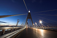
Megyeri Bridge

The Megyeri Bridge previously known as Northern M0 Danube Bridge is a cable stayed bridge that spans River Danube between Buda and Pest respectively west and east sides of Budapest, capital of Hungary. It is an important section of M0 ringroad around Budapest. The details of Megyeri Bridge are explained in world tour guides below.

Megyeri BridgeThe bridge cost 63 billion forints approximately US$ 300M to build and was officially opened on September 30, 2008 however National Transport Authority of Hungary has only issued temporary permits because of disagreement among suburban cities surrounding the bridge. A naming poll to determine new name of recently-built bridge caused controversy and received media attention when American comedians Stephen Colbert and Jon Stewart won. The total length of bridge is 1862m. Structurally it is composed of five parts. They are Left quayside inundation area bridge 148m, Main Danube-branch bridge cable stayed 590m with a span of 300m, Szentendre island inundation area bridge 559m, Szentendre Danube-branch bridge 332m and Right quayside inundation area bridge 218m.

The Ministry of Economic Affairs and Transport of Hungary organized a public vote online to solicit possible names for new bridge. The three names with most votes as well as suggestions from local governments, cartographers, linguists and other experts were to be reviewed by government committee before a final name for bridge was chosen. New nominations were accepted until August 21, 2006, and voting ended on September 8, 2006, with Stephen Colbert winning with 93,163 votes, and Jon Stewart and Zrinyi close behind with 85,171 and 83,966 votes, respectively.

On August 1, 2006 Reuters reported that top candidate according to the online poll was the Chuck Norris hid named for American action star Chuck Norris. On August 11, 2006 American satirist Stephen Colbert discussed story on his comedy program The Colbert Report instructing his viewers to visit polling website and vote for him instead of Norris. The next day the number of votes for him had grown 230 times and he now asked his viewers to follow a link from his own Colbert Nation website to avoid all that illegible Hungarian. Colberts site also indirectly offered techniques for stuffing the ballot box as users of their forums created several automated scripts to cast multiple votes for Colbert.

Megyeri BridgeMegyeri Bridge
On August 15, 2006 he repeated his call to be voted top of Hungarian poll and by August 22, 2006 Stephen Colbert hid was in first with 17 million votes about 14 million votes ahead of second-placed Zrinyi hid named after Croatian Hungarian national hero Miklos Zrinyi and about 7 million more than entire population of Hungary. The same day site announced a new round of voting which would require registration to participate and Colbert asked his viewers to call off dogs requesting on his website that fans stop using scripts to vote. Despite this Stephen Colbert hid remained in the top position on the website in the second round.

On September 14, 2006 Andras Simonyi the ambassador of Hungary to the United States announced on The Colbert Report that Stephen Colbert had won the vote. Unfortunately for Colbert Ambassador Simonyi declared that under Hungarian law Colbert would have to be fluent in Hungarian and would have to be deceased in order to have the bridge named for him. However after saying the rules could most likely be bent he invited Colbert to visit Hungary and view the construction in person and gave him a Hungarian passport and a 10,000 HUF Bill with an approximate value of as the ambassador put it fifty dollars, fifty good US dollars. Colbert promptly tried to bribe him with said money.

Thursday, August 19, 2010

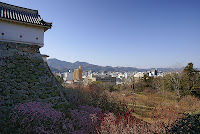
Kochi Castle in Japan

Kochi Castle is a castle located in Kochi, Kochi Prefecture, Japan. Next to the Battle of Sekigahara in 1600 Kochi Castle was constructed in what was then the province of Tosa. It was built by Yamanouchi Kazutoyo who took control of the province after the Tokugawa victory. The castle was constructed as part of the move from Urado to the more defensible Otakasa area. The details of Kochi Castle are explained in world tour guides below.

Kochi CastleThe construction of Kochi Castle was begun in 1601 and was completed in 1611. Much of original fortress burned down in 1727. It was reconstructed between 1729 and 1753 in original style. The castle underwent major restoration from 1948 to 1959. Though no battles were fought at castle it is remarkable because castle is the original structure and not a post war replica. It is also the only castle in Japan to retain both its original tenshu or keep and its palace. In fact, it is the only castle to have all the original buildings in the honmaru or innermost ring of defense, still standing.

Two previous attempts were made to build castles on Otakasa Hill. Both failed. The first attempt was by Otakasa Matsuomaru sometime during the late Heian or Kamakura periods. The second was in 1588 by the conqueror of Shikoku Chosokabe Motochika. The area around the hill at this time was extremely swampy due to the influx of alluvial sediments from the Kagami River. Consequently, previous builders were never successful in establishing a permanent fortress on the site where Kochi Castle stands today.

As one of only twelve intact castles in Japan, Kochi Castle was popularly called a National Treasure before the 1950 National Treasure Protection Law was enacted. After the law was passed, it was demoted to the status of Important Cultural Asset. Kochi Castle can be seen in the background of the animated film I Can Hear the Sea by Studio Ghibli during the class reunion scene. The castle figures prominently in the film The Harimaya Bridge. Key scenes in the movie take place in the courtyard just inside the Oteman Gate on the top level of the castle itself, and at the entrance to the castle grounds just outside the Oteman Gate.

Two rivers, the Kagami River and the Enokuchi River, form the outer moat of the castle. The tower is five stories high and sits atop Otakasa Hill, commanding an extensive view of the city. It rises above the Kaitokukan palace which was constructed in the Shoin style of the Edo period. The castle retains this structure today and has been fitted with period-appropriate items in the lower rooms. In addition to a tearoom, Genkan entrance area and latrine the Kaitokukan contains eight traditional rooms, ranging in size from three to twelve tatami. It is surrounded by a veranda on the east and south sides. The Kaitokukan also burned during the fire of 1727, but it was not repaired until 1747, with work completed in 1749.

Kochi CastleKochi CastleKochi Castle is located in downtown Kochi. The main entrance is directly across from the west entrance of the Obiyamachi shopping area. Visitors are asked to remove their footwear before entering the building. Slippers are provided. As the castle is quite old, the tatami rooms are visible but not accessible. There is a small museum area with information entirely in Japanese. This museum houses several cultural artifacts of the Tosa region not native to the castle itself.

The upper rooms of the tower are all empty, but visitors are allowed to climb to the top. There is a railing but no net around the balcony. Handicap access is extremely limited as the approach to the castle involves many steps. There is no elevator. The castle grounds are now a public park, and a popular location in spring for hanami. They contain the Prefectural Library and the Kochi Literary Museum, in addition to statues of notable scions of the Yamanouchi family.

Tuesday, August 17, 2010

Roskilde Cathedral

Roskilde Cathedral is a cathedral in the city of Roskilde on Island of Zealand in eastern Denmark. It was the first Gothic cathedral to be built of brick and its construction encouraged the spread of this Brick Gothic style throughout Northern Europe which was built during 12th and 13th centuries and incorporates both Gothic and Romanesque architectural features in its design. It was the only cathedral in Zealand until the 20th century. The details of Roskilde Cathedral are explained in world tour guides below.

Roskilde CathedralRoskilde Cathedral has been the main burial site for Danish monarchs since the 15th century. As such, it has been significantly extended and altered over time as individual rulers have added multiple burial chapels. Following the Reformation in 1536 the Bishops residence was moved to Copenhagen, and he from then on held the title Bishop of Zealand. Royal coronations normally took place in Copenhagens Church of Our Lady or the chapel of Frederiksborg Palace. It is a major tourist attraction bringing in over 125,000 visitors annually. Since 1995 the cathedral has been listed as a UNESCO World Heritage Site.

The cathedral has been the home of one of Denmark leading boys choirs, the Roskilde Cathedral Boys Choir. The choir soon celebrating its 20th birthday is a key resource in the parish youth work. All choristers go to normal school but meet up 2-3 times a week to rehearse. Every second year the choir travels abroad destinations being as different as New Zealand, Scandinavia, England, Greenland, France and Canada. Roskilde was named as the new capital of Denmark by King Harald Bluetooth about the year 960. A small timber church was built there and dedicated to the Holy Trinity. King Harald was buried inside the little church at Roskilde but no trace of it has ever been located.

In about 991 Roskilde was made seat of Bishop of Roskilde under supervision of Archbishop of Hamburg, who had responsibility for converting pagan kingdoms of Scandinavia. The bishop was responsible for island of Zealand, Scania, and islands to south including Rugen off coast of northern Germany. The church was built in Romanesque style with half rounded interior arches to support the flat interior ceiling. A three sided stone monastery was constructed adjoining cathedral on north side for monks and others associated with cathedral. Bishop Svend succeeded in bringing an important relic, skull of St. Lucius, an early pope, who became patron saint of the cathedral. The skull is now located in Catholic Cathedral of St. Ansgar in Copenhagen.

Bishop Jacob Erlandsen built a school at cathedral for education of poor children in 1249. In 1310 a Lady Chapel was added onto cathedral of present mausoleum which houses tombs of many of Denmarks recent royal family. Bishop Peder Jensen Lodehat forcibly removed body of Queen Margrethe I from Soro Abbey in 1414 and interred her with great pomp inside cathedral. In 1439 work began on interior of cathedral, proceeding as far as the choir. But on 14 May 1443 a terrible fire swept through city and burned cathedral. It was damaged so severely that it was not rededicated until 1464, built in footprint of earlier building. King Christian I paid for addition of a new Chapel of Three Kings as part of overall reconstruction.

Roskilde CathedralRoskilde Margrethe GraveThe cathedral was last bastion of Catholicism in Sjaelland but in 1536 Lutheran Superintendent of Zealand moved to Copenhagen, although Roskilde was still officially cathedral. The decline of Roskilde was precipitous, all the monasteries, church schools, chapter houses, were closed and property snapped up by crown or local noble families. The cathedrals gigantic crucifix and other Catholic symbols were taken down or destroyed. Because the church was a royal resting place, the cathedral was spared the savage looting of churches that accompanied the Reformation in other parts of the country. Superintendents quickly were titled bishops again and Bishop of Zealand continued to live and work from Copenhagen until Zealand Diocese was split from Copenhagen in 1920s.

In 1635-6 two west towers were raised and given now familiar tall thin spires clad in copper. The towers house six bells. The oldest surviving bell was cast in 1508 by Hans Jensen. Johannes Fastenowe cast two bells in 1511 paid for by Bishop Johan Ravensberg. The largest bell Stormklokken hangs in the north tower. Burchado cast a bell in 1594 that hangs with the Jensen and smaller Fastenowe bell in the south tower. A magnificent Royal Door on the west front was carved by Geert Barchmann. The new portal was used only on state occasions visitors enter by the south door. The beautiful entrance was later moved to Holmen Church in Copenhagen. In 1645 Zealand's bishop ordered the recording of all baptism, marriages, and deaths throughout Zealand and many of Denmark's earliest vital records exist as a result.

Thursday, August 12, 2010

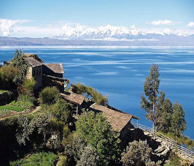
Lake Titicaca

Lake Titicaca is a lake located on the border of Peru and Bolivia. It sits 3,811 m above sea level making it the highest commercially navigable lake in the world. By volume of water it is also the largest lake in South America. The details of Lake Titicaca are explained in world tour guides below.

Lake TiticacaThe lake is located at the northern end of the endorheic Altiplano basin high in the Andes on the border of Peru and Bolivia. The western part of the lake lies within the Puno Region of Peru, and the eastern side is located in the Bolivian La Paz Department. The lake is composed of two nearly separate sub-basins that are connected by the Strait of Tiquina which is 800 m across at the narrowest point. The larger sub basin Lago Grande has a mean depth of 135 m and a maximum depth of 284 m. The smaller sub basin Winaymarka has a mean depth of 9 m and a maximum depth of 40 m. The overall average depth of the lake is 107 m.

Lake Titicaca is fed by rainfall and meltwater from glaciers on the sierras that abut the Altiplano. Five major river systems feed into Lake Titicaca. In order of their relative flow volumes these are Ramis, Coata, Ilave, Huancane and Suchez. More than 20 other smaller streams empty into Titicaca, and the lake has 41 islands, some of which are densely populated. The cold sources and winds over the lake give it an average surface temperature of 10 to 14 °C. In the winter mixing occurs with the deeper waters, which are always between 10 to 11 °C.

The origin of name Titicaca is unknown. It has been translated as Rock Puma for its resembling shape of a puma hunting a rabbit, combining words from the local languages Quechua and Aymara and as well as translated as Crag of Lead. The southeast quarter of lake is separate from main body the Bolivians calling it Lago Huinaymarca and larger part Lago Chucuito. In Peru these smaller and larger parts are referred to as Lago Pequeno and Lago Grande respectively. Titicaca is notable for a population of people who live on the Uros a group of 42 or so artificial islands made of floating reeds. These islands have become a major tourist attraction for Peru drawing excursions from lakeside city of Puno.

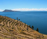
Amantani is another small island on Lake Titicaca populated by Quechua speakers. About 800 families live in six villages on the roughly circular 15 square kilometres island. There are two mountain peaks called Pachatata and Pachamama, and ancient ruins on the top of both peaks. The hillsides that rise up from the lake are terraced and planted with wheat, potatoes, and vegetables. Most of the small fields are worked by hand. Long stone fences divide the fields, and cattle, sheep, and alpacas graze on the hillsides.

AmantaniTaquile IslandTaquile is a hilly island located 35 kilometres east of Puno. It is narrow and long and was used as a prison during the Spanish Colony and into the 20th century. In 1970 it became property of the Taquile people, who have inhabited the island. Pre Inca ruins are found on the highest part of the island, and agricultural terraces on hillsides. Situated on the Bolivian side of lake with regular boat links to Bolivian town of Copacabana, Isla del Sol is one of the lakes largest islands. Geographically, the terrain is harsh; it is a rocky, hilly island. There are no motor vehicles or paved roads on the island. The main economic activity of the approximately 800 families on the island is farming, with fishing and tourism augmenting the subsistence economy.

Isla de la Luna is situated east from the bigger Isla del Sol. According to legends that refer to Inca mythology Isla de la Luna is where Viracocha commanded the rising of the moon. Ruins of a supposed Inca nunnery occupy the oriental shore. Suriqui lies in the Bolivian part of Lake Titicaca. Suriqui is thought to be the last place where the art of reed boat construction survives, at least as late as 1998. Craftsmen from Suriqui helped Thor Heyerdahl in the construction of several of his projects, such as the reed boats Ra II and Tigris, and a balloon gondola.

Monday, July 19, 2010

Balkan Mountains

Balkan Mountains range is a mountain range in the eastern part of the Balkan Peninsula. The Balkan range runs 560 km from the Vrashka Chuka Peak on the border between Bulgaria and eastern Serbia eastward through central Bulgaria to Cape Emine on the Black Sea. The highest peaks of the Stara planina are in central Bulgaria. The highest peak is Botev which is 2,376m located in the Central Balkan National Park. The mountain gives the name of the Balkan Peninsula. Stara Planina played an enormous role in the History of Bulgaria and the development of the Bulgarian nation and people.

Balkan MountainsIn earlier times the mountains were known as the Haemus Mons. Scholars consider that Haemus is derived from an unattested Thracian word saimon, meaning mountain range. Other names used to refer to the mountains in different time periods include Aemon, Haemimons, Hem, Emus, the Slavonic Matorni gori, the Turkish Kodzhabalkan and Balkan. The term Balkan however is Persian in its origin brought into southeastern Europe by the Turkic peoples from Central Asia. In places like Turkmenistan and the eastern shores of the Caspian Sea one still encounters this name, such as the Balkan Peninsula and the Balkan Province in Turkmenistan.

Stara Planina is remarkable for its flora and fauna. Edelweiss grows there in the region of Kozyata stena. Some of the most striking landscapes are included in the Central Balkan National Park with steep cliffs, the highest waterfalls in the Balkan peninsula and lush vegetation. There are a number of important nature reserves such as Chuprene, Kozyata stena and others. Most of Europe's large mammals inhabit the area including the brown bear, wolf, boar, chamois, deer.

In geological term Stara Planina is a young mountain. It is part of the Alp-Himalayan chain which stretches across most of Europe and Asia. It can be divided into two parts: the main Balkan Chain and the Pre- Balkan which follows the main chain to the north. To the north the Pre Balkan slightly goes into the Danubian Plain, while to the south the mountain borders with the Sub-Balkan valleys a row of 11 valleys running from the border with Serbia to the west to the Black Sea to the east which separate the Balkan mountains from a chain of other mountains known as Srednogorie which include Vitosha and Sredna Gora.

The range consists of around 30 portions called mountains. Stara Planina can be divided into three sections. They are Western Stara Planina from Vrashka Chuka at the border with Serbia to the Pass of Arabakonak with a total length of 190 km and highest peak Midzhur is 2,169 m, Central Stara Planina from Arabakonak to the Vratnik Pass with a length of 207 km. Botev Peak which is 2,376 m the highest in the range is located in that section and Eastern Stara Planina from the Vratnik Pass to Cape Emine with a length of 160 km and highest peak Balgarka is 1181 m. Eastern Stara Planina forms the lowest part of the range.

Stara Planina forms a water divide between the rivers flowing to Danube in north and those flowing to Aegean Sea in south. It is crossed by Bulgaria widest river Iskar which forms the spectacular Iskar Gorge. Rivers which take their source from Stara Planina and flow northwards to the Danube include Timok, Archar, Lom, Tsibritsa, Ogosta, Skat, Vit, Osam, Yantra, Rusenski Lom. It is also the source of the Kamchia which directly flows in the Black Sea. Although not so abundant in mineral waters as other parts of Bulgaria, there are several spas such as Varshets, Shipkovo and Voneshta Voda. There are a number of waterfalls, especially in the western and central parts of the range such as Raysko Praskalo which is the highest waterfall in the Balkan Peninsula, Borov Kamak, Babsko Praskalo, Etropole Waterfall, Karlovsko Praskalo, Skaklya and others.

Shipka MonumentStara-PlaninaStara Planina has a significant and special place in the history of Bulgaria since its foundation in 681. It was a natural fortress of Bulgarian Empire for centuries and formed an effective barrier to Moesia where most of the Medieval capitals were located. The Balkan Mountains were the site of numerous battles between Bulgarian and the Byzantine Empires including the Battle of the Rishki Pass in 759, Battle of the Varbitsa Pass in 811, Battle of Tryavna in 1190 and many others. In the battle of the Varbitsa Pass Khan Krum decisively defeated an enormous Byzantine army killing Emperor Nikephoros I. For many centuries the Byzantines feared that mountain and on several occasions Byzantine armies had pulled back only on the news of approaching Stara Planina.

During the Ottoman rule many haiduks found refuge in Stara Planina. Close to the highest summit the Botev Peak is Kalofer the birth place of Hristo Botev, a Bulgarian poet and national hero who died in the Western Stara Planina near Vratsa in 1876 in the struggle against the Ottoman Empire. Also close to Botev peak is the Shipka Pass scene of four battles in Russo Turkish War, 1877-78 which ended Turkish rule in the Balkans. Close to the pass in the village of Shipka there is a Russian Orthodox Church built to commemorate Russian and Bulgarian bravery during pass defense.

Wednesday, July 14, 2010

Peles Castle

Peles Castle is a historical monument Neo-Renaissance castle placed in an idyllic setting in the Carpathian Mountains near Sinaia in Prahova County, Romania, on an existing medieval route linking Transylvania and Wallachia built between 1873 and 1914. The inauguration was held in 1883. It is also called as Castelul Peles in Romania. The details of Peles Castle are explained in world tour guides below.

Peles CastleKing Carol I who is one of the great Romanian kings and conqueror of National Independence first visited the region and future site of castle in 1866. In 1872 one thousand pogoane which is approximately 1,300 acres was purchased by King and Piatra Arsa region becomes Royal Domain of Sinaia, destined to be a royal hunting preserve and summer retreat for monarch. On August 22, 1873 the foundation for Peles Castle city of Sinaia and certainly for country of Romania was established. Several other buildings are invaded to castle were built concurrently are Guards Chambers, Economat Building, Foisor Hunting Chateau, Royal Stables. The Power Plant was also constructed then, and Peles became worlds first castle fully operated by electric power.

Peles Castle has 3200 sq. meters of floor plan, over 170 rooms, 30 bathrooms, many with dedicated themes from world, themes that can vary by function or by style are extremely lavishly furnished and decorated to the slightest detail. The establishment hosts one of the finest collections of art in East and Central Europe, consisting of statues, paintings, furniture, arms and armour, gold, silver, stained glass, ivory, fine china, tapestries and rugs. The collection of arms and armour has over 4000 pieces, divided between Eastern and Western war, ceremonial or hunting spreading over four centuries in history. Oriental rugs come from the finest sources Bukhara, Mosul, Isparta, Saruk and Smirna, porcelain from Sevres and Meissen, leather from Cordoba but perhaps the most acclaimed are the hand painted stained glass vitralios.

A towering statue of King Carol I by Raffaello Romanelli overlooks the main entrance but many other statues are present on the seven Italian neo-Renaissance terrace gardens, mostly of Carrara marble executed by the Italian sculptor Romanelli. The gardens also host fountains, urns, stairways, guarding lions, marble paths and other decorative pieces. This has many different kinds all over the world, till today we still do not know. Peles Castle shelters one of the most important and most valuable painting collections in Europe almost 2,000 pieces. An interesting account about Peles Castle remains the one that comes from Angelo de Gubernatis an Italian writer who arrived in 1898 in Sinaia as a guest of the Royal Family.

Inaugurated in 1883, Peles Castle is not only a pleasant place during summer time. It has been conceived to be also a national monument, meant to keep the trophies of the Plevna victory, which explains the simple but majestic style. The castles courtyard Bramantes type with a fountain in the middle, in the most accurate Renaissance style, pleasantly surprises the visitor. The courtyard has a merry decoration, made out of plants and flowers all round the buildings facades are animated by elegant drawings. The interior of the castle is a true wonder, due to the beauty and richness of the sculpted wood and the stained glass windows.

There are 168 rooms in the castle only 35 are accessible to the public. While an important area is in the upper levels, this is off limits. Only the museum in the basement and the rooms on the first floor can be visited. The visiting hours are from 9 a.m. to 5 p.m Wednesday through Sunday. On Mondays the castle is closed and on Tuesdays the hours are till 11 a.m. to 5 p.m. These visiting hours are subject to change by the Romanian Culture Ministry. Each year in November the castle is closed to public for whole month, during which time it undergoes maintenance and cleaning. Admission fee is 20 RON for adults, 5 RON for school-age children. Additionally you must check your camera or pay 30 RON to take photos or 50 RON for video.

The location of Peles Castle is northwest of the town of Sinaia, 60 km from Brasov and 135 km away from Bucharest which is Romania capital. Nested in the south-eastern Carpathian Mountains, the complex is composed of three monuments Peles Castle, Pelisor Chateau and Foisor Hunting Chateau. The notable Grand rooms are Honour Hall, Imperial Suite, Grand Armory or The Arsenal, Small Armory, Playhouse, Florentine Room, Moorish Salon and Turkish Parlor.

Peles CastlePeles Castle

Monday, July 5, 2010

Komodo National Park

The Komodo National Park is a national park in Indonesia located within the Lesser Sunda Islands in the border region between the provinces of East Nusa Tenggara and West Nusa Tenggara. The park includes the three larger islands Komodo, Padar and Rincah, and 26 smaller ones, with a total area of 1,733 km² or 603 km² of it land. The national park was founded in 1980 in order to protect the Komodo dragon, the world's largest lizard. Later it was dedicated to protecting other species, including marine species. In 1991 the national park was declared a UNESCO World Heritage Site. The details of Komodo National Park are explained in world tour guides below.

Komodo Dragon in Komodo National ParkThe park comprises a coastal section of western Flores, the three larger islands of Komodo, Padar and Rincah, 26 smaller islands and the surrounding waters of the Sape Straights. The islands of the national park are of volcanic origin. The terrain is generally rugged, characterized by rounded hills, with altitudes up to 735 m. The climate is one of the driest of Indonesia with annual rainfall between 800mm and 1000mm. Mean daily temperatures in the dry season from May to October are around 40°C.

The hot and dry climate of the Park, characterized by savannah vegetation, make it to a good habitat for the endemic Komodo dragon or Varanus komodoensis. Their populations are restricted to the islands of Komodo is 1,700, Rinca is 1,300, Gili Motang is 100, Gili Dasami is 100, and Flores is ca. 2,000, while extinct on Padar. Cloud forests appear only in few areas above 500 metres but they provide habitat to several endemic flora. Coastal vegetaion includes mangrove forest, which generally appear in the sheltered bays of the three larger islands.

Fringing and patch coral reefs are extensive and best developed on the north-east coast of Komodo. The park is rich in marine life, including whale sharks, ocean sunfish, manta rays, eagle rays, pygmy seahorse, false pipefish, clown frogfish, nudibranchs, blue-ringed octopus, sponges, tunicates, and coral. The island of Padar and part of Rincah have been established as nature reserves in 1938. Komodo Island has been declared a nature reserve in 1965, and in 1977 an UNESCO biosphere reserve. The three islands have been declared a national park in 1980, which was later extended to include the surrounding marine area and a section of Flores in 1984. In 1991 the national park was declared a UNESCO World Heritage Site.

Since 1995, the national park authority has been supported by The Nature Conservancy or TNC, an American environmental organization. A new management plan was co-authored with TNC and implemented in 2000 to address the problem of increasing resource exploitation, both marine and terrestrial. Most pressure on marine resources originates from fishing communities and commercial enterprises from outside the park. However, regulations and restrictions on resource use impact mostly on park residents, who have few options to make a living but rely on what the park has to offer. The provision of alternative livelihoods is part of the overall management strategy, but communities within the park are yet to benefit from appropriate measures addressing their needs.

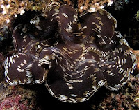
Cuttlefish in Komodo National ParkGiant Clam in Komodo National ParkKomodo National Park has been selected as one of 28 finalists to become one of the New7Wonders of Nature. About 4,000 people live within the park. Scuba diving is popular because of the park's high marine biodiversity. The development of, largely marine-based, ecotourism is the main strategy to make the park self-financing and generate sufficient revenue through entrance fees and tourism licenses to cover operational and managerial costs. To this end, a joint venture between TNC and a tourism operator were granted a tourism concession that also entails extensive park management rights. This concession has generated an ongoing controversy. The joint venture has been accused of making decisions behind closed doors, and many people in and around Komodo claim that they haven’t been consulted regarding decisions that ultimately affect their lives.

Most controversy, however, was caused by the death of several fishermen since the 1980s. The circumstances of the fishermen’s deaths are contested. While park patrol including, at the time, police and navy personnel claim they acted in self-defense, fishing communities accuse park management of having deliberately killed the fishermen.

Saturday, July 3, 2010

Fountains Hall

Fountains Hall is a country house near Ripon in North Yorkshire, England, close to the World Heritage Site of Fountains Abbey. It belongs to the National Trust as part of its Fountains Abbey & Studley Royal Water Garden property, and is a Grade I listed building. The details of Fountains Hall are explained in world tour guides below.

Fountains HallThe house was built by Stephen Proctor between 1598 and 1604, partly with stone from the Abbey ruins. It is a fine example of late Elizabethan architecture, perhaps influenced by the work of Robert Smythson. After Proctors death in 1619, Fountains Hall passed into the possession of the Messenger family, who sold it to William Aislabie of neighbouring Studley Royal one hundred and fifty years later. Fountains Hall became virtually redundant as the Aislabie family remained at Studley Royal. It was leased to various tenants and at one time parts of it were used for farm storage. However it was renovated and modernised between 1928 and 1931, and the Duke and Duchess of York later King George VI and Queen Elizabeth often stayed there as guests of Lady Doris Vyner, wife of the Marquis of Ripon and sister to the then-current Duke of Richmond and Gordon.

During the Second World War, Fountains Hall and other estate buildings were used to house evacuees. Studley Royal became the wartime home of Queen Ethelburga's School of Harrogate, while the Q.E. Sanatorium was over at Fountains Hall. The stable block with the courtyard, set apart from the house at Studley Royal, was used for dormitaries while one corner became the School Chapel, at which Sunday Evensong was regularly said by the Arch Deacon at Ripon. It has a balcony of note, although it cannot be used at present because the second floor is used for weddings and the staircase is considered unsafe for the public.

Fountains HallFountains HallDuring the war the Vyners lost a son and a daughter; Charles was a Royal Naval Reserve pilot missing in action near Rangoon. Elizabeth was a member of the Womens Royal Naval Service and died of lethargic encephalitis while on service in Felixstowe, Suffolk. There is a sculpture remembering them which can be seen as one comes out of the house down the stone stairs.

Elizabeth Vyner WRNS - Died on Active Service June 3rd 1942 Aged 18 years. Also her brother Charles De Grey Vyner Sub Lieut RNVR Reported missing from Air Operations off Rangoon May 2nd 1945 Aged 19 Years. After the war the Hall again fell into a state of serious dilapidation. The National Trust acquired the Fountains Estate from North Yorkshire County Council in 1983 and has been undertaking restoration work on the Hall since then. Part of it has been divided into flats, one of which is available for holiday lets. Visitors to Fountains Abbey can view the oak-paneled Stone Hall and an adjoining exhibition room, and there are plans to restore the chapel.

Wednesday, June 30, 2010

Verrazano Narrows Bridge

The Verrazano Narrows Bridge is a double decked suspension bridge that connects boroughs of Staten Island and Brooklyn in New York City at the Narrows, reach connecting the relatively protected upper bay with larger lower bay. The details of Verrazano Narrows Bridge are explained in world tour guides below. The bridge is named for Italian explorer Giovanni da Verrazano, the first known European navigator to enter New York Harbor and Hudson River, while crossing Narrows. It has a center span of 4,260 feet or 1,298 m and was largest suspension bridge in the world at the time of its completion in 1964, until it was surpassed by the Humber Bridge in United Kingdom in 1981. It now has the eighth longest center span in the world, and is the largest suspension bridge in the United States. Its massive towers can be seen throughout a good part of the New York metropolitan area, including from spots in all five boroughs of New York City.

Verrazano Narrows BridgeThe bridge furnishes a critical link in local and regional highway system. Since 1976, it has been starting point of New York City Marathon. The bridge marks gateway to New York Harbor all cruise ships and most container ships arriving at Port of New York and New Jersey must pass underneath the bridge and thus must be built to accommodate clearance under the bridge. This is most notable in case of the ocean liner RMS Queen Mary 2. The bridge is owned by New York City and operated by Triborough Bridge and Tunnel Authority, an affiliate agency of Metropolitan Transportation Authority. Interstate 278 passes over the bridge connecting Staten Island Expressway with the Gowanus Expressway and the Belt Parkway. The Verrazano, along with the other three major Staten Island bridges, created a new way for commuters and travelers to reach Brooklyn, Long Island, and Manhattan by car from New Jersey.

The bridge was the last great public works project in New York City overseen by Robert Moses, the New York State Parks Commissioner and head of the Triborough Bridge and Tunnel Authority, who had long desired the bridge as a means of completing the expressway system which was itself largely the result of his efforts. The bridge was also the last project designed by Chief Engineer Othmar Ammann, who had also designed most of the other major crossings of New York City, including the George Washington Bridge, the Bayonne Bridge, the Bronx Whitestone Bridge, the Robert F. Kennedy Bridge, and the Throgs Neck Bridge. The plans to build the bridge caused considerable controversy in neighborhood of Bay Ridge, because many families had settled in homes in the area where bridge now stands and were forced to move.

Construction on the bridge began August 13, 1959, and the upper deck was opened on November 21, 1964 at a cost of $320 million. New York City Mayor Robert F. Wagner cut the ribbon at the opening ceremony, which was attended by over 5,000 people. The lower deck opened on June 28, 1969. The bridge took over the title of the longest suspension bridge in the world from 1964 until 1981, when it was eclipsed by the Humber Bridge in England. Fort Lafayette was an island coastal fortification in New York Harbor, built next to Fort Hamilton at the southern tip of what is now Bay Ridge. It was destroyed as part of the bridge's construction in 1960; the Brooklyn-side bridge pillars now occupy the fort's former foundation.

According to the US Department of Transportation each of the two towers contains 1,000,000 bolts and 3,000,000 rivets. The diameter of each of the four suspension cables is 36 inches. Each cable is composed of 26,108 wires amounting to a total of 143,000 miles or 230,136 km in length. Because of the height of the towers 693 ft and their distance apart 4,260 ft, the curvature of the Earth's surface had to be taken into account when designing the bridge the towers are 1+5⁄8 inches or 41.275 mm farther apart at their tops than at their bases. Because of thermal expansion/contraction of the steel cables, the bridge roadway is 12 feet or 3.66 m lower in summer than its winter elevation.

The bridge is affected by weather more than any other bridge in the city because of its size and isolated location close to the open ocean. It is occasionally closed either partially or entirely during strong wind and snow storms. The Queen Mary 2 was designed with a flatter funnel to pass under the bridge, and has 13 feet of clearance under the bridge during high tide. The bridge has fostered more traffic on the Outerbridge Crossing and the Goethals Bridge, both of which connect Staten Island with New Jersey. In 2009, all 262 of the mercury vapor fixtures in the bridge's necklace lighting were replaced with energy efficient light emitting diodes.

Verrazano Narrows BridgeVerrazano Narrows BridgeIn 2008 about 190,000 vehicles used the bridge per day on average. As of 2009 one way toll in cash is $11 per car or $5 per motorcycle. E-Z Pass users with New York State transponders pay $9.14 per car or $3.98 per motorcycle; out-of-state account holders get no discount. From 1964 to 1986, the toll was collected in both directions, until Staten Island residents concerned about pollution from idling vehicles called for one way tolls. However, as of 2009 the eastbound toll booths are still in place, requiring drivers to slow down. While the high cost of the toll between Brooklyn and Staten Island has always been an issue for residents, some favor the toll because they see it as a way to curb population growth on Staten Island. Each of the four bridges to the Island is tolled.

Beginning in 2009, eight of the unused Brooklyn-bound toll booths will be removed in a project to improve traffic flow at the toll plaza, three of the unused toll booths will be subsequently removed in 2009 during construction of second phase. Recently residents living on both ends of the bridge have lobbied for pedestrian access. In October 2003 Mayor Michael Bloomberg promised to look into establishing the long-awaited pedestrian and bicycle access.

Tuesday, June 29, 2010

Jungfrau Aletsch

Jungfrau Aletsch is located in south western Switzerland between the cantons of Berne and Valais. It is also called as Jungfrau Aletsch protected area and officially called as Swiss Alps Jungfrau-Aletsch. It is a mountainous region in the easternmost side of the Bernese Alps, containing the northern wall of Jungfrau and Eiger, and the largest glaciated area in western Eurasia, comprising the Aletsch Glacier. The Jungfrau-Aletsch protected area is the first World Natural Heritage site in the Alps, it was inscribed in 2001.

Jungfrau AletschThe Jungfrau Aletsch protected area is located in the Swiss Alps between the Bernese Oberland and north-eastern Valais, about 25 km south of Interlaken and 20 km north of Brig. The site covers the whole Aar massif from the Oeschinensee in the west to the Giselle in the east, including the basins of the Aletsch, Fiescher, Aar and Grindelwald glaciers. The culminating point is the Finsteraarhorn which, with its 4,270 metres, is also the highest mountain in the Bernese Alps. 8 other summits above 4,000 metres are located in the area: Aletschhorn, Jungfrau, Monch, Schreckhorn, Gross Fiescherhorn, Hinter Fiescherhorn, Grunhorn and Lauteraarhorn.

The summit ridge separating the cantons of Valais and Berne is the main watersheds of Europe. The principal valleys on the north side run due north below the precipitous 20 kilometer north wall of the Jungfrau, Monch and Eiger, thence to the Aar, a tributary of the Rhine which runs into the North Sea. The southern valleys drain into the southwest running valley of the Rhone which flows into the Mediterranean Sea. The climate of the region is strongly influenced by the height of the mountains. They form a barrier between the wet sub-oceanic climate of the north and the dryer climate of the south-facing Valais slopes. On the north side the rainfall exceeds 2,200 mm, most falling in summer, but on the south side it is only 1,000 mm, with more falling in winter. The Valais experiences a sub continental climate at low and medium altitudes and is markedly semi-arid. Mean annual temperatures range from -8.5°C at Jungfraujoch which is 3,500 m to 9.1°C at Brig.

The Jungfrau Aletsch site is almost untouched, except for trails and mountain huts. It is deeply glaciated. About half of the area is higher than 2,600m a few hundred metres lower than the limit between the glaciers accumulation and ablation zones. The total area covered by glacier is 35,000 ha, it constitutes the largest continuous area of ice in the Alps. The largest and longest glacier in the Alps, the Aletsch Glacier is 23 km long and has a maximum thickness of 900 metres at Konkordiaplatz. The protected site covers an area of 82,388 ha, comprising the 53,888 ha existing World Heritage Site plus extensions at both ends totaling 28,500 ha. 56% is within the Canton of Valais, 44% within the Canton of Berne.

Glaciers and barren rock constitute 80% of the area; 6% is forested, 5.2% is alpine meadow, and 8% is scrub. Altitude is the strongest factor influencing the distribution and diversity of the vegetation. Within the nominated area there are 1,800 species of vascular plants and 700 mosses. The growing period decreases with altitude, but there are 529 species of phanerogams and pteridophytes above the tree line. Broadleaf montane forest extends from 900m to 1,300m on north facing slopes. On south-facing slopes the same zone is approximately 200m higher. The subalpine zone lies between 1,300m to 2,000m, between the broadleaf and alpine zone. Characteristic species are the Swiss Pine or Pinus Cembra and the Norway Spruce or Picea abies on the north and south side respectively. An example of Pinus cembra forest is the Aletsch Forest above the Aletsch Glacier and near the tree line. It developed on the moraine of the glacier after its maximum extension in 1850. The zone directly above the tree line forms a girdle of moorland vegetation and Alpine grassland.

Jungfrau AletschJungfrau Aletsch
In Jungfrau Aletsch 1,250 species have been recorded on the site, including 271 vertebrates. In that 42 mammals, 99 birds, 8 reptiles, 4 amphibians, 7 fish, 97 molluscs plus 979 insects. As for the rest of the Alps, common species are the chamois, alpine ibex, red deer. Smaller mammals include the mountain hare, fox, ermine, marmot and the reintroduced lynx. Both the regions of the Bernese Oberland and Valais had been popular tourist destinations since the 19th century. The Jungfrau was first climbed in 1811 and the Finsteraarhorn in 1812. The first tourists came mostly in summer, but in the 1930s winter sports became also popular. On the north side visitors are only able to visit the site via the Jungfrau railway which leads to the Jungfraujoch. So the site is both exceptionally accessible to large nearby populations and rather inaccessible in itself.

The Jungfrau railway was built between 1870 and 1912, taking visitors from Kleine Scheidegg to Jungfraujoch, the saddle between the Monch and Jungfrau. On the south side the area of Riederalp Bettmeralp concentrates most of the visitors. Other inhabited regions on the margin are Kandersteg and the Lotschental and the Oberhasli. The network of foot-paths is well developed around the site but nonexistent inside, being inaccessible to walkers. The site can be accessed by experienced mountaineers and there is a series of 37 shelters and five mountain refuges with a total of 1,582 beds, managed by the Swiss Alpine Club. The Aletsch ecological centre in Riederalp run by Pro Natural functions as a visitor center.

Monday, June 28, 2010

Leeds Castle

Leeds Castle which is 4 miles or 6.5 km southeast of Maidstone, Kent, England, dates back to 1119, though a manor house stood on the same site from the 9th century. The castle and grounds lie to the east of the village of Leeds, Kent, which should not be confused with the far bigger and better-known city of Leeds in West Yorkshire. The travel destination and tourism attraction details of Leeds castle is explained in world tour guides below.

Leeds CastleBuilt in 1119 by Robert de Crevecoeur to replace the earlier Saxon manor of Esledes, the castle became a royal palace in 1278 for King Edward I of England and his queen, Eleanor of Castile. Major improvements were made during his time, including the barbican, made up of three parts, each with its own entrance, drawbridge, gateway and portcullis.

Richard II's first wife, Anne of Bohemia, spent the winter of 1381 at the castle on her way to be married to the king. In 1395, King Richard II received the French chronicler Jean Froissart there, as Froissart described in his Chronicles. Henry VIII transformed the castle for his first wife, Catherine of Aragon, and a painting commemorating his meeting with Francis I of France still hangs there. His daughter, Queen Elizabeth I was imprisoned in the castle for a time before her coronation. Thomas Fairfax, 6th Lord Fairfax of Cameron was born at Leeds Castle. Consequently, there is a sundial at Fairfax, Virginia, telling the time in Leeds Castle, and a sundial at Leeds Castle telling the time in Virginia.

The castle escaped destruction during the English Civil War because its owners, the Culpeper family, sided with the Parliamentarians. The last private owner of the castle was the Hon. Olive, Lady Baillie, a daughter of Almeric Paget, 1st Baron Queen Borough, and his first wife, Pauline Payne Whitney, an American heiress. Lady Baillie bought the castle in 1926. She redecorated the interior, first working with the French architect and designer Armand-Albert Rateau and then, later, with the Paris decorator Stephane Boudin.


During WWII Lady Baillie hosted burned Commonwealth airmen at the castle as part of their recovery. Survivors remember the experience with fondness to this day. Upon her death in 1974, Lady Baillie left the castle to the Leeds Castle Foundation, a private charitable trust whose aim is to preserve the castle and grounds for the benefit of the public. The castle was opened to the public in 1976. On 17 July 1978, the castle was the site of a meeting between the Egyptian President Anwar Sadat and Israeli Foreign Minister Moshe Dayan in preparation for the Camp David Accords. This castle and its grounds are now a leisure destination in the county of Kent.

The castle grounds have an aviary, a maze, a grotto, a golf course and what may be the world's only museum of dog collars. The castle is available to host conferences. Also seasonal hot air balloon flights are available at Leeds Castle. The maze was constructed in 1988 using 2400 yew trees. To the disappointment of some who use the technique of solving a maze by keeping one hand on a wall while walking through as a wall follower, the method fails at the Leeds Castle Maze because not all walls are connected.

Friday, June 25, 2010

Visoki Decani Monastery

Visoki Decani Monastery is a major Serb Orthodox Christian monastery located in Kosovo which is 12 km or 7 mi south of the town of Pec. The monastic catholicon is the largest medieval church in the Balkans containing the most extensive preserved fresco decoration. The details of Visoki Decani are explained in world tour guides below.

Visoki Decani MonasteryThe monastery was established in a chestnut grove by Serbian King Stefan Uros III Decanski in 1327. Its original founding charter is dated to 1330. The following year the king died and was buried at the monastery, which henceforth became his popular shrine. Indeed, the epithet Decanski refers to the king's foundation of the monastery. The construction was continued by his son Emperor Stefan Uros IV Dusan until 1335, but the wall-painting was not completed until 1350.

Visoki Decani MonasteryThe monastic church dedicated to Christ Pantocrator and built from blocks of red-purple, light-yellow and onyx marble was constructed by builders working under a Franciscan monk, Vitus of Kotor. The church is distinguished by its imposing size and Romanesque and Early Gothic structure and design. Apart from the extensive and well preserved fresco cycles the interior features the original 14th-century stone templon, the throne of the hegumen and the carved wooden sarcophagus of the founder King Stefan.

On the Crucifixion fresco, painted in 1350, objects similar to UFOs can be found. They represent two comets that looks like space ships, with two men inside of them, and are often quoted by Ufologists.

Visoki Decani was declared Monument of Culture of Exceptional Importance in 1990, and it is protected by Republic of Serbia. In 2004, UNESCO listed the monastery on the World Heritage List, citing its frescoes as one of the most valued examples of the so-called Palaeologan renaissance in Byzantine painting and a valuable record of the life in the 14th century. In 2006, it was added to the List of World Heritage Sites in danger due to the potential for attacks by ethnic Albanian partisans it is protected by the United Nations KFOR.

On 30 March 2007 an explosion was heard near the monastery. The explosion was confirmed by Serbian and international sources in Kosovo. Bishop Teodosije, the prior of the Visoki Decani monastery, stated that the incident was a grenade attack on the monastery, with an objective of sending threatening messages to the monks and KFOR forces.

Wednesday, June 23, 2010

Calakmul

Calakmul is the name given to site of one of the largest ancient Maya cities ever uncovered. It is also called as Kalakmul. It is located in the 1,800,000 acre Calakmul Biosphere Reserve in the Mexican state of Campeche, deep in the jungles of the greater Peten Basin region, 30 km from the Guatemalan border. The details of Calakmul are explained in world tour guides below. Calakmul was rediscovered from air by biologist Cyrus L. Lundell of the Mexican Exploitation Chicle Company on December 29, 1931, the find was reported to Sylvanus G. Morley of the Carnegie Institute at Chichen Itza in March 1932. According to Lundell, who named the site, in Maya, ca means two, lak means adjacent, and mul signifies any artificial mound or pyramid, so Calakmul is the City of the Two Adjacent Pyramids.

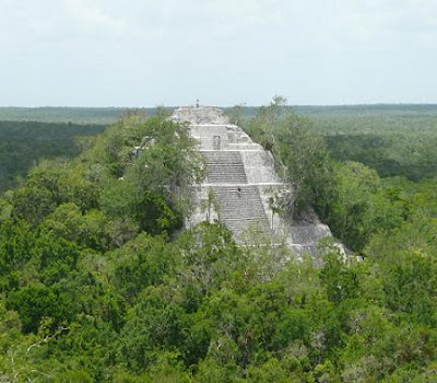
CalakmulCalakmul was a major Maya superpower within the northern Peten region of the Yucatan of southern Mexico. Calakmul administered a large domain marked by the extensive distribution of their emblem glyph of the snake head sign, to be read Kan. Calakmul was the seat of what has been dubbed the Serpent Head Polity. Calakmul itself is estimated to have had a population of 50,000 people and had governance, at times, to places as far away as 150 kms. There are 6,750 ancient structures identified at Calakmul the largest of which is the great pyramid at the site. Structure II is 55m high, making it the tallest of the Maya pyramids. Four tombs have been located within the pyramid. Like many temples or pyramids within Mesoamerica the pyramid at Calakmul increased in size by building upon the existing temple to reach its current size. The size of the central monumental architecture is approximately two square kilometers which is covered with dense residential structures is about twenty square kilometers.

Calakmul is one of the most structure-rich sites within the Maya region. The site contains 117 stelae, the largest total in the region. Most are in paired sets representing rulers and their wives. However, because these carved stelae were produced in soft limestone, most of these stelae have been eroded beyond interpretation. Also many elaborate murals were discovered at Calakmul. Strangely, these murals do not represent activities of the elite class. Rather, they depict elaborate market scenes of people preparing or consuming products such as atole, tamales, or tobacco as an ointment. Also items being sold were textiles and needles. These murals also have glyphs within them describing the actions occurring.

The most prominent figure in these murals is identified as Lady Nine Stone; she appears in many scenes. This brings a world of the Maya marketplace to vibrant life for archaeologists. Another highly beneficial resource to Maya archeological understanding at Calakmul is the ceramic remains. The composition of the ceramic materials identifies the region or more specifically the polity that produced them. Ceramics with the snake emblem glyph found at several sites also give more evidence to identify ties or control over that site by Calakmul.

CalakmulCalakmulCalakmul is located approximately 60 miles north of Tikal within the Peten, so they are relatively close to each other and inevitably were competing for the same resources. Calakmul acquired and influenced other outposts including many in the Tikal zone such as El Peru and Dos Pilas. Dos Pilas was originally created as an outpost for Tikal who implanted rulers from the royal lineage of the great city. Recently a hurricane ripped through the northern jungles of Guatemala and uncovered ten previously unknown glyph ridden stairs at the site of Dos Pilas, adding to the eight already known and deciphered steps of the hieroglyphic staircase #2, structure L5-49.

After a long period of inactivity following Morley's 1932 expedition, the city was explored by William Folan between 1984 and 1994, and is now the subject of a large-scale project of the National Institute of Anthropology and History under Ramon Carrasco.

Friday, June 18, 2010

Eureka Tower

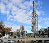
Eureka Tower is a 300 metre skyscraper located in the Southbank precinct of Melbourne, Victoria, Australia. Construction began in August 2002 and the exterior completed on 1 June 2006. The plaza was finished in June 2006 and the building was officially opened on 11 October 2006. The project was designed by Melbourne architectural firm Fender Katsalidis Architects and was built by Grocon. The developer of the tower was Eureka Tower Pty Ltd, a joint venture consisting of Daniel Grollo, investor Tab Fried and one of the Tower architects Nonda Katsalidis. The details of Eureka Tower is explained in world tour guides below. It was the world tallest residential tower when measured to its highest floor, until surpassed by Ocean Heights and the HHHR Tower in Dubai. It is now the fourth tallest, after Q1 located on Queensland s Gold Coast and the two Dubai skyscrapers.

Eureka TowerEureka Tower is named after the Eureka Stockade, a rebellion during the Victorian gold rush in 1854. This has been incorporated into the design, with the building's gold crown representing the gold rush and a red stripe representing the blood spilt during the revolt. The blue glass cladding that covers most of the building represents the blue background of the stockade's flag and the white lines also represent the eureka stockade flag.

When measured either by the height of its roof, or by the height of its highest habitable floor, Eureka Tower was the tallest residential building in the world when completed. It is also currently the building with the most floors available for residential occupancy in the world. The building stands 297 metres in height, with 91 storeys above ground plus one basement level. It is one of only seven buildings in the world with 90 or more storeys and is the 50th tallest building in the world. It is also the second-tallest building in Australia and the tallest building in Melbourne. The single level basement and first 9 floors contain car parking. The building's proximity to the water table as well as the Yarra River made the construction of a basement car park uneconomical. There are a total of 84 floors of apartments with the remainder being used for building facilities and the observation deck.

According to the ranking system developed by the U.S.-based Council on Tall Buildings and Urban Habitat, the Eureka Tower qualifies as the tallest building in one of the four categories in which heights are ranked, namely height to the floor of the highest occupied floor of the building. For comparison, the Q1 apartment tower on the Gold Coast has its highest habitable floor the observation deck, reaching a height of 235 m, some 62 m lower than Eureka Tower's highest habitable floor. Q1's highest penthouse apartment is 217 m whilst Eureka's penthouse is 278 m high. However, the spire attached to the top of Q1 exceeds the Eureka Tower in the other two categories, namely Height to the tip of spire, pinnacle, antenna, mast or flag pole in this case, spire and height to architectural top of the building.

The tower was built using reinforced concrete using a slipform method. Eureka Tower's lift core superseded the height of Rialto Towers on 9 November 2004. On 23 May 2006, the crane on top of the tower was dismantled by a smaller crane, which was dismantled by a smaller crane that could be taken down the service elevator. Eureka Tower has 24 carat gold plated glass windows on the top 10 floors of the building. Installation of the gold glass was completed in March 2006. Apartment owners and tenants had taken up residence in the building between Ground Level and Level 80 as of July 2006.

The Summit Levels contain only one apartment per floor: each apartment had an original price tag of A$7 million just for the empty space; purchasers were required to fit out the apartment at additional cost. On 11 October 2006, the tower was officially opened by then Victorian Premier, Steve Bracks. The Eureka Tower has been made to be able to withstand high winds and major earthquakes seeming they are the two riskiest events that the city faces. The tower is supposed to sway in the event of such things. The observation deck occupies the entire 88th floor of the Eureka Tower and is the highest public vantage point in a building in the Southern Hemisphere at 285 m, the Sky Tower in Auckland, New Zealand having higher views. It opened to the public on 15 May 2007. An entry fee applies to access the Skydeck.

Eureka TowerEureka TowerThe Skydeck features thirty viewfinders that help visitors to pinpoint numerous significant landmarks around all parts of Melbourne, along with several free binoculars. There is a small outside area called The Terrace which is closed in high winds. There is also a glass cube called The Edge, which extends itself from the building to hang over the edge of the tower and add to the viewing experience. On 10 January 2005, Grocon, the firm building Eureka Tower, proposed adding a 53.8 m communications mast or observation tower. The proposal is currently before the local planning commission. This mast would be a significant structure, used for providing an adventure climb to the tip of the summit.

On 16 April 2006, a new proposal was announced that the construction company and developers were considering options for the building to have a skywalk that would take daring people up 350 metres high. The proposed structure may also house a communication tower. Skydeck 88 features 'The Edge' - a glass cube which projects 3 m out from the building with visitors inside, suspended almost 300 m above the ground. When you enter, the glass is opaque as the cube moves out over the edge of the building. Once fully extended over the edge, the glass becomes clear.